

大日本國全圖
Yoshida-South Library, Kyoto University
IIIF Discovery in Japan

大日本國全圖
National Diet Library, Japan
ARC Early Japanese Book Portal Database

大日本國大繪圖
National Diet Library, Japan
ARC Early Japanese Book Portal Database

大日本全圖
Kyoto University Library
IIIF Discovery in Japan

大日本國沿海略圖
Kyoto University Library
IIIF Discovery in Japan

大和全國地圖
Nara Prefectural Library and Information Center
Mahoroba Digital Library

大日本海岸全圖
Kyoto University Library
IIIF Discovery in Japan

大日本海陸全圖
Kyoto University Library
IIIF Discovery in Japan

大日本帝國越中國土性圖
Yoshida-South Library, Kyoto University
IIIF Discovery in Japan

大日本帝國豊後全國豊前國東南部土性圖
Yoshida-South Library, Kyoto University
IIIF Discovery in Japan
萬國全圖
Shimane University Library Digital Archive Collection
IIIF Discovery in Japan

新撰縮圖大和全國地圖
Nara Prefectural Library and Information Center
Mahoroba Digital Library

大日本帝國中部地形圖
Yoshida-South Library, Kyoto University
IIIF Discovery in Japan

日本國中細見圖
National Diet Library, Japan
ARC Early Japanese Book Portal Database

武蔵國全圖
Tokyo Metropolitan Central Library
Tokyo Metropolitan Library Edo-Tokyo Digital Collections

改正大日本新精全圖
Kochi Prefectural Library
OTEPIA Kochi Library collection search

日本全圖 : 西部
Yoshida-South Library, Kyoto University
IIIF Discovery in Japan

日本全圖 : 東部
Yoshida-South Library, Kyoto University
IIIF Discovery in Japan

「大日本物産圖會」「同國長鮑製之圖」
Tokyo Metropolitan Central Library
Tokyo Metropolitan Library Edo-Tokyo Digital Collections

「大日本物産圖會」「伊勢國鮑採之圖」
Tokyo Metropolitan Central Library
Tokyo Metropolitan Library Edo-Tokyo Digital Collections

大日本帝國日向國土性圖 = Agronomic map of Hyūga-province
Yoshida-South Library, Kyoto University
IIIF Discovery in Japan

「徳島縣管内全圖」 大日本管轄分全圖
Kochi Prefectural Library
OTEPIA Kochi Library collection search

國郡全圖 2巻
Doshisha University
IIIF Discovery in Japan

重訂萬國全圖
Kyoto University Library
IIIF Discovery in Japan
大日本全圖
Kyoto University Library
IIIF Discovery in Japan

Kūchū shashin sokuzu yōzu Adomirarutī Shotō Jūmanbun no ichi
Stanford University Libraries
Stanford Libraries SearchWorks
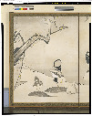
松梅群鶏図屏風
Tokyo National Museum
ARC Ukiyo-e Portal Database

「大谷目鏡橋之景」
C. V. Starr East Asian Library, University of California, Berkeley
ARC Ukiyo-e Portal Database
![Ichimanbun no ichi "Berezuniyakī" kinbo [cartographic material]](https://stacks.stanford.edu/image/iiif/cz633dr9513%2Fcz633dr9513_00_0001/full/!200,200/0/default.jpg)
Ichimanbun no ichi "Berezuniyakī" kinbo [cartographic material]
Stanford University Libraries
Stanford Libraries SearchWorks
大日本國沿海略圖
Kyoto University Library
IIIF Discovery in Japan

Hermit Islands
Stanford University Libraries
Stanford Libraries SearchWorks
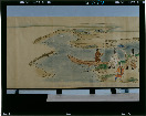
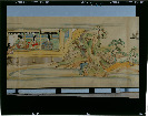
伊勢物語絵巻_模本
Tokyo National Museum
ARC Ukiyo-e Portal Database
![Kure [cartographic material] : plan of port and naval establishments](https://stacks.stanford.edu/image/iiif/rk636yd7844%2Frk636yd7844_0001/full/!200,200/0/default.jpg)
Kure [cartographic material] : plan of port and naval establishments
Stanford University Libraries
Stanford Libraries SearchWorks
![Kūchū shashin sokuzu yōzu Harumaheratō jūmanbun no ichi [cartographic material]](https://stacks.stanford.edu/image/iiif/gf930kv0405%2Fgf930kv0405_00_0001/full/!200,200/0/default.jpg)
Kūchū shashin sokuzu yōzu Harumaheratō jūmanbun no ichi [cartographic material]
Stanford University Libraries
Stanford Libraries SearchWorks
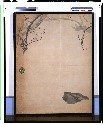
梅図
Tokyo National Museum
ARC Ukiyo-e Portal Database

Southwest Japan (Kyūshū, Shikoku, and southwest Honshū), non-metallic mineral production
Stanford University Libraries
Stanford Libraries SearchWorks
![Nijumanbunnoichi zu pantaruto [cartographic material] : Daitoshu timorushu oyobi zokuchi](https://stacks.stanford.edu/image/iiif/vs896bc0895%2Fvs896bc0895_00_0001/full/!200,200/0/default.jpg)
Nijumanbunnoichi zu pantaruto [cartographic material] : Daitoshu timorushu oyobi zokuchi
Stanford University Libraries
Stanford Libraries SearchWorks
伊勢物語絵巻_模本
Tokyo National Museum
ARC Ukiyo-e Portal Database

Plans on the north-eastern coast of New Guinea
Stanford University Libraries
Stanford Libraries SearchWorks
Last Updated: 2020-04-16
Uploaded: 2021-07-27