

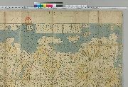
大日本海陸全図
Fukuoka City Museum
Fukuoka City Museum Collection Database

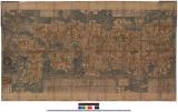
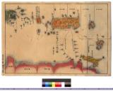
大日本海岸全圖
Kyoto University Library
IIIF Discovery in Japan

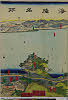
大日本海陸名所圖會
Kyoto University Library
IIIF Discovery in Japan
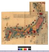
日本海山潮陸圖
National Diet Library, Japan
ARC Early Japanese Book Portal Database

大日本全圖
Kyoto University Library
IIIF Discovery in Japan

大日本海陸輿地全図
Fukuoka City Museum
Fukuoka City Museum Collection Database

大日本國全圖
Kyoto University Library
IIIF Discovery in Japan

大日本國全圖
Yoshida-South Library, Kyoto University
IIIF Discovery in Japan

大日本國全圖
National Diet Library, Japan
ARC Early Japanese Book Portal Database
大日本海岸全図 : 大日本海岸全図
Iwase Bunko Libray
ADEAC: A System of Digitalization and Exhibition for Archive Collections
![[歴民カード_歴史] 大日本海陸全図](https://khirin-i.rekihaku.ac.jp/iiif/nmjh_rekimin_h/12847220_02.tif/full/200,/0/default.jpg)
[歴民カード_歴史] 大日本海陸全図
National Museum of Japanese History
IIIF Discovery in Japan

大日本国海陸之記
Tokyo Metropolitan Central Library
Tokyo Metropolitan Library Edo-Tokyo Digital Collections
大日本壽海全図/全
University of the Ryukyus Library
Ryukyu/Okinawa-related Materials Digital Special Collections

大日本國沿海略圖
Kyoto University Library
IIIF Discovery in Japan
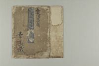
日本山海図道大全 : 日本山海図道大全
Iwase Bunko Libray
ADEAC: A System of Digitalization and Exhibition for Archive Collections

大日本籌海全図
東京海洋大学図書館 (国文学研究資料館)
IIIF Discovery in Japan

改正大日本新精全圖
Kochi Prefectural Library
OTEPIA Kochi Library collection search
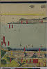
「大日本海陸名所図会」
Museum of Oriental Arts, Venice
ARC Ukiyo-e Portal Database
「大日本海陸名所図会」
Museum of Oriental Arts, Venice
ARC Ukiyo-e Portal Database
「大日本海陸名所図会」
RHAM
ARC Ukiyo-e Portal Database

日本全圖 : 西部
Yoshida-South Library, Kyoto University
IIIF Discovery in Japan

日本全圖 : 東部
Yoshida-South Library, Kyoto University
IIIF Discovery in Japan

「徳島縣管内全圖」 大日本管轄分全圖
Kochi Prefectural Library
OTEPIA Kochi Library collection search
大日本壽海全図/享
University of the Ryukyus Library
Ryukyu/Okinawa-related Materials Digital Special Collections
大日本海岸全圖
Kyoto University Library
IIIF Discovery in Japan

坤輿全圖
Kyoto University Library
IIIF Discovery in Japan
大日本全圖
Kyoto University Library
IIIF Discovery in Japan

さかなのはんじもの
National Institute of Japanese Literature
IIIF Discovery in Japan

Eastern Archipelago. Sumba or Sandelhout
Stanford University Libraries
Stanford Libraries SearchWorks

Revised estimate of Nansei-Shotō (including Ryūkyū-rettō and Satsunan-shotō)
Stanford University Libraries
Stanford Libraries SearchWorks
琉球国全図 : 三国通覧図〈付琉球、朝鮮、蝦夷、無人島〉
Iwase Bunko Libray
ADEAC: A System of Digitalization and Exhibition for Archive Collections
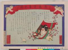
Nishikiehyakujishinbun 00038kaeuta ume no haru
東大近代日本法政史料C(明治新聞雑誌文庫)
ARC Ukiyo-e Portal Database
![Rumoi, Rumoi [Sub]prefecture. Hokkaido, Japan](https://stacks.stanford.edu/image/iiif/bp444yn9111%2Fbp444yn9111_0001/full/!200,200/0/default.jpg)
Rumoi, Rumoi [Sub]prefecture. Hokkaido, Japan
Stanford University Libraries
Stanford Libraries SearchWorks
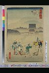
「東都三十六景」 「増上寺浅霧」
National Diet Library, Japan
ARC Ukiyo-e Portal Database

Southwest Japan (Kyūshū, Shikoku, and southwest Honshū), non-metallic mineral production
Stanford University Libraries
Stanford Libraries SearchWorks

「法四季紙家橘拙」 「中村芝翫」
National Diet Library, Japan
ARC Ukiyo-e Portal Database
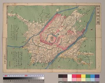
加賀金澤細見圖
国際日本文化研究センター
SODA Collection: Pictorial and Miscellaneous Materials
Last Updated: 2020-04-16
Uploaded: 2021-07-27