
map from "Notes on the late expedition against the Russian settlements in Eastern Siberia; and of ...
- Time
- Owner Organization

The war against Japan (Map USSR, China & Australia)

The war against Japan (Japanese & Pacific Map)
AN INCIDENT OF THE LATE WAX: RUSSIAN SAILORS FROM THE BALTIC FLEET STRANDED ON THE JAPANESE COAST. After ti...

JAPANESE POLE-SEEKERS: LEADERS OF THE EXPEDITION ON BOARD THE KAINAN MARU AT WELLINGTON

BACK FROM ANTARCTICA: THE JAPANESE EXPEDITION UNEXPECTEDLY RETURNS TO WELLINGTON
![[A Russian officer and a Japanese officer are standing on a large map, the Japanese officer has pulled up a piece of the map causing the Russian officer to slip and fall]](https://tile.loc.gov/storage-services/service/pnp/jpd/00900/00990_150px.jpg)
[A Russian officer and a Japanese officer are standing on a large map, the Japanese officer has pulled up a piece of the map causing the Russian officer to slip and fall]
[A Russian officer and a Japanese officer are standing on a large map, the Japanese officer has pulled up a piece of the map causing the Russian officer to slip and fall]
A CRUISER AGAINST A FLEET: THE SINKING OF THE RUSSIAN SHIP VARIAG AT CHEMULPO. The cruiser Variag and the gu...

Large scale experiments on the processing of Japanese persimmons : with notes on the preparation o...
Large scale experiments on the processing of Japanese persimmons : with notes on the preparation o...

Facsimile of the official map made by Abel Janszoon Tasman's expedition to Japan in 1639

THE JAPANESE FLEET OPERATING AGAINST THE RUSSIANS AT THE SECOND ATTACK ON PORT ARTHUR

August, from the Calendar of the American League Against War and Fascism

map from "The Claims of Japan and Malaysia upon Christendom exhibited in notes of voyages made in ...

map from "The Claims of Japan and Malaysia upon Christendom exhibited in notes of voyages made in ...

A New and Accurate Map of the Colony of Massachusets Bay, In North America from a Late Survey

A New and Accurate Map of the Colony of Massachusets Bay, In North America from a Late Survey

Stanford's map of China and Japan with the adjacents parts of the Russian Rebubcs., India, Burma &...

ship from "The Americans in Japan; an abridment of the Government narrative of the U.S. expedition...
The Islands of Japan with Corea, Manchooria and the russian territory on the Amoor
Japan opened compiled chiefly from the narrative of the American expedition to Japan, in the years...
Background Notes on Countries of the World: Japan
Map showing Green Islands, to the north of Biika. Several of the Japanese bases marked on the map 1 have sin...

Notes and sketches from the wild coasts of Nipon; with chapters on cruising after pirates in Chine...

Japan from "Japan: its history, traditions, and religions. With the narrative of a visit in 1879 ....

Carta General para las Navegaciones a la India Oriental por el Mar del Sur y el Grande Oceano que ...
map from "The Claims of Japan and Malaysia upon Christendom exhibited in notes of voyages made in ...

Iles Kouriles, Yeso et Sakhaline

2me. Carte mste. du Royaume et des Isles dépendantes de Liéou Kiéou en Chine dessinée et envoyée à...
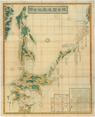
Ezokoukyouyochizenzu

小城郡村図舟田苅
Carta particolare dello stretto di Iezo fra l'America è l'isola Iezo / AF: Lucini fece
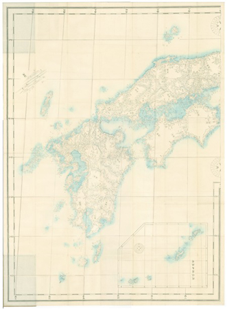
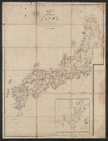
Kanbanjissokunihonchizu sanin sanyou nankai saikai
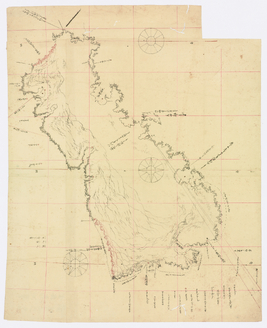
志古丹島測量原図
![[歴民カード_歴史] 西国筋街道実測図](https://khirin-i.rekihaku.ac.jp/iiif/nmjh_rekimin_h/12748019_02.tif/full/200,/0/default.jpg)
[歴民カード_歴史] 西国筋街道実測図

Chart of Discoveries made in 1787, in the Seas of China and Tartary, by the Boussole and Astrolabe...
Carte de L'Empire du Japon ..

名護屋古城之図
![[3 maps of Leyte Island, Philippines, in Japanese.]](https://collections.library.yale.edu/iiif/2/15251299/full/!200,200/0/default.jpg)
[3 maps of Leyte Island, Philippines, in Japanese.]
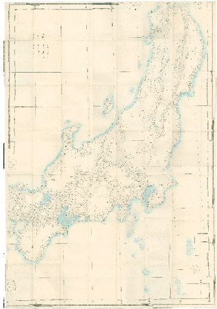
Kanbanjissokunihonchizu kinai toukai touzan hokuriku
![Carte de la Découverte faite en [1735] par les Hollandois, à la partie la plus orientale de l'Asie...](https://api.europeana.eu/api/v2/thumbnail-by-url.json?uri=http%3A%2F%2Fgallica.bnf.fr%2Fark%3A%2F12148%2Fbtv1b53032838p.thumbnail.jpg&type=IMAGE)
Carte de la Découverte faite en [1735] par les Hollandois, à la partie la plus orientale de l'Asie...

筑後川改修図
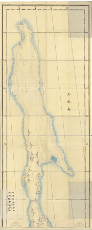
Kanbanjissokunihonchizu kitaezo(karafuto)

仁比山村志波屋字全図三ノ角全図
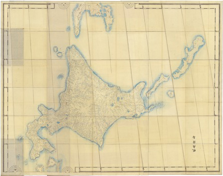
Kanbanjissokunihonchizu ezoshotou(hokkaidou oyobi kunashiri)

China, Japan >> Kaart der Japansche Eylanden, een gedeelte der Chineesche Kust, het Schierei...
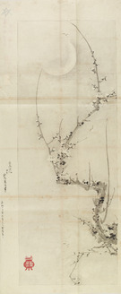
黙庵/月梅図
Gōshū shūikizu : Roppyakumanbun no ichi
Last Updated:
Uploaded: 2021-07-27