Stanford's map of the empires of China and Japan : with the adjacent parts of the Russian Empire, ...
- Time
- Owner Organization
Stanford's map of the empires of China and Japan with the adjacent parts of the Russian Empire, India, Burma &c / Stanford's Geogl. Estabt
Stanford's map of China & Japan with the adjacent parts of the Russian Repubcs. India, Burma &c / Stanford's Geographical Establishment

Stanford's map of China and Japan with the adjacents parts of the Russian Rebubcs., India, Burma &...

Map of the Empire of Japan

(Composite Map of) Map of the Island of Japan, Kurile &c. with the Adjacent Coasts of the Chinese ...

Japan and Korea. (with) The Japanese Empire. (with) Port Arthur and Adjacent Territory. (with) For...
Stanford's map of eastern China, Japan and Korea : the seat of war in 1894

Map of the Empire of Japan in 1914

A map of the city of Nagasaki, and of the adjacent country; Sorts of money current in the Japanese Empire
![[Russian Map of Northeastern Asia, Japan, Korea, China, Alaska, etc.] ( Summary map of hydrographi...](https://stacks.stanford.edu/image/iiif/pj697kr2558%2F35405/full/!200,200/0/default.jpg)
[Russian Map of Northeastern Asia, Japan, Korea, China, Alaska, etc.] ( Summary map of hydrographi...
1 1/2 sen Map of the Empire of Japan

(Upper Sheet to) Map of the Island of Japan, Kurile &c. with the Adjacent Coasts of the Chinese Do...

Map of the Island of Japan, Kurile &c. with the Adjacent Coasts of the Chinese Dominions and a Ske...

Map of the Island of Japan, Kurile &c. with the Adjacent Coasts of the Chinese Dominions and a Ske...
(Lower Sheet to) Map of the Island of Japan, Kurile &c. with the Adjacent Coasts of the Chinese Do...

General map of China and adjacent regions, showing treaty ports and railways

Map of Asia

A chart of the tradeing part of the East Indies and China, with the adjacent islands, from Surrat ...

Karta Aziatskoi Rossii . . . [Map of the Asian part of Russia and Possessions Adjacent, with the R...

Map of the Empire of China and Japan. J.W. del. (engraved by) Stockley, Sc London, James Wyld, Cha...

Charts, etc

Asia, Japan and Korea : with the surrounding seas and the adjacent coastal region of China / published at Wa...

A Map of the East-Indies and the Adjacent Countries; with the Settlements, Factories and Territori...

A Map of the East-Indies and the Adjacent Countries; with the Settlements, Factories and Territori...
Het Koninkrijk der Nederlanden / bew. door I. Dornseiffen ; get. door E. de Geest
Fujimijuusanshuuyochizenzu
China and Japan

Europa um 350 nach Christo

Geological Survey of Japan : reconnaissance map, geology : div. 2

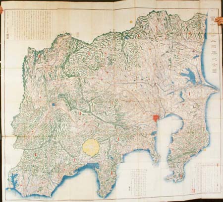
大日本帝國中部地形圖
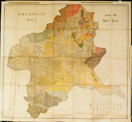
大日本帝国土性図 上野全国
<i>Map of Tartary</i>

Persia from "Narrative of the Chinese Embassy to the Khan of the Tourgouth Tartars in the years 17...

Chinese Empire (including Trans Oceanic Cables to Hong Kong,etc.)

大日本帝國豊後全國豊前國東南部土性圖
![Settsu no Kuni meisho ōezu [cartographic material] : zen](https://stacks.stanford.edu/image/iiif/jy281rj3743%2Fjy281rj3743_0001/full/!200,200/0/default.jpg)
Settsu no Kuni meisho ōezu [cartographic material] : zen
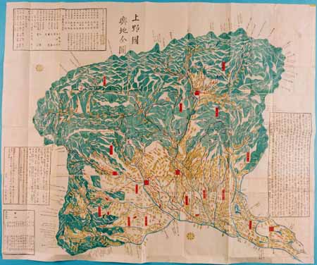
Kouzukenokunizenzu

大日本帝國豫察中部地形圖
Dattanzu

Takada, Niigata Prefecture, Honshu, Japan
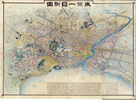
東京一目新図

Europa in der zweiten Hälfte des zehnten Jahrhunderts
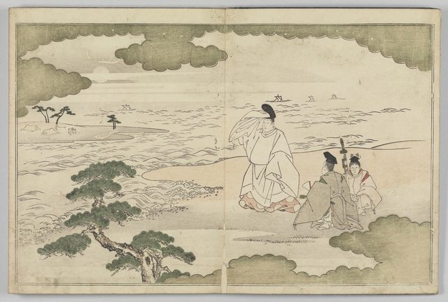
龢謌夷 絵本

National school board series : No. 6 : England

View of Futamigaura, Seishuu

最新満州帝國大地圖
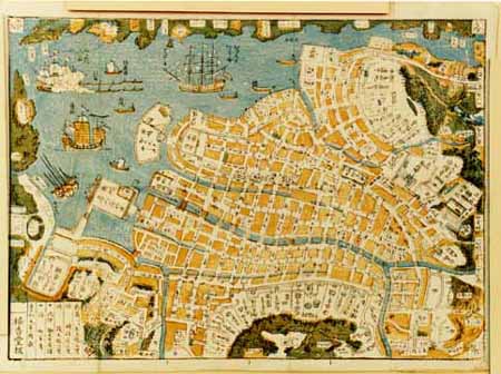
Shinsen nagasakinozu

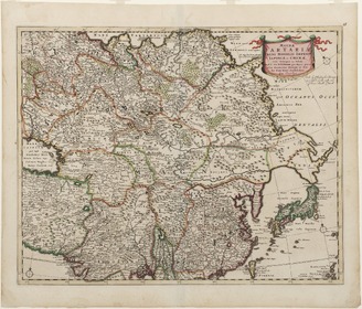
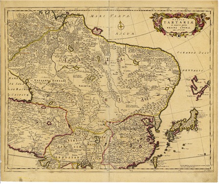
Tabula Tartariae et majoris partis Regni Chinae . .
Last Updated:
Uploaded: 2021-07-27