A Chart of the Northern Part of the China Sea [Material cartográfico] : shewing the Passage from F...

Chart of the Coast of China from Cambodia to Nanquam with Part of Japan
Stanford University Libraries
Stanford Libraries SearchWorks

A Chart of the Coast of China From Cambodia to Nanquam with Part of Japan
Stanford University Libraries
Stanford Libraries SearchWorks

A Chart of the Eastermost part of the East Indies and China from Cape Comarin to Japan with the Ad...
Stanford University Libraries
Stanford Libraries SearchWorks

A chart of the tradeing part of the East Indies and China, with the adjacent islands, from Surrat ...
Royal Museums Greenwich
Europeana API

A chart of the easternmost part of the East Indies with all the adjacent islands from Cape Comorin...
Royal Museums Greenwich
Europeana API

Chart of the S.W. Part of Japan from a dutch MS / by A. Dalrymple ; W. Harrison sc
Bibliothèque nationale de France
Europeana API
A chart of ye eastermost part of the East Indies / by Iohn Seller
National Library of Australia
Trove: National Library of Australia

A chart of the eastermost part of the East Indies with all the adjacent islands from Cape Comorin to Iapan / by Iohn Seller, Hydrographer to the King ; F. Lamb Sculp
State Library of New South Wales
Trove: National Library of Australia
Chart of northern part of Hiroshima Harbor (1928) (city appears on the chart). Report No. 3t(4), USSBS Index Section 2
NDL Digital Collections
NDL Digital Collections
A chart of the eastermost part of the East Indies with all the adjacent islands from Cape Comorin to Iapan / by Iohn Seller, Hydrographer to the King
National Library of Australia
Trove: National Library of Australia
![[Railroads in China, Manchuria, Korea, Japan and the eastern U.S.S.R.] [cartographic material]](https://stacks.stanford.edu/image/iiif/pf710vm7134%2Fpf710vm7134_00_0001/full/!200,200/0/default.jpg)
[Railroads in China, Manchuria, Korea, Japan and the eastern U.S.S.R.] [cartographic material]
Stanford University Libraries
Stanford Libraries SearchWorks

Chart of Discoveries made in 1787, in the Seas of China and Tartary, by the Boussole and Astrolabe...
Stanford University Libraries
Stanford Libraries SearchWorks
Part II of the Conspiracy: The Expansion of Control and Domination from Manchuria to the Rest of China. Summation E
NDL Digital Collections
NDL Digital Collections

Northern Quarter (Hokkoku), from the series "Three Amusements of Contemporary Beauties (Tosei bijin sanyu)"
Art Institute of Chicago
Art Institute of Chicago API
The northern part of Luzon Island, in the Philippines, where a large Japanese force is reported to be attemp...
National Library of New Zealand
DigitalNZ New Zealand API
Japan : Nipon, Kiusiu and Sikok, and a part of the coast of Korea / according to Krusenstern's Chart of 1827 ; J & C Walker sculpt
Library of Congress
Trove: National Library of Australia
Maritime territorial disputes in East Asia: a comparative analysis of the South China Sea and the ...
GESIS - Leibniz-Institut für Sozialwissenschaften. Bibliothek Köln
Europeana API
Fisherman rowing out to fish in the snowstorm, in northern district in Japan, along the coast of the Japan Sea
Minneapolis Institute of Arts
Minneapolis Institute of Art API

Chart of Discoveries made in 1787 In the Seas of China and Tartary between Manilla and Avateha by ...
Stanford University Libraries
Stanford Libraries SearchWorks
The entrance of Nangasacqui the chief port of the island of Kiusiu in the Kingdom of Japan from the manuscript chart of the Dutch East India Company
National Library of Australia
Trove: National Library of Australia

A Correct Sea Chart of the Whole World, According to Wright's, Commonly Called Mercator's, Project...
Stanford University Libraries
Stanford Libraries SearchWorks

A new & correct chart of the Indian sea from Cabo Bonea Esperanca to Japan : according to Mr Edwar...
Bibliothèque nationale de France
Europeana API

A New Chart of The Pacific Ocean, Exhibiting The Western Coast of America from Cape Horn to Beerin...
Stanford University Libraries
Stanford Libraries SearchWorks
Universal - Historie auf der Land-Karten [ ... most of the eastern hemisphere, omitting Japan, part of China...
Yale University Library
Yale University Library Digital Collections
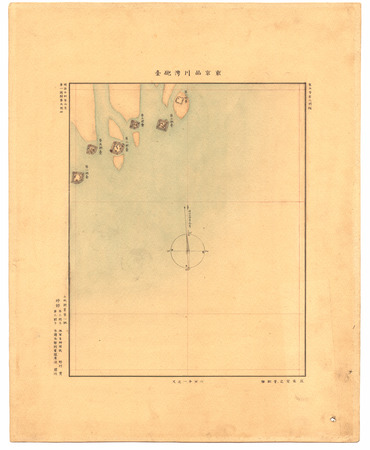
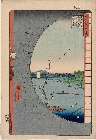
東京品川湾砲臺
Geospatial Information Authority of Japan
FishPix

Nagasaki
Yale University Library
Yale University Library Digital Collections
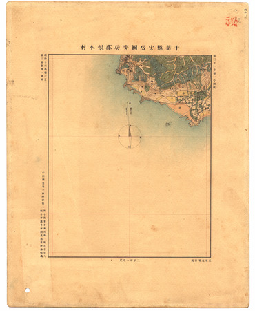
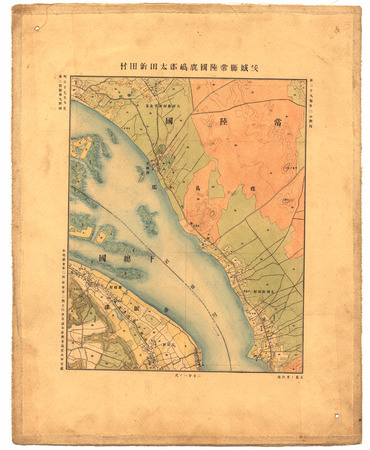
千葉縣安房國安房郡根本村
Geospatial Information Authority of Japan
FishPix
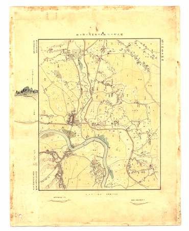
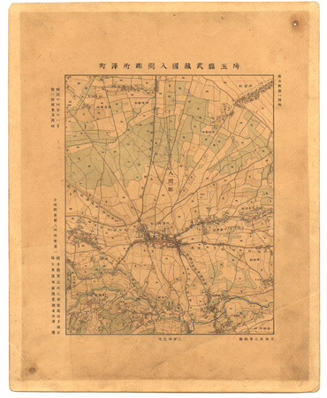
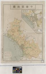
埼玉縣武蔵國北足立郡川口町ノ圖
Geospatial Information Authority of Japan
FishPix

滿洲歴史地理. : 第壹巻附図 : 後魏時代満洲図 (439-550)
Yoshida-South Library, Kyoto University
IIIF Discovery in Japan

Tōkyō shigai zenzu
Stanford University Libraries
Stanford Libraries SearchWorks
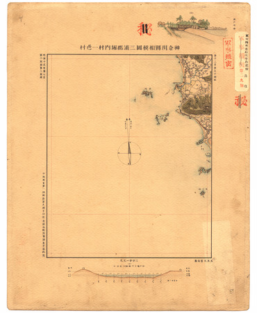
神奈川縣相模國三浦郡堀内村一色村
Geospatial Information Authority of Japan
FishPix
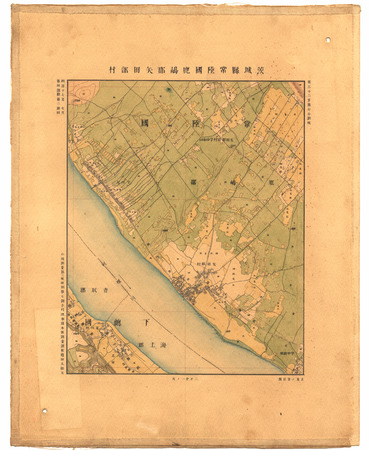
茨城縣常陸國鹿嶋郡矢田部村
Geospatial Information Authority of Japan
FishPix
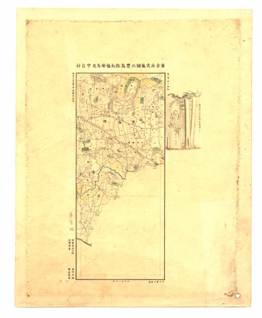
東京府武蔵國北豊島郡板橋練馬及中台村
Geospatial Information Authority of Japan
FishPix
埼玉縣武蔵國入間郡所澤町
Geospatial Information Authority of Japan
FishPix
千葉郡地図
Funabashi-shi Western Library
ADEAC: A System of Digitalization and Exhibition for Archive Collections
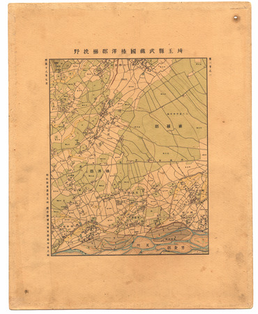
埼玉縣武蔵國榛澤郡櫛挽野
Geospatial Information Authority of Japan
FishPix
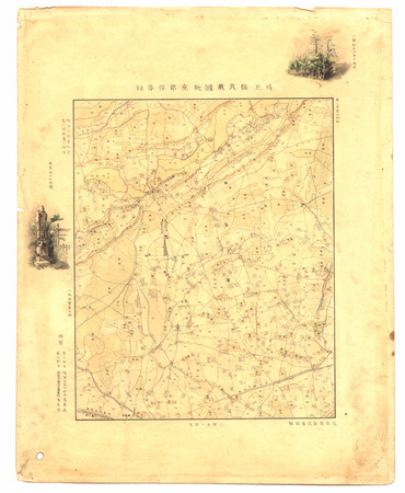
埼玉縣武蔵國新座郡保谷村
Geospatial Information Authority of Japan
FishPix
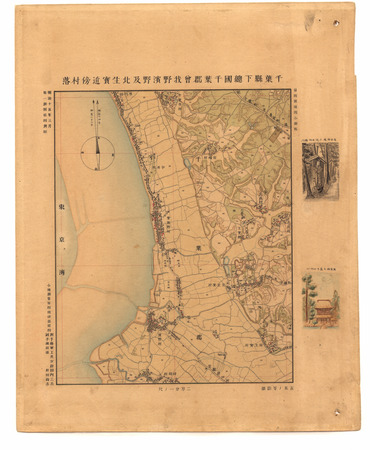
千葉縣下總國千葉郡曽我野濱野及北生實近傍村落
Geospatial Information Authority of Japan
FishPix
Meishoedohyakkei
Museum of Fine Arts, Boston
ARC Ukiyo-e Portal Database

Noordoost Cust van Asia : van Iapan tot Nova Zemla
Stanford University Libraries
Stanford Libraries SearchWorks

Henshi gafu (Object)
British Museum
British Museum Collection
東京府武蔵国芝区芝濱崎町近傍
Geospatial Information Authority of Japan
FishPix
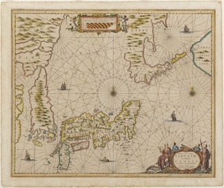
<i>The New and Accurate Map of Japan, Ezo, and Adjacent Islands</i>
Kyushu National Museum
Integrated Collections Database of the National Museums, Japan
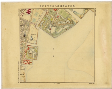
茨城縣常陸國鹿嶋郡太田新田村
Geospatial Information Authority of Japan
FishPix
Last Updated:
Uploaded: 2021-07-27