
A chart of the tradeing part of the East Indies and China, with the adjacent islands, from Surrat ...
- Time
- Owner Organization

A chart of the easternmost part of the East Indies with all the adjacent islands from Cape Comorin...
Royal Museums Greenwich
Europeana API
A chart of the eastermost part of the East Indies with all the adjacent islands from Cape Comorin to Iapan / by Iohn Seller, Hydrographer to the King
National Library of Australia
Trove: National Library of Australia

A chart of the eastermost part of the East Indies with all the adjacent islands from Cape Comorin to Iapan / by Iohn Seller, Hydrographer to the King ; F. Lamb Sculp
State Library of New South Wales
Trove: National Library of Australia

A Chart of the Eastermost part of the East Indies and China from Cape Comarin to Japan with the Ad...
Stanford University Libraries
Stanford Libraries SearchWorks

A Map of the East-Indies and the Adjacent Countries; with the Settlements, Factories and Territori...
Stanford University Libraries
Stanford Libraries SearchWorks

A Map of the East-Indies and the Adjacent Countries; with the Settlements, Factories and Territori...
Stanford University Libraries
Stanford Libraries SearchWorks

A Map of the East-Indies and the Adjacent Countries; with the Settlements, Factories and Territori...
Stanford University Libraries
Stanford Libraries SearchWorks

A Map of the East-Indies and the Adjacent Countries; with the Settlements, Factories and Territori...
Stanford University Libraries
Stanford Libraries SearchWorks
A chart of ye eastermost part of the East Indies / by Iohn Seller
National Library of Australia
Trove: National Library of Australia

A Chart of the Coast of China From Cambodia to Nanquam with Part of Japan
Stanford University Libraries
Stanford Libraries SearchWorks

Chart of the Coast of China from Cambodia to Nanquam with Part of Japan
Stanford University Libraries
Stanford Libraries SearchWorks
A Chart of the Northern Part of the China Sea [Material cartográfico] : shewing the Passage from F...
Biblioteca Nacional de España
Europeana API

Map of the Island of Japan, Kurile &c. with the Adjacent Coasts of the Chinese Dominions and a Ske...
Stanford University Libraries
Stanford Libraries SearchWorks

Map of the Island of Japan, Kurile &c. with the Adjacent Coasts of the Chinese Dominions and a Ske...
Stanford University Libraries
Stanford Libraries SearchWorks
Stanford's map of China & Japan with the adjacent parts of the Russian Repubcs. India, Burma &c / Stanford's Geographical Establishment
National Library of Australia
Trove: National Library of Australia

News from the Dutch East Indies
Netherlands Institute for Sound and Vision
Europeana API

Charts, etc
Yale University Library
Yale University Library Digital Collections

News from the Dutch East Indies: landing of the Dutch troops on Bali
Netherlands Institute for Sound and Vision
Europeana API

News from the Dutch East Indies: landing of the Dutch troops on Bali
Netherlands Institute for Sound and Vision
Europeana API

Chart of the S.W. Part of Japan from a dutch MS / by A. Dalrymple ; W. Harrison sc
Bibliothèque nationale de France
Europeana API

A New Map of India & China From the latest Observations
Stanford University Libraries
Stanford Libraries SearchWorks

General map of China and adjacent regions, showing treaty ports and railways
Stanford University Libraries
Stanford Libraries SearchWorks
A view of-the Regent's residence at Medan, capital of the Netherlands East Indies island of Sumatra, The Jap...
National Library of New Zealand
DigitalNZ New Zealand API
Sketch of a voyage to the India and China seas, including Japan and the Pacific islands, for the p...
Research Libraries UK
Europeana API
A Chart of the Coast of China From Cambodia to Nanquam with Part of Japan
Stanford University Libraries
Stanford Libraries SearchWorks

Carte Reduite De L'Ocean Septentrional compris entre l'Asie et l'Amerique Suivant les Decouvertes ...
Stanford University Libraries
Stanford Libraries SearchWorks

Tabula Indiae Orientalis et Regnorum Adjacentium J. Van Braam et G. onder de Linden . .
Stanford University Libraries
Stanford Libraries SearchWorks
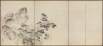
West Lake in Spring, High Tide at Qiantang
Tokyo National Museum
Integrated Collections Database of the National Museums, Japan
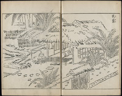
A Drawing Book
Minneapolis Institute of Arts
Minneapolis Institute of Art API

Pas-Caart van Zuyd-Zee tusschen California en Ilhas de Ladrones . . . (shows New Zealand, Carpenta...
Stanford University Libraries
Stanford Libraries SearchWorks
Chart of the Coast of China from Cambodia to Nanquam with Part of Japan
Stanford University Libraries
Stanford Libraries SearchWorks
Picture Book of Seasoned Grass (Ehon chiyomi-gusa): Beauties with Waka in 3 Volumes
Harvard Art Museums
Harvard Art Museums API
Picture Book of Seasoned Grass (Ehon chiyomi-gusa): Beauties with Waka, 1st of 3 Volumes
Harvard Art Museums
Harvard Art Museums API
Bag of Historical Treasures and People of Japan and China (Ehon shahō-bukuro), 7th of 10 Volumes
Harvard Art Museums
Harvard Art Museums API

(Southeast Asia, China &c.)
Stanford University Libraries
Stanford Libraries SearchWorks

Portion of an illustrated Japanese or Chinese manuscript or scroll that belonged to Arnold Genthe
Library of Congress
Digital Collections, Library of Congress
Encyclopedia of Western Art : [volume 4]
Metropolitan Museum of Art
The Metropolitan Museum of Art Digital Collection

Nieuwe Paskaart van het Noordelijkste Gedeelte van de Golf van Bengalen Vertoonende de Custen van ...
Stanford University Libraries
Stanford Libraries SearchWorks
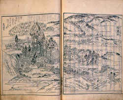
Toukaidoumeishozue hanpon
Saiku Historical Museum
Saiku Historical Museum Collections
Picture Book of Seasoned Grass: Waka by Famous Poets (Ehon yachiyo-gusa), 1st of 3 Volumes
Harvard Art Museums
Harvard Art Museums API
Last Updated:
Uploaded: 2021-07-27