
A chart of the easternmost part of the East Indies with all the adjacent islands from Cape Comorin...
- Time
- Owner Organization
A chart of the eastermost part of the East Indies with all the adjacent islands from Cape Comorin to Iapan / by Iohn Seller, Hydrographer to the King
National Library of Australia
Trove: National Library of Australia

A chart of the eastermost part of the East Indies with all the adjacent islands from Cape Comorin to Iapan / by Iohn Seller, Hydrographer to the King ; F. Lamb Sculp
State Library of New South Wales
Trove: National Library of Australia

A chart of the tradeing part of the East Indies and China, with the adjacent islands, from Surrat ...
Royal Museums Greenwich
Europeana API

A Chart of the Eastermost part of the East Indies and China from Cape Comarin to Japan with the Ad...
Stanford University Libraries
Stanford Libraries SearchWorks
A chart of ye eastermost part of the East Indies / by Iohn Seller
National Library of Australia
Trove: National Library of Australia

A Map of the East-Indies and the Adjacent Countries; with the Settlements, Factories and Territori...
Stanford University Libraries
Stanford Libraries SearchWorks

A Map of the East-Indies and the Adjacent Countries; with the Settlements, Factories and Territori...
Stanford University Libraries
Stanford Libraries SearchWorks

A Map of the East-Indies and the Adjacent Countries; with the Settlements, Factories and Territori...
Stanford University Libraries
Stanford Libraries SearchWorks

A Map of the East-Indies and the Adjacent Countries; with the Settlements, Factories and Territori...
Stanford University Libraries
Stanford Libraries SearchWorks

Eastern Archipelago : Flores Sea. Tana Jampea and Adjacent Islands
Stanford University Libraries
Stanford Libraries SearchWorks

News from the Dutch East Indies
Netherlands Institute for Sound and Vision
Europeana API

Chart of the Coast of China from Cambodia to Nanquam with Part of Japan
Stanford University Libraries
Stanford Libraries SearchWorks

A New Chart of The Pacific Ocean, Exhibiting The Western Coast of America, From Cape Horn To Beeri...
Stanford University Libraries
Stanford Libraries SearchWorks

A New Chart of The Pacific Ocean, Exhibiting The Western Coast of America, From Cape Horn To Beeri...
Stanford University Libraries
Stanford Libraries SearchWorks

News from the Dutch East Indies: landing of the Dutch troops on Bali
Netherlands Institute for Sound and Vision
Europeana API

News from the Dutch East Indies: landing of the Dutch troops on Bali
Netherlands Institute for Sound and Vision
Europeana API
Asia with the islands adioyning described, the atire of the people, & townes of importance, all of them newly augmented
National Library of Australia
Trove: National Library of Australia
A view of-the Regent's residence at Medan, capital of the Netherlands East Indies island of Sumatra, The Jap...
National Library of New Zealand
DigitalNZ New Zealand API

North Pacific Ocean : Eastern Part of Hawaiin Islands
Stanford University Libraries
Stanford Libraries SearchWorks
The entrance of Nangasacqui the chief port of the island of Kiusiu in the Kingdom of Japan from the manuscript chart of the Dutch East India Company
National Library of Australia
Trove: National Library of Australia

Map of the Island of Japan, Kurile &c. with the Adjacent Coasts of the Chinese Dominions and a Ske...
Stanford University Libraries
Stanford Libraries SearchWorks

Map of the Island of Japan, Kurile &c. with the Adjacent Coasts of the Chinese Dominions and a Ske...
Stanford University Libraries
Stanford Libraries SearchWorks

A New Chart of The Pacific Ocean, Exhibiting The Western Coast of America from Cape Horn to Beerin...
Stanford University Libraries
Stanford Libraries SearchWorks
A Chart of the Northern Part of the China Sea [Material cartográfico] : shewing the Passage from F...
Biblioteca Nacional de España
Europeana API

Pascaart vertoonende de zeecusten van Chili, Peru, Hispania Nova, Nova Granada, en California . .
Stanford University Libraries
Stanford Libraries SearchWorks

Pascaarte vande noord oost cust van Asia verthoonende in sich alle de zee-custen van Tartarien, va...
Royal Museums Greenwich
Europeana API

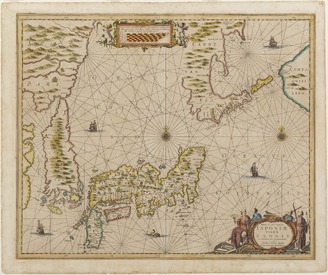
't Ooster deel van Oost Indien, streckende van Ceylon tot Japan en Hollandia Nova
Royal Museums Greenwich
Europeana API
Chart of the Coast of China from Cambodia to Nanquam with Part of Japan
Stanford University Libraries
Stanford Libraries SearchWorks
![Noordoost Cust Van Asia Van Japan tot Nova Zemla [Gold Highlighted!]](https://stacks.stanford.edu/image/iiif/zc604np2680%2F17235/full/!200,200/0/default.jpg)
Noordoost Cust Van Asia Van Japan tot Nova Zemla [Gold Highlighted!]
Stanford University Libraries
Stanford Libraries SearchWorks

Seekarte vom Pazifischen Ozean mit Kalifornien als Insel , ca. 1:21 500 000, Kupferstich, 1715
Deutsche Fotothek
Europeana API

Paskaerte Zynde t'Oosterdeel Van Oost Indien, met alle de Eylanden daer ontrendt geleegen van C.Co...
Stanford University Libraries
Stanford Libraries SearchWorks

Yotsudeami Fishing from a Covered Boat
Tokyo National Museum
Integrated Collections Database of the National Museums, Japan
<i>The New and Accurate Map of Japan, Ezo, and Adjacent Islands</i>
Kyushu National Museum
Integrated Collections Database of the National Museums, Japan

「風流謡三ぶくつい」
Art Institute of Chicago
ARC Ukiyo-e Portal Database

British Museum
British Museum Collection

Actor as Yaoya Oshichi (a, right panel); and Actor as an unidentified character (b, left panel)
Philadelphia Museum of Art
Philadelphia Museum of Art collection
Nova et accvrata Iaponiæ, Terræ Esonis ac insularum adjacentium ex novißima detectione descriptio
VU University Amsterdam Library
Europeana API

Magnum Mare del Zur cum Insula California | De Groote Zuyd-Zee en 't Eylandt California
Stanford University Libraries
Stanford Libraries SearchWorks

Japanese Paintings: Children's Games, 1894
University of Edinburgh
Europeana API

The Dancing Pot at Ninnaji Temple
Philadelphia Museum of Art
Philadelphia Museum of Art collection

Couple Feeding a Fowl
Tokyo National Museum
Integrated Collections Database of the National Museums, Japan

探幽/聖賢障子図
Tokyo National Museum
Integrated Collections Database of the National Museums, Japan
Last Updated:
Uploaded: 2021-07-27