

Expo 70: Roy Cowan mural
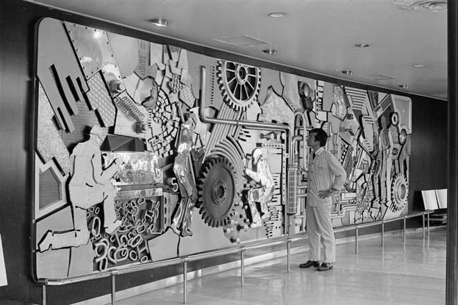
National Library Mural 1970 by John Drawbridge
John Drawbridge in front of his National Library Mural

EXPO '70

Expo ‘70

Osaka Expo ‘70

PAVILJOENS VOOR EXPO'70 VORDEREN

Fragment of a Mural

EXPO'70 象牙海岸共和国

Miss Williams to work at Expo 70 in Japan, 1969

絵葉書「EXPO’70 生活産業館」
Mural on Japanese ship, `Shin Sakura Maru'
Mural on Shin Sakura Maru, Japanese floating fair, 1976
John Oxley, 1810 - [miniature portrait]
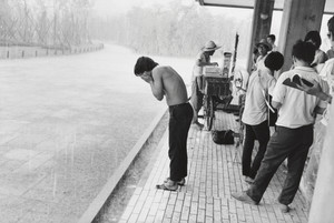
Young Man Washing His Face in the Rain at the "Anti-War Exposition", Held Near the Proposed Site for Expo '70, Osaka
The Oriental navigator, or, Directions for sailing to, from, and upon the coasts of, the East-Indies, China, Australia...To the work are prefixed a series of ... tables of the determined positions of all the principle points and places from the British seas to Cape Horn, the Cape of Good Hope, and thence to the islands of Japan, by John Purdy. (Plan of Chatham Island, &c. Whittle & Laurie, London, 1815.)
Last Updated:
Uploaded: 2020-12-17