This map of the Pacific shows the "pincers" strength of the United States from the Aleutian Islands in the n...
- Time
- Owner Organization
This map of the South-ivest Pacific combat zone shows how United Nations offensives are preparing the ' way ...

Map - Japan, Trust Territory of the Pacific Islands

Map of the Pacific Ocean
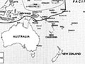
This map shows how the United Nations' action in the Solomon Islands opens the way to a possible move agains...
WAR IN THE EAST This map shows Malaya and the Philippine Islands and the principal scenes of the Japanese of...
The decks of a United States cruiser as the crew pour shells into one of the Pacific Islands held, by the Ja...
Map of the Pacific theatre, 1941-1945
This map shows, by the cross-lining, the Netherlands East Indies and also the island possessions of the U.S....

An Improved Map of the United States By Shelton & Kensett

North Pacific Ocean : Eastern Part of Hawaiin Islands
.jpg)
This map shows the tracks of the 36th Battalion patrols which searched Mono Island for Japanese stragglers
Meeting of the new Pacific War Council, during World War II, Washington, DC, United States
Relief map of Northern Honshu / prepared and reproduced in the United States Department of the Interior Geological Survey
Carrier-based planes of the United States Pacific Fleet struck heavily at Japanese shipping and shore instal...
Relief map of Northern Honshu : special airfield relief map / prepared and reproduced in the United States Department of the Interior Geological Survey
Span of the U.S. in the Pacific / news map by staff artist Sundberg

Fishes of Honolulu, from the series The United States

Okinawa henkan kinenzu : Map of Japan / limited first edition in commemoration of the return by the United States to Japan of Administrative Rights over the Ryūkyū Islands and the Daitō Islands, May 15, 1972
Hagstrom's map of the Pacific and the Far East : on Mercator's projection

The Pacific - Vital area for United States and Japan. Los Angels Examiner ... November 1942. Howar...
.jpg)
This Map shows 3 NZ Division's long lines of communication in the Solomons and the dates on which units of t...

Williams' Copper - Plate Map Of The United States, Canada, Mexico, Central America, West Indies, &...
.jpg)
This map indicates the tactical position in the Pacific in August 1942 when the Allied counter offensive was...

AMERICA'S NAVAL AND AERIAL STRENGTH: UNITED STATES AIRCRAFT SUCCESSFULLY ATTACK JAPANESE VESSELS OFF THE PHI...
Last Updated:
Uploaded: 2020-12-17