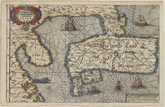
<i>The New and Accurate Map of Japan, Ezo, and Adjacent Islands</i>
- People
- Time
- Owner Organization
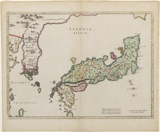
<i>New and Accurate Map of the Empire of Japan</i>
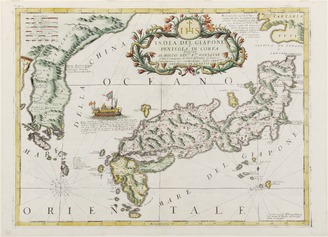
<i>Map of Japan and Korea</i>
<i>Map of Japan</i>
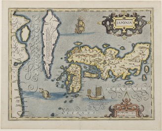
<i>Map of Japan</i>
<i>Map of Japan</i>

Ezo Monogatari (Stories of the Ainu)
<i>Accurate Chart on the Position of Japan</i>

Landscape of Ezo
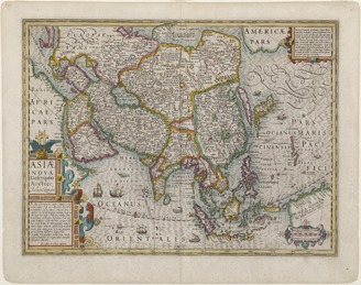
<i>New Map of Asia</i>
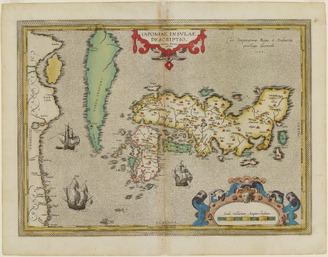
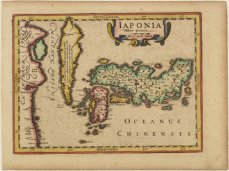
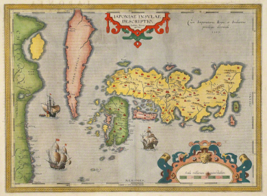
<i>Iaponiae insulae descriptio</i> (map of Japan)
<i>Map of the Eastern Izu Peninsula and the Izu Islands</i>

Tōbu, the Chieftain of Monbetsu, Ezo
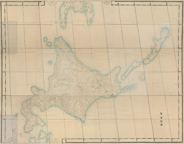
Kanban jissoku Nihon chizu (Ezo shotō)
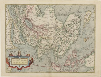
<i>Asiae nova descriptio</i> (<i>New Map of Asia</i>)

Minamoto no Yoshitsune Crossing the Sea to Ezo
The First Map of Japan in the Atlas

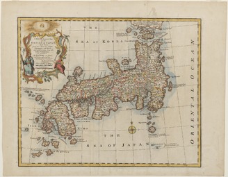
A new and accurate map of the Empire of Japan : laid down from the memoirs of the Portuguese and Dutch, and ...

A New and Accurate Map of the Empire of Japan Laid down from the Memoirs of the Portugese and Dutc...

A new and accurate map of the Empire of Japan. Laid down from the memoirs of the Portuguese and Du...

Map of Japan

Revised Route Map of Japan
Map of the Yaeyama Islands
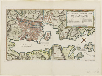
<i>Map of the Port and Town of Nagasaki</i>

Materials related to Tojuin Temple, one of the three government temples of Ezo

Kaart van Japan

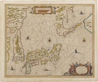
Nova Et Accurata Iaponiae Terrae Esonis Ac Insularum . . . (Korea shown as an island)

Carte des découvertes au Nord du Japon faites en 1643 par les vaisseaux hollandais le Kastrikum et...
A Chart of the Northern Part of the China Sea [Material cartográfico] : shewing the Passage from F...

A chart of the Tartarian Sea from Nova Zemla to Japan
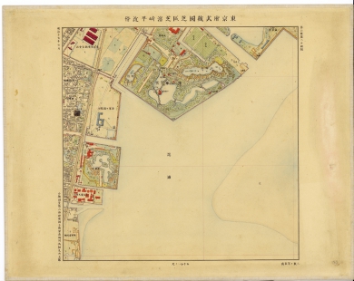
東京府武蔵国芝区芝濱崎町近傍
![備中国[山陽道図]](https://rmda.kulib.kyoto-u.ac.jp/iiif/RB00020052/RB00020052_00001_0.ptif/full/200,/0/default.jpg)
備中国[山陽道図]
![[双六集]新版大相撲土俵入飛双六](https://lapis.nichibun.ac.jp/image?did=6&pic=2&fid=11-4-18_01_01.jpg)
[双六集]新版大相撲土俵入飛双六
A new and accurate map of the Empire of Japan : laid down from the memoirs of the Portuguese and Dutch, and ...
![[唐獅子]](http://base1.nijl.ac.jp/~collectors_seal/0043869.jpg)
[唐獅子]

Murasaki Shikibu Genji Karuta (Object)

Shin Yoshiwara Tamaya shōgi Komurasaki (Object); Kankyo hyakurankai (Series)

surimono

A mapp of the Formosa described by Candidius being Tyawan and part of the coast of Formosa
<i>New and Accurate Map of the Empire of Japan</i>
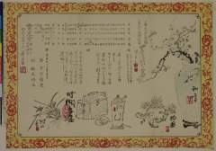
「四季混題三句会」「書画会」「催 白雪総連」「扱 稲見悟友」
![[北海道拾壹箇國圖]](https://lapis.nichibun.ac.jp/image?did=6&pic=2&fid=10-5_01_01.jpg)
[北海道拾壹箇國圖]
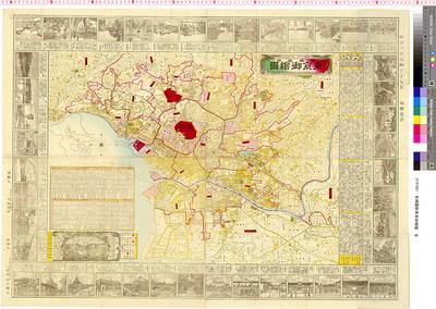
名勝圖解東亰御繪圖 : 全
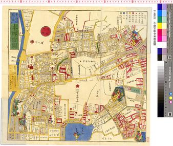
小石川谷中本郷繪圖
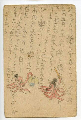
高橋達太郎ヵ宛森田洸一ヵ葉書(皇后から菓子を下賜された、タコの絵)

Seekarte vom Pazifischen Ozean mit Kalifornien als Insel , ca. 1:21 500 000, Kupferstich, 1715

't Ooster deel van Oost Indien, streckende van Ceylon tot Japan en Hollandia Nova

karta, gravyr
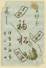
生そば 福松
Last Updated: 2025-07-22T01:06:05
Uploaded: 2025-07-23