

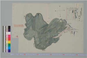
Shimousanokuni chibagun shiina kamigou ezu

Shitagaki yawatagouchika
Ougoumura(ezu)
Asakusa shitaya hongou hen ezu
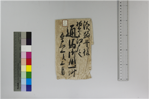
Shojou(shitagaki)
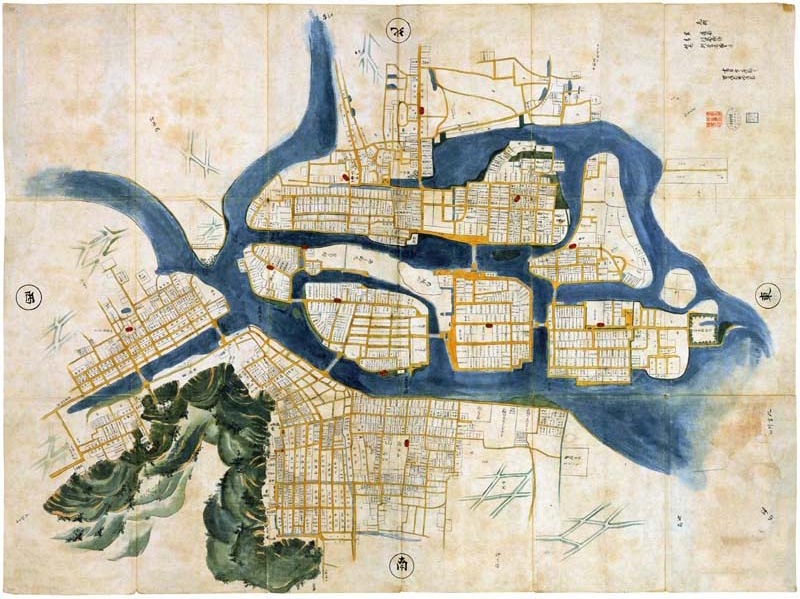
Gojōka ezu

Kouyouroku shitagaki

Shuinjouutsushi shitagaki

Shuinjouutsushi shitagaki
Kawahakemura(ezu)
Shimonakagomimura(ezu)
Shimohiraomura(ezu)
Asakusa shitaya hongou hen ezu

Shitagaki kizugawa tagai

Meitou gun shimoha man mura ezu ( ni )

Meitou gun shimoha man mura ezu ( ichi )

Shuumon onaratamechou shitagaki

Shuumon onaratamechou shitagaki
Shitaya sakamotochou ezu
Senbokugun rokugou takanomura ezu
Senbokugun rokugou motodatemura ezu
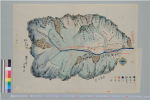
Kantō suji kawanami Uchigo ezu

Shuinjouutsushi oyobi shitagaki

Shuinjouutsushi oyobi shitagaki

Noushuufugeshigunnafunemuraryouhegurajimananatsujimaezu
Laurie and Whittle's new chart of the Indian and Pacific Oceans between the Cape of Good Hope, New Holland, and Japan, comprehending New Zealand, New Caledonia, New Britain, New Ireland, New Guinea,&c., Louisiade and New Georgia; also the Pelew, New Caroline, Ladrone, and Philippine Islands; &c. with the most remarkable tracks of the English, Spanish, French and Dutch navigators: and chiefly the track of the Walpole, Eastindiaman, Captn. Thos. Butler, 1794 from the Cape of Good Hope to Van Diemen's Land and, from thence to China, and the track of the Royal Admiral Captn. Henr. Bond in 1792 and 93, from the Cape to Port Jackson and China

Noushuukuchigunbungenezu

Shimoasouyoritokuman、kanayahongouyoridemachimadekirishitaezu

Neigunmitoribungenezu

Enumagunmitoribungenezu

「駿州富士郡」「駿東郡三牧大絵図」

Tonamigunbungenezu

Imizugunbungenezu

Niikawagunbungenezu

Imizugunezu

Notokuchigunbungenezu

Tonamigunyanazemuraonkenchishitanawahariezu
Aoshima shigai kinbōzu

「弥生雛」

玉野市都市計画図

冨士裾野演習場(二万五千分1演習場図)
Chūko fukin dai jūni shidan no sentō san-gatsu jūroku-nichi

Imizugunhoujouzugatamawariofushinkatachinadobungenezu

「亀山噺」「中の藤兵へ 嵐三五郎」「女房お雪」
Tangū mātō haisen oyobi futō no zu / Un'yu-bu Haisha-ka
近世職人尽絵詞

Niikawagunoofusegumimiyanobirakiryounarabiniyousuiesujiezu

The Arton Trial (third plate)
Uploaded: 2026-02-25