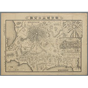


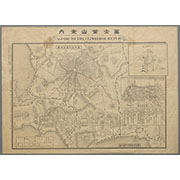
冨士登山案内 A GUIDE TO CLIMBER OF MT.FUJI

(Covers to) Picture map of China. Designed by Frank Randolph Southard. Printed in United States of...
Karte vom Japanischen Reiche, nach Original-karten und astronomischen Beobachtungen der Japaner : ...

A New Map of Great Tartary and China, with the adjoyning Parts of Asia, Taken from Mr. De Fer's Ma...

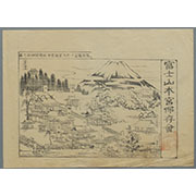
冨士登山口全図

Das Chinesische Reich mit den Schutz-Staaten, und Japan: entw. u. gez. v. C.G R.(eichard) 1826. Ge...
Collection of Thirty-six Kyōka Poems

Das Chinesische Reich Mit Seinen Schutzstaaten, Nebst dem Japanischen Inselreiche Gotha, bei Justu...

Indiae Orientalis, Insularumque Adiacentium Typus. Cum Privilegio

China. (with) Islands of Japan. By Keith Johnston, F.R.S.E. Keith Johnston's General Atlas. Engrav...

India Orient

Christianographie (Ancient World)

China and Japan. (with) Islands of Japan. By Keith Johnston, F.R.S.E. Keith Johnston's General Atl...

India Orientalis

Domestic And Foreign Missions Of The Methodist Episcopal Church. (These Maps are taken from "Histo...
Domestic And Foreign Missions Of The Methodist Episcopal Church. (These Maps are taken from "Histo...
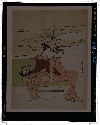
見立玄宗皇帝

Carte De La Coree et Du Japon

China, Contains 15 Subject Provinces, including the 2 Islands of Hainan Formosa and the Tributary ...

India Orientalis . . . 1600

Japan and Korea. (with) The Japanese Empire. (with) Port Arthur and Adjacent Territory. (with) For...
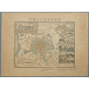
駿河国富士郡大宮国幣中社浅間神社之図

China and Japan by Keith Johnston, F.R.S.E. (with) Islands of Japan. Engraved & printed by W. & A....

見立東下り
Last Updated: 2025-06-03T01:00:34
Uploaded: 2025-06-04