Map of Japan and Manchoukuo : issued with the Japan year book, 1938-39 / by T. Sasaki, Y. Nogi
- People
- Time
- Owner Organization
General Soil map of Japan proper / compiler: Toyotaro Seki, Dr. Agr. ; drawer: Nobukata Sasaki
National Library of Australia
Trove: National Library of Australia

New map of Shanghai. (on verso) A map of China : Published by K. Saito. Osaka Japan Sole agent T. ...
Stanford University Libraries
Stanford Libraries SearchWorks

Ernst von Stein during his two-year stay in Japan (1885-1888), t
Museum of Ethnology, Vienna
Europeana API

The conifers and taxads of Japan. Issued December 30, 1916
University of Toronto
Europeana API
The conifers and taxads of Japan. Issued December 30, 1916
University of Toronto
Europeana API

A map of China : Published by K. Saito. Osaka Japan. Sole agent T. Kishida & Co. Shanghai. (inset ...
Stanford University Libraries
Stanford Libraries SearchWorks

Coal Resources of the World. Japan. Map No. 17. Plate IV. Karatsu and Sasebo Coal Fields. After Y....
Stanford University Libraries
Stanford Libraries SearchWorks
A map of China : Published by K. Saito. Osaka Japan. Sole agent T. Kishida & Co Shanghai. (inset m...
Stanford University Libraries
Stanford Libraries SearchWorks

Topographical map of the Japanese Empire, 1899 / Imperial Geological Survey of Japan ; drawn by T. Togawa an...
Yale University Library
Yale University Library Digital Collections

(Map of the Ishikari plains, Japan). (to accompany) Shomitsu Nippon chizu. (Atlas of Japan). Nippo...
Stanford University Libraries
Stanford Libraries SearchWorks

Coal Resources of the World. Japan. Map No. 15. Plate II. Ishikari Coal Fields After Y. Oinouye
Stanford University Libraries
Stanford Libraries SearchWorks

(Covers to) Map of Hiroshima. Nakao. (cover title) Map of Hiroshima 1947. Japan Travel Bureau, Hir...
Stanford University Libraries
Stanford Libraries SearchWorks

Map of Japan. Published by George F. Cram, Chicago, Ill. (to accompany) Cram's atlas of the world,...
Stanford University Libraries
Stanford Libraries SearchWorks

Mem-O-Map of Japan and Korea. Drawn by T/4 John G. Drury 214th Ordnance Battalion. Copyright 1946 ...
Stanford University Libraries
Stanford Libraries SearchWorks

Series (Standard map series designation system) ; 5205
Yale University Library
Yale University Library Digital Collections

Okinawa henkan kinenzu : Map of Japan / limited first edition in commemoration of the return by the United States to Japan of Administrative Rights over the Ryūkyū Islands and the Daitō Islands, May 15, 1972
Library of Congress
Trove: National Library of Australia
The Suma oriental of Tomé Pires : an account of the East from the Red Sea to Japan, written in Malacca and India in 1512-1515; and, The Book of Francisco Rodrigues, rutter of a voyage in the Red Sea, nautical rules, almanack and maps written and drawn in the East before 1515 (Map in pocket of vol.2: The east, from the Red Sea to Japan, as known to Francisco Rodrigques)
National Library of Australia
Trove: National Library of Australia
Map of Japan
National Library of Australia
Trove: National Library of Australia
Kōgun senka kakudai ikkenzu : (fu) fukin chiten no koji gaisetsu
National Library of Australia
Trove: National Library of Australia
Nanpōken jikyoku shigen seizu
National Library of Australia
Trove: National Library of Australia
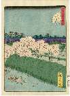
Edomeishoshijuuhakkei
Museum of Fine Arts, Boston
ARC Ukiyo-e Portal Database
(恵比須)
British Museum
ARC Ukiyo-e Portal Database

Oonoshinmuranaikenchishitaezu
Imizu City Shinminato Museum
ADEAC: A System of Digitalization and Exhibition for Archive Collections

Catalogue illustré de la section japonaise à l'exposition internationale des arts décoratifs et in...
Bibliothèque nationale de France
Europeana API
Stanford's map of eastern China, Japan and Korea : the seat of war in 1894
National Library of Australia
Trove: National Library of Australia
China and Japan
National Library of Australia
Trove: National Library of Australia

Edomeishoshijuuhakkei
Museum of Fine Arts, Boston
ARC Ukiyo-e Portal Database
「嵐三四郎か」
Museum of Fine Arts, Boston
ARC Ukiyo-e Portal Database

Yamanashiken sougou kaihatsu keikakuzu
Yamanashi Prefectural Library
Yamanashi Digital Archive

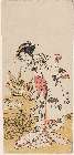
「はん官」「高野」
Art Research Center, Ritsumeikan University
ARC Ukiyo-e Portal Database

Kaidō ni shōkin
Library of Congress
Digital Collections, Library of Congress

Yamanashiken kenyuurin ichizu
Yamanashi Prefectural Library
Yamanashi Digital Archive

郡山市街全図 昭和8年
Koriyama City Library
ADEAC: A System of Digitalization and Exhibition for Archive Collections

Touto kinkaizu
Chiba Prefectral Central Library
Chiba Prefectural Digital Archive
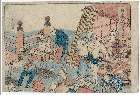
「(東海道五十三次)日本橋」 「品川へ二里」
Museum of Fine Arts, Boston
ARC Ukiyo-e Portal Database

立川町々勢一覧 : 立川町全図
Tamashin Chiiki Bunka Zaidan
ADEAC: A System of Digitalization and Exhibition for Archive Collections

Mandchourie et Coree de Kharbine a Seoul de Port-Arthur a Vladivostok Traduction de la Carte d'Eta...
Stanford University Libraries
Stanford Libraries SearchWorks
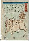
Hakutakunozu
Museum of Fine Arts, Boston
ARC Ukiyo-e Portal Database
Grande Tartarie et isles du Japon suivant les rélations les plus autentiques / par Mr. Brion, Ingénieur-Géographe du Roy
National Library of Australia
Trove: National Library of Australia

「芸州三筋道大略図「
Tokyo Metropolitan Central Library
ARC Ukiyo-e Portal Database

御代官所其外地形絵図面(万延元年)
Miyashiro Town local museum
ADEAC: A System of Digitalization and Exhibition for Archive Collections
Last Updated: 2020-06-05
Uploaded: 2021-07-22