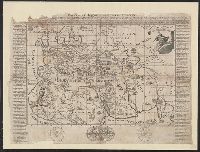
Japan : the country / Sydney Morning Herald ; designed by the Art Dept. of John Fairfax and Sons Limited
- People
- Time
- Owner Organization
Japan the country / Sydney Morning Herald ; designed by the Art Dept. of John Fairfax and Sons Limited

A pictorial map : Victory in the Pacific Designed and published by Ernest Dudley Chase of Winchest...
A chart of the South Sea / by John Seller, Hydrographer to the Kings most Excellent Majestie ; Dundee, sculp

Stainless steel table fork, part of a stainless steel and gilt brass cutlery set, designed by Gunn...
The Coffin Islands / surveyed by order of Commodore M.C. Perry U.S.N. by Lieuts. G.B. Balch, G.H. Cooper & L.A. Beardslee Mid. of the U.S. Ship Plymouth Commander John Kelly U.S.N. ; engraved by S. Siebert, lettering by C.A. Knight
Aerial view of the country looking towards Castelfrentano, Italy, World War II - Photograph taken by George ...

A Country Bridge, The Construction of This Bridge Seems Very Wonderful to Travellers. It is Formed by Two Vi...
Pacific war map / Dept. of Home Security ; issued by authority of the Minister for Home Security with the permission of Associated Newspapers Ltd
Wreckage of a harbour vessel sunk at her moorings in Sydney Harbour by the blast of a Japanese torpedo when ...
Navigantium atque itinerantium bibliotheca ; Or, A complete collection of voyages and travels : Consisting of above six hundred of the most authentic writers ... Containing whatever has been observed worthy of notice in Europe, Asia, Africa, and America ... the climate, soil and produce ... of each country: likewise the religion, manners, and customs ... To which is prefixed a copious introduction, comprehending the rise and progress of the art of navigation ... together with the invention and use of the loadstone ... / by John Harris ... .
The Oriental navigator, or, Directions for sailing to, from, and upon the coasts of, the East-Indies, China, Australia...To the work are prefixed a series of ... tables of the determined positions of all the principle points and places from the British seas to Cape Horn, the Cape of Good Hope, and thence to the islands of Japan, by John Purdy. (Plan of Chatham Island, &c. Whittle & Laurie, London, 1815.)
The country trade East-India pilot, for the navigation of the East-Indies and oriental seas, within the limits of the East-India Company, extending from the Cape of Good Hope to China, New Holland and New Zeeland, with the Red Sea, Gulf of Persia, Bay of Bengal, and China Seas / chiefly composed from actual surveys and draughts communicated by experienced officers of the East-India Company, and from the Neptune oriental by M. d'Apres de Mannevillette
Caroline Islands 1:25,000 : Yap / prepared under the direction of Engineer, Hq AFFE/BA, by the Military Geology Branch, Intelligence Division ; map compiled by C. G. Johnson, geologist, Military Geology Branch, U.S. Geological Survey, for the Intelligence Division, Office of the Engineer, Hq. U.S. Army Japan
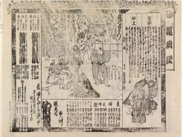
Yanaginoitohikuyagohiiki、kasuminoirotsuretehitomure
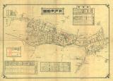
水戸市略図
![Sodegauraukinanoharusame、[komochiyamauba]](http://mfas3.s3.amazonaws.com/styles/grid-2_thumbnail_retina/s3/objects/SC211652.jpg)
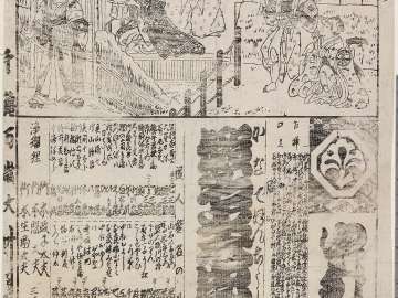
Sodegauraukinanoharusame、[komochiyamauba]

Dai yon gō

日活時代劇・後編・清水次郎長 ほか

Jinkō sanjūnidai Yōmei Tennō kinjō Yamato no Kuni Buttōzan jōgū kōin Tachibanadera sōezu : Nihon Buppō saisho Shōtoku Taishi otanjōsho
Kanadehonchuushingura

冨士山禅定図

The Empire of China and Island of Japan, Agreeable to Modern History
Hikosangongenchikainosukedachi、natsumatsuridanshichijima

Jinmu Tennō goryō shinkei
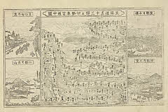
「東海道五十三駅並伊勢参宮道中図」
Ezo no Kuni Zenzu / Hayashi Shihei zu

佐賀県管内図
Tsuizensatsukirenga、natsumatsurinaniwakagami
Hatsumidorisaiwaisoga
Datekurabeokunikabuki、sekitorisenryounobori

Kokuhei Chūsha Shiogama Jinja meisai zenzu
Universal - Historie auf der Land-Karten [ ... most of the eastern hemisphere, omitting Japan, part of China...
Kuruwabunshou
![Taoyanagiimosenomato、[yaehitoe]kotonohasoga](http://mfas3.s3.amazonaws.com/styles/grid-2_thumbnail_retina/s3/objects/SC209733.jpg)
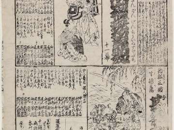
Taoyanagiimosenomato、[yaehitoe]kotonohasoga
![Hanafubukitsuzurenonishiki、[kamagafuchifutatsudomoe]、[tokiwanoiroouginoutsushie]](http://mfas3.s3.amazonaws.com/styles/grid-2_thumbnail_retina/s3/objects/SC211498.jpg)
Hanafubukitsuzurenonishiki、[kamagafuchifutatsudomoe]、[tokiwanoiroouginoutsushie]
Igagoedouchuusugoroku
Last Updated: 2020-06-05
Uploaded: 2021-07-22