Map - Manchuria, Military Situation (1931-1932)
![[Manchuria] (7 sheet US Military Information Division Map of Manchuria)](https://stacks.stanford.edu/image/iiif/yr430hp5690%2F41524/full/!200,200/0/default.jpg)
[Manchuria] (7 sheet US Military Information Division Map of Manchuria)
Map - Huai Jou (Manchuria)

Map of Manchuria, Corea & Japan
![Map of Manchuria, Corea & Japan [cartographic material]](https://collections.library.yale.edu/iiif/2/15828540/full/!200,200/0/default.jpg)
Map of Manchuria, Corea & Japan [cartographic material]

Strategical map of part of Korea and Manchuria / prepared by the Second Division, General Staff (Military In...

Military Map of South-Eastern Virginia

The latest map of Manchuria, Korea, Formosa, and Saghalien

Strategical Map of Part of Korea and Manchuria . . . 1906
Military airfields in Korea. Report No. 12-a(13), USSBS Index Section 6

Military Disciplinary Law (Oct. 13, 1909, Military Command No. 4)

Mitsukoshi, vol.22, no.6 (June 1932)
Court Exh. No. 717: Report concerning Japanese military settlements in Manchuria
Court Exh. No. 717: Report concerning Japanese military settlements in Manchuria
A map of South China, scene of the latest military operations by the Japanese. , (Evening Post, 13 October 1...

Minamimanshuu kouzan bunpuzu = Map showing mineral distribution in South Manchuria
Translation No. 66, military topographical map of Nansei Shoto. Report No. 3-d(73), USSBS Index Section 6
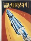
Kagakuchishiki, vol.12 no.6 (June 1932)
Court Exh. No. 2711: Map of China and Manchuria drawn up by Research Scientific Department of the Society of the East Asia Culture, published in Nov 1932
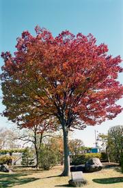
13・11・6 ケヤキ
Court Exh. No. 3856: Map entitled "Latest Great Map of Chinese Republic" published in Japan in 1932. For idetification only
Current situation of military supply depots. Report No. 43e(3), USSBS Index Section 2
Military Tribunal Documents, Case Number 1-6
General map of northern China and Manchuria. Report No. 64a(12), USSBS Index Section 2
Last Updated:
Uploaded: 2020-12-17