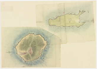
Map of Rebun and Rishiri Islands
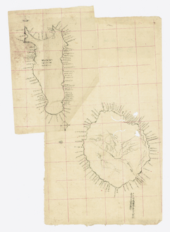
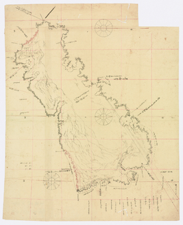
Survey Map of Okushiri Island
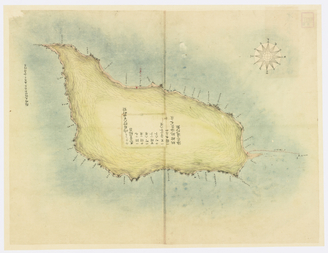
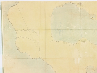
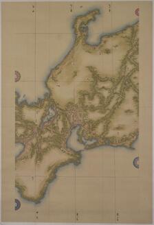
Survey Map of the Etorofu Island
〔利尻島 礼文島〕
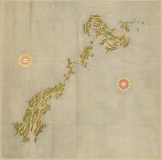
Map of the Yaeyama Islands

奥尻島測量原図
<i>Map of the Eastern Izu Peninsula and the Izu Islands</i>
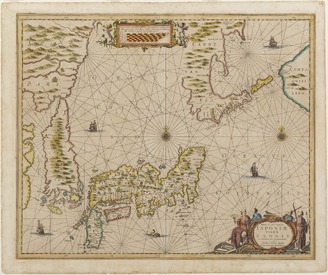
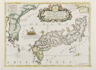
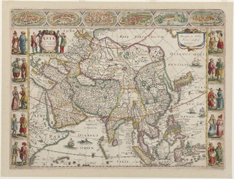
<i>The New and Accurate Map of Japan, Ezo, and Adjacent Islands</i>

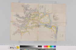
Kanmei sokuryou seizu

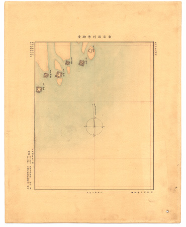
エドモ湾測量製図

Hawaikoku shotou zenzu = Map of the Hawaiian Islands
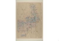
蝦夷地測量製図

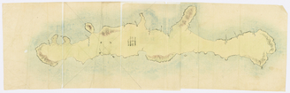
国後島測量原図
Map of Kyushu (Large map) No. 15, Koshikijima
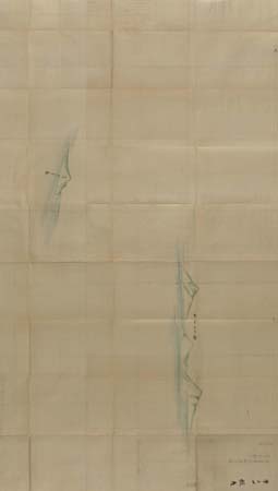
志古丹島測量原図
![[色丹島]測量図《シコタン嶋全図》](https://colbase.nich.go.jp/media/tnm/P-9997/image/slideshow_s/P-9997_C0072451.jpg)
[色丹島]測量図《シコタン嶋全図》

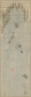
択捉島測量原図「エトロフ全図」

測量用製図用器具各種
<i>Map of Japan and Korea</i>
Map of Japan (Medium Scale): Chūbu and Kinki

Map of Sea and Land Routes in Japan
.jpg)
Map of the World and 28 Famous Cities
<i>Illustrated Map of the Cities and Peoples of Asia</i>

Night Festival of Tsushima Shrine
![[Grand poisson, fucus et crevette] : [estampe] / [Pierre Roche]](https://api.europeana.eu/thumbnail/v2/url.json?uri=https%3A%2F%2Fgallica.bnf.fr%2Fiiif%2Fark%3A%2F12148%2Fbtv1b105004925%2Ff1%2Ffull%2F512%2C%2F0%2Fnative.jpg&type=IMAGE)


![薩摩国[西海道図]](https://rmda.kulib.kyoto-u.ac.jp/iiif/RB00020071/RB00020071_00001_0.ptif/full/200,/0/default.jpg)
![相模国[東海道図]](https://rmda.kulib.kyoto-u.ac.jp/iiif/RB00020021/RB00020021_00001_0.ptif/full/200,/0/default.jpg)


![[歴民カード_歴史] 紙本淡彩 覚園寺境内図](https://khirin-i.rekihaku.ac.jp/iiif/nmjh_rekimin_h/11449107_02.tif/full/200,/0/default.jpg)


![日向国[西海道図]](https://rmda.kulib.kyoto-u.ac.jp/iiif/RB00020069/RB00020069_00001_0.ptif/full/200,/0/default.jpg)


Last Updated: 2025-07-22T01:06:05
Uploaded: 2025-07-23