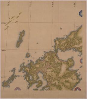
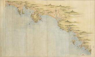
日本沿海輿地図(中図) 九州北部
東京国立博物館
国立博物館所蔵品統合検索システム
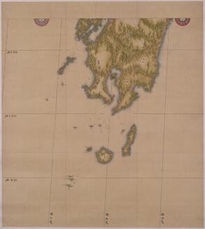
日本沿海輿地図(中図) 九州南部
東京国立博物館
国立博物館所蔵品統合検索システム
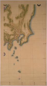
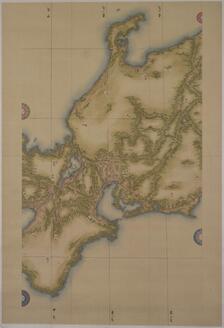
日本沿海輿地図(中図) 関東
東京国立博物館
国立博物館所蔵品統合検索システム
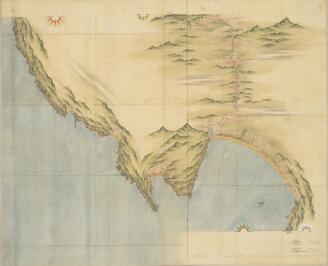
日本沿海輿地図(中図) 中部・近畿
東京国立博物館
国立博物館所蔵品統合検索システム
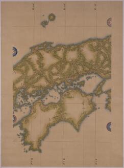
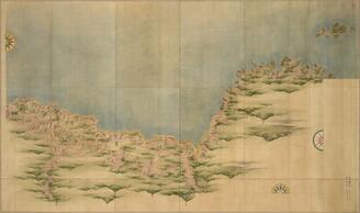
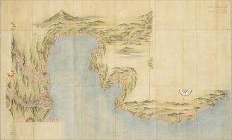
日本沿海輿地図(中図) 中国・四国
東京国立博物館
国立博物館所蔵品統合検索システム
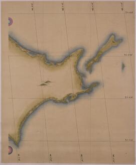
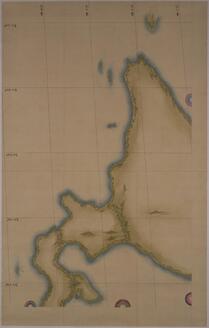
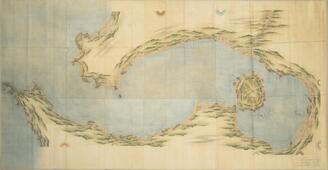
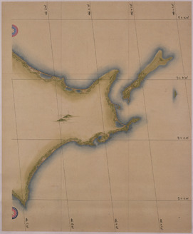
日本沿海輿地図(中図) 北海道東部
東京国立博物館
国立博物館所蔵品統合検索システム
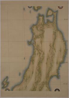
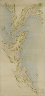
日本沿海輿地図(中図) 東北
東京国立博物館
国立博物館所蔵品統合検索システム
北海道全部縮図
東京国立博物館
国立博物館所蔵品統合検索システム

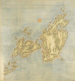
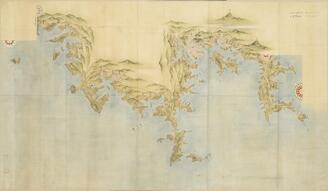
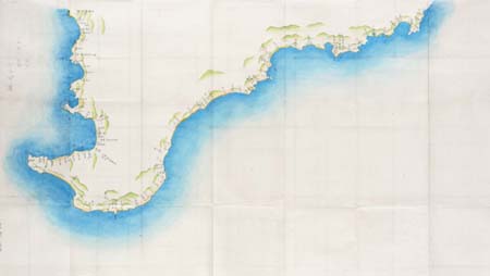
九州沿海図(中図)
東京国立博物館
国立博物館所蔵品統合検索システム

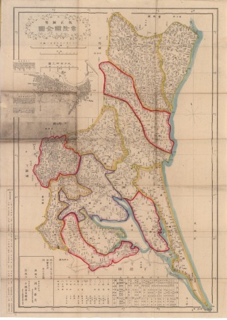
大日本輿地全図
東京国立博物館
国立博物館所蔵品統合検索システム

本邦西部海路図
京都国立博物館
国立博物館所蔵品統合検索システム

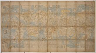
新刻日本輿地路程全図
東京国立博物館
国立博物館所蔵品統合検索システム
九州沿海図(大図)第二 中津
東京国立博物館
国立博物館所蔵品統合検索システム
九州沿海図(大図)第九 志布志
東京国立博物館
国立博物館所蔵品統合検索システム
九州沿海図(大図)第十九 天草
東京国立博物館
国立博物館所蔵品統合検索システム
九州沿海図(大図)第十
東京国立博物館
国立博物館所蔵品統合検索システム
日本図
東京国立博物館
国立博物館所蔵品統合検索システム
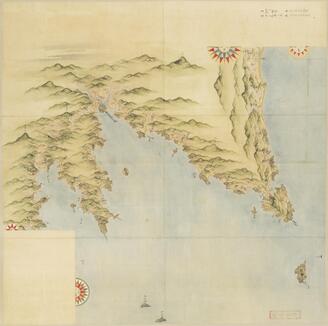
九州沿海図(大図) 第一
東京国立博物館
国立博物館所蔵品統合検索システム
九州沿海図(大図)第七 宮崎・高鍋
東京国立博物館
国立博物館所蔵品統合検索システム
九州沿海図(大図)第六 延岡
東京国立博物館
国立博物館所蔵品統合検索システム
九州沿海図(大図)第三 大分
東京国立博物館
国立博物館所蔵品統合検索システム
九州沿海図(大図)第五 佐伯
東京国立博物館
国立博物館所蔵品統合検索システム
九州沿海図(大図)第四 臼杵
東京国立博物館
国立博物館所蔵品統合検索システム

大日本沿海輿地全図 小図 本州西南部
東京都立中央図書館
東京都立図書館デジタルアーカイブ(TOKYOアーカイブ)

Italy before the growth of the Roman Power
京都大学吉田南総合図書館
IIIF Discovery in Japan
日本沿海輿地図(中図) 東北
東京国立博物館
国立博物館所蔵品統合検索システム

城田村詫田字白石全図
佐賀県立図書館
IIIF Discovery in Japan
日本沿海輿地図(中図) 中部・近畿
東京国立博物館
国立博物館所蔵品統合検索システム
伊能忠敬日本図(中図)
東京国立博物館
国立博物館所蔵品統合検索システム

鹿江村字九ノ坪篭一角全図
佐賀県立図書館
IIIF Discovery in Japan
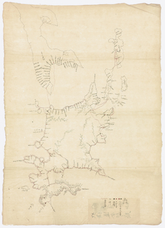
日本沿海輿地図(中図) 九州北部
東京国立博物館
国立博物館所蔵品統合検索システム
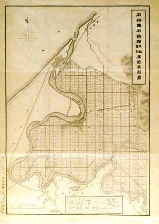
石狩国石狩郡生振当別原野区画図
国土地理院
古地図コレクション
![淡路国[南海道図]](https://rmda.kulib.kyoto-u.ac.jp/iiif/RB00020058/RB00020058_00001_0.ptif/full/200,/0/default.jpg)
淡路国[南海道図]
京都大学附属図書館
IIIF Discovery in Japan
日本沿海輿地図(中図) 北海道東部
東京国立博物館
国立博物館所蔵品統合検索システム

Map of Edo (Ōedo dai ezu)
フィラデルフィア美術館
フィラデルフィア美術館コレクション
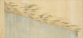
安房 小湊 勝山 上総
国土地理院
古地図コレクション
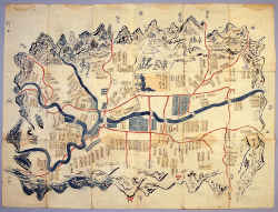
伊勢国多気城下古図
斎宮歴史博物館
斎宮歴史博物館所蔵品

鉱山借區図
高山市教育委員会
ADEAC:デジタルアーカイブシステム
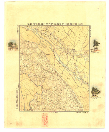
埼玉縣武蔵國北足立郡大門町及戸塚村近傍村落
国土地理院
古地図コレクション

surimono
大英博物館
大英博物館コレクション

小城郡村図池上苅
佐賀県立図書館
IIIF Discovery in Japan

朝鮮国図
東京国立博物館
国立博物館所蔵品統合検索システム
常陸国全図
国土地理院
古地図コレクション
登録日: 2026-03-26