
Trench hewn in rock marks the scene of the ancient Roman Battle of Cannae, Italy - Photograph taken by Georg...
Alexander Turnbull Library
DigitalNZ New Zealand API

The King of Italy
Philadelphia Museum of Art
Philadelphia Museum of Art collection

Rickover : the birth of nuclear power
Stanford University Libraries
Stanford Libraries SearchWorks
The role of growth stresses on the orientation of the tree branch
NDL Digital Collections
NDL Digital Collections
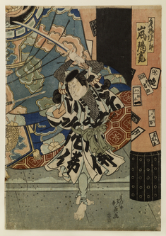
Fight Before Statue of the King of Hell
The Walters Art Museum
The Walters Art Museum API
Women of Campobasso, Italy, still use the old Roman washing place for their laundry - Photograph taken by Ge...
Alexander Turnbull Library
DigitalNZ New Zealand API

Europe showing the general direction of the Barbarian inroads on the fall of the Roman Empire
Yoshida-South Library, Kyoto University
IIIF Discovery in Japan

The Monkey Songokū Appears before the King of Hell
Philadelphia Museum of Art
Philadelphia Museum of Art collection
Before the Mirror
Harvard Art Museums
Harvard Art Museums API

Before the Act
Philadelphia Museum of Art
Philadelphia Museum of Art collection

Before the Storm
Art Institute of Chicago
Art Institute of Chicago API
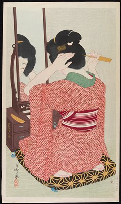
Before the Mirror
Minneapolis Institute of Arts
Minneapolis Institute of Art API
New Zealanders of the Royal Air Force checking their equipment before a flight, Foggia airfield, Italy - Pho...
Alexander Turnbull Library
DigitalNZ New Zealand API
South wall of ancient Roman fortress of Lucera, Italy, World War II - Photograph taken by George Kaye
Alexander Turnbull Library
DigitalNZ New Zealand API

The army of the north melts away before the Rising Sun
Library of Congress
Digital Collections, Library of Congress
The significance of looking back : fertility before the "fertility decline"
GESIS - Leibniz-Institut für Sozialwissenschaften. Bibliothek Köln
Europeana API
Hudson Talor and the China Inland mission(The Growth Of A Work Of God)
Kansai University Open Research Center for Asian Studies
IIIF Discovery in Japan
Hudson Taylor and the China inland mission : the growth of a work of God
Kansai University Open Research Center for Asian Studies
IIIF Discovery in Japan

Hudson Talor and the China Inland mission(The Growth Of A Work Of God)
Kansai University Digital Archive
Kansai University Digital Archive
Peasants praying before images of the God of Light, Nikko
Victoria and Albert Museum
Victoria and Albert Museums API
The Effects of the Demographic Transition on Economic Growth Implications for Japan
Uppsala University
Europeana API
Role of hepatocyte growth factor in the repair process of gastric ulcer
NDL Digital Collections
NDL Digital Collections
Petition for the Formal Release of Power Japanese Munitions
NDL Digital Collections
NDL Digital Collections
Women's leadership online summit. The power of introverted women
Stanford University Libraries
Stanford Libraries SearchWorks

Greece in the fifth century B.C
Yoshida-South Library, Kyoto University
IIIF Discovery in Japan
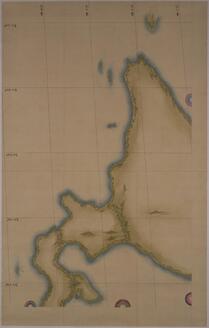
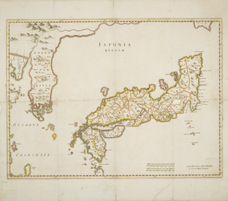
Map of Japan (Medium Scale): Western Hokkaido
Tokyo National Museum
Integrated Collections Database of the National Museums, Japan
![淡路国[南海道図]](https://rmda.kulib.kyoto-u.ac.jp/iiif/RB00020058/RB00020058_00001_0.ptif/full/200,/0/default.jpg)
淡路国[南海道図]
Kyoto University Library
IIIF Discovery in Japan
常陸国全図
Geospatial Information Authority of Japan
FishPix

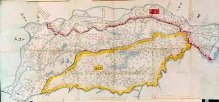
杵島郡村図佐留志村 (3)
Saga Prefectual Library
IIIF Discovery in Japan
![[五十鈴川勢田川河口]](https://www.bunka.pref.mie.lg.jp/Miebunka/rest/media/S?cls=muse_col22&pkey=0000000183)
[五十鈴川勢田川河口]
三重県環境生活部文化振興課
Specified Historical Public Records and Archives, Mie
![Rumoi, Rumoi [Sub]prefecture. Hokkaido, Japan](https://stacks.stanford.edu/image/iiif/bp444yn9111%2Fbp444yn9111_0001/full/!200,200/0/default.jpg)
Rumoi, Rumoi [Sub]prefecture. Hokkaido, Japan
Stanford University Libraries
Stanford Libraries SearchWorks
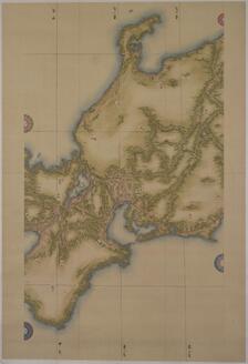
Map of Japan (Medium Scale): Chūbu and Kinki
Tokyo National Museum
Integrated Collections Database of the National Museums, Japan
![Japan [and Korea]](https://stacks.stanford.edu/image/iiif/xv761my3964%2F41979/full/!200,200/0/default.jpg)
Japan [and Korea]
Stanford University Libraries
Stanford Libraries SearchWorks
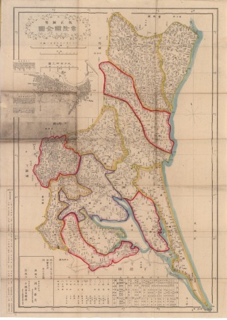
武蔵国石高附 三郡
Geospatial Information Authority of Japan
FishPix

鹿江村字九ノ坪篭一角全図
Saga Prefectual Library
IIIF Discovery in Japan
日本国図
Tokyo National Museum
Integrated Collections Database of the National Museums, Japan
![安房国[東海道図]](https://rmda.kulib.kyoto-u.ac.jp/iiif/RB00020023/RB00020023_00001_0.ptif/full/200,/0/default.jpg)
安房国[東海道図]
Kyoto University Library
IIIF Discovery in Japan
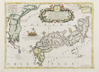
<i>Map of Japan and Korea</i>
Kyushu National Museum
Integrated Collections Database of the National Museums, Japan
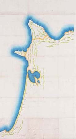
陸奥 三厩 龍飛岬 十三潟
Geospatial Information Authority of Japan
FishPix
Last Updated: 2020-04-16
Uploaded: 2021-07-27