
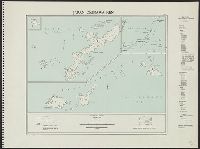
A mapp of the Formosa described by Candidius being Tyawan and part of the coast of Formosa
- Time
- Owner Organization
A chart of the northern part of the China Sea shewing the passage from Formosa to Japan : with the eastern coast of China and the Lekeyo Islands

A mapp of the Isles of Iapon
![[Taiwan and the Coast of Fujian and Guandong, China] Kaart van de Chineesche Kust en van Formosa v...](https://stacks.stanford.edu/image/iiif/zy510ks0323%2F34567/full/!200,200/0/default.jpg)
[Taiwan and the Coast of Fujian and Guandong, China] Kaart van de Chineesche Kust en van Formosa v...

A Chart of the Coast of China From Cambodia to Nanquam with Part of Japan

Chart of the coast of China and of the Japan islands including the Marianes and part of the Philippines

A New Mapp of the World By Phil. Lea

The central and part of the right portion of Tseszetai forts on the W. Coast of Wei-Hai-Wei
A chart of the northern part of the China Sea shewing the passage from Formosa to Japan with the eastern coast of China and the Lekeyo islands / by Van Kuelen ; improved from the maps drawn in China by Father Gaubil in 1752

Japan : Nipon, Kiusiu and Sikok, and a part of the coast of Korea / according to Krusenstern's Chart of 1827 ; J & C Walker sculpt

Japan described and illustrated by the Japanese section ten

Chart of the Coast of China from Cambodia to Nanquam with Part of Japan

The latest map of Manchuria, Korea, Formosa, and Saghalien
Chart of the coast of China and of the Japan Islands including the Marianes and a part of the Philippines / compiled by order of Commodore M.C. Perry U.S.N. from the latest authorities with additions and corrections by the U.S. Japan Expedition by Lieuts. W.L. Maury and S. Bent U.S.N. ; drawn by Edw. Sels ; engr. by S. Siebert
A chart of ye eastermost part of the East Indies / by Iohn Seller

A portion of the shelter trenches on Motienling, on the E. coast of Wei-Hai-Wei

A portion of the shelter trenches on Motienling, on the E. coast of Wei-Hai-Wei

People deserting their homes, in Manchuria, as a result of being invaded by the Japanese and the a...

A portion of the eminence to the left of the Tseszetai forts on the W. coast of Wei-Hai-Wei
Map of Nanking, the Chinese southern capital, which is being attached by a Japanese army and is expected to ...
The flight of the Lapwing, a naval officer's jottings in China, Formosa and Japan

Bronze Figurine, Being The Lid Of A Censer

Part of Japan or Nipon. (with) View of the coast of Japan when we first saw it (Engraved by) W. H(...
A new plaine and exact map of Asia / described by N.I. Vischer and rendered into English with habits of the countries and manner of the chiefe citties

A portion of the Lungmeaoutsuy forts, on the E. coast of Wei-Hai-Wei, and the Japanese torpedo-boat No. 22, run aground

Shinchiku shigaizu = : Map of Hsinchu city

Descripcion De Las Indias Del Poniente

Carte des Isles du Iapon : esquelles est remarqve la Route tant par Mer que par Terre que tiennent les Holla...
![[Southeast Asia, China & India]](https://stacks.stanford.edu/image/iiif/jj467gk2095%2F0171gh/full/!200,200/0/default.jpg)
[Southeast Asia, China & India]

都市計畫基本圖. : 7 松ヶ崎

A new and accurate map of the Empire of Japan : laid down from the memoirs of the Portuguese and Dutch, and ...

滿洲歴史地理. : 第壹巻附図 : 後魏時代満洲図 (439-550)

千葉県北総東葛飾郡沿浦之地図
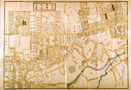
改正青山長者丸辺図 全

Empire of Japan ... Published under the Supervision of the Society for the Diffusion of Useful Kno...
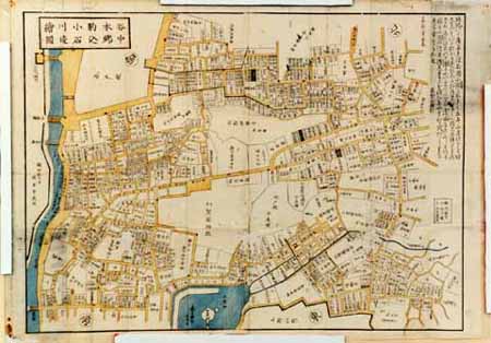
谷中本郷駒込小石川辺絵図

Plan of Hong Kong City of Victoria . . .

Kawagoe, Japan, Saitama-ken, Honshu

Suite De L'Ocean Oriental Contenant Les Isles De La Sonde Les Costes De Tunquin Et De La Chine Les...

The Guide Map to the Railway in The Neighbourhood of Tokyo
A new & correct chart of the Indian Sea from Cabo Bonea Esperanca to Japan according to Mr. Edward Wrights projection vulgarly called Mercators chart
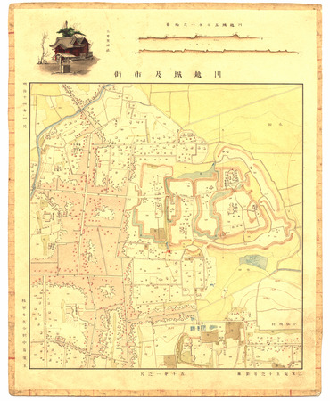
川越城及市街(五千分之一尺)
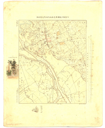
千葉縣下總國東葛飾郡野田町近傍村落
![[弘化改正大坂細見図]](https://lapis.nichibun.ac.jp/image?did=6&pic=2&fid=10-68_01_01.jpg)
[弘化改正大坂細見図]

Carte particulière des isles du Japon et partie des costes de la Chine

An Improved Map of the United States By Shelton & Kensett
Okinawa-ken

都市計畫基本圖. : 6 上賀茂

Iaponia Regnum
Last Updated: 2021-01-30
Uploaded: 2021-07-29