Central Japan :
- Time
- Owner Organization

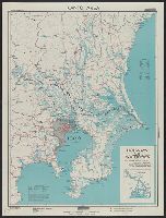
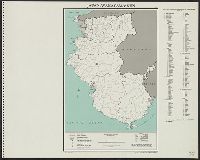
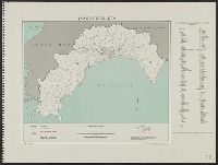
Central Japan (central and northern Honshū) water supply
Stanford University Libraries
Stanford Libraries SearchWorks

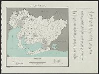
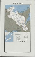
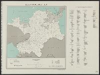
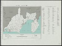
Central Japan (Central and Northern Honshū). Administrative divisions. No. 5282
Stanford University Libraries
Stanford Libraries SearchWorks

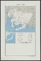
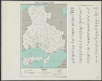
Central Japan (central and northern Honshū) distribution of population
Stanford University Libraries
Stanford Libraries SearchWorks
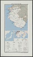
Japan--USSR : northern territories / Central Intelligence Agency
National Library of Australia
Trove: National Library of Australia

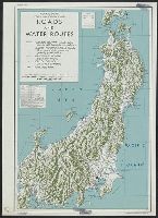
Japan, motor roads and ports
Stanford University Libraries
Stanford Libraries SearchWorks
Joint Army-Navy Intelligence Study of Central Japan, Central and Northern Honshu, Regional Summary, JANIS 85, February 1945, Chapter 1-2
NDL Digital Collections
NDL Digital Collections
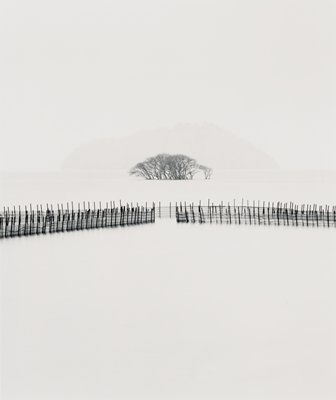
Submerged Trees, Kohoku, Honshu, Japan
Minneapolis Institute of Arts
Minneapolis Institute of Art API

Japan Series: North Honshu Islands
Museum of New Zealand Te Papa Tongarewa
DigitalNZ New Zealand API
No. 85, central Japan: Central and northern Honshu, Vol. 2 of 2 (Plans), October 1944. Report No. 1-c(25), USSBS Index Section 7
NDL Digital Collections
NDL Digital Collections

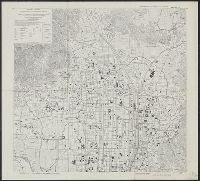
Ichinomiya and environs, Aichi Prefecture, Honshu, Japan
Stanford University Libraries
Stanford Libraries SearchWorks
Joint Army-Navy Intelligence Study of Central Japan, Central and Northern Honshu, Regional Summary, JANIS 85-2, February 1945, Figures S-19 to S-41
NDL Digital Collections
NDL Digital Collections
No. 85-2, central Japan: Central and northern Honshu, Vol. 1 of 2 (charts), May 1945. Report No. 1-c(28), USSBS Index Section 7
NDL Digital Collections
NDL Digital Collections
Joint Army-Navy Intelligence Study of Central Japan, Central and Northern Honshu, Regional Summary, JANIS 85-2, February 1945, Figures S-1 to S-18
NDL Digital Collections
NDL Digital Collections
No. 85-2, central Japan: Central and northern Honshu, Vol. 2 of 2 (charts), May 1945. Report No. 1-c(29), USSBS Index Section 7
NDL Digital Collections
NDL Digital Collections
Kyoto North : Kyoto Prefecture, Honshu, Japan
Yale University Library
Yale University Library Digital Collections
Joint Army-Navy Intelligence Study of Central Japan, Central and Northern Honshu, Regional Summary, JANIS 85, February 1945, Chapter 3-15 and Plans (Maps) A to 41(b)
NDL Digital Collections
NDL Digital Collections

Otsu and Seta: Shiga Prefecture, Honshu, Japan
Monash University Library
Trove: National Library of Australia

Shikama, Hirohata and Aboshi, Hyogo Prefecture, Honshu, Japan
Stanford University Libraries
Stanford Libraries SearchWorks

Blind Japanese women claiming to be mediums gather once a year in Northern Honshu ... (Japan)
Museum of New Zealand Te Papa Tongarewa
DigitalNZ New Zealand API
No. 85-3, central Japan: Central and northern Honshu, (air facilities supplement to No. 85), May 1945. Report No. 1-c(30), USSBS Index Section 7
NDL Digital Collections
NDL Digital Collections

Otsu and Seta, Shiga Prefecture, Honshu, Japan
Stanford University Libraries
Stanford Libraries SearchWorks

Takasago and Befu, Hyogo Prefecture, Honshu, Japan
Stanford University Libraries
Stanford Libraries SearchWorks

Southwest Japan (Kyūshū, Shikoku, and southwest Honshū) water works and springs [cartographic mate...
Stanford University Libraries
Stanford Libraries SearchWorks

Tomano, Okayama and Kagawa Prefectures, Honshu, Japan
Stanford University Libraries
Stanford Libraries SearchWorks
Central Japan (central and northern Honshū) water supply
Stanford University Libraries
Stanford Libraries SearchWorks

Japan, spring areas
Yale University Library
Yale University Library Digital Collections

Japan, radiotelephone and radiotelegraph stations : 1941
Yale University Library
Yale University Library Digital Collections

Southwest Japan (Kyūshū, Shikoku, and southwest Honshū), railroads and railroad facilities
Yale University Library
Yale University Library Digital Collections
Japan. Aichi-ken : administrative divisions, November 1943
Yale University Library
Yale University Library Digital Collections
Kantō area : highways and waterways
Yale University Library
Yale University Library Digital Collections
Japan : Kyoto-Fu
Yale University Library
Yale University Library Digital Collections
Japan, Aichi-ken
Yale University Library
Yale University Library Digital Collections
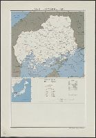
Japan, Hiroshima-ken
Yale University Library
Yale University Library Digital Collections

Eastern Asia
Yale University Library
Yale University Library Digital Collections
Fukuoka-ken
Yale University Library
Yale University Library Digital Collections
![Hokkaidō agriculture and fishing [cartographic material].](https://stacks.stanford.edu/image/iiif/db438gj7162%2Fdb438gj7162_00_0001/full/!200,200/0/default.jpg)
Hokkaidō agriculture and fishing [cartographic material].
Stanford University Libraries
Stanford Libraries SearchWorks
Hyōgo-ken
Yale University Library
Yale University Library Digital Collections

Japan, Oita-ken
Yale University Library
Yale University Library Digital Collections
![Japan, radiotelephone and radiotelegraph stations [cartographic material] : 1941](https://stacks.stanford.edu/image/iiif/pp234mp0165%2Fpp234mp0165_00_0001/full/!200,200/0/default.jpg)
Japan, radiotelephone and radiotelegraph stations [cartographic material] : 1941
Stanford University Libraries
Stanford Libraries SearchWorks
Japan, Wakayama-ken
Yale University Library
Yale University Library Digital Collections

Tokushima, Tokushima Prefecture, Shikoku, Japan
Stanford University Libraries
Stanford Libraries SearchWorks
Wakayama-ken
Yale University Library
Yale University Library Digital Collections

Japan. Shimane-ken : administrative divisions, November 1943
Yale University Library
Yale University Library Digital Collections

Eastern Archipelago : Eastern Part of Celebes
Stanford University Libraries
Stanford Libraries SearchWorks

Miyagi-ken
Yale University Library
Yale University Library Digital Collections
Kōchi-ken
Yale University Library
Yale University Library Digital Collections
Japan. Shizuoka-ken : administrative divisions, November 1943
Yale University Library
Yale University Library Digital Collections

Japan cities and towns : (shi and machi)
Yale University Library
Yale University Library Digital Collections
Last Updated: 2021-01-30
Uploaded: 2021-07-29