
Japan : political divisions / Board of Economic Warfare ; drawn in R and A, OSS
- Time
- Owner Organization

Provinces of Kansu and Ninghsia : Board of Economic Warfare / drawn in R. and A., O.S.S
Yale University Library
Yale University Library Digital Collections

Japan, political divisions
Stanford University Libraries
Stanford Libraries SearchWorks
![Far East, Japanese occupied area, major railroads [cartographic material] / Board of Economic Warfare, Enemy...](https://collections.library.yale.edu/iiif/2/15510697/full/!200,200/0/default.jpg)
Far East, Japanese occupied area, major railroads [cartographic material] / Board of Economic Warfare, Enemy...
Yale University Library
Yale University Library Digital Collections
Economic Growth in Sweden, Japan and Turkey A Comparison of Success and Failure
Uppsala University
Europeana API

Map of Asia Showing its Gt. Political Divisions and...Routes of Trade between London & India, Chin...
Stanford University Libraries
Stanford Libraries SearchWorks

Map of Asia Showing its Gt. Political Divisions and...Routes of Trade between London & India, Chin...
Stanford University Libraries
Stanford Libraries SearchWorks

Map of Asia Showing its Gt. Political Divisions and...Routes of Trade between London & India, Chin...
Stanford University Libraries
Stanford Libraries SearchWorks

Map of Asia Showing its Gt. Political Divisions and...Routes of Trade between London & India, Chin...
Stanford University Libraries
Stanford Libraries SearchWorks

Commercial Culture, Political Culture & the Political Economy of Trade Policy: The Case of Japan
Stanford University Libraries
Stanford Libraries SearchWorks

The recent Aims and political development of Japan
Bavarian State Library
Europeana API

Map of Asia showing its Gt. Political Divisions, and, also, the Various routes of travel between L...
Stanford University Libraries
Stanford Libraries SearchWorks
TANKAN : short-term economic survey of enterprises in Japan
Stanford University Libraries
Stanford Libraries SearchWorks
Globalization, political discourse, and welfare systems in comparative perspective : the Federal R...
GESIS - Leibniz-Institut für Sozialwissenschaften. Bibliothek Köln
Europeana API
The political economy of arms export restrictions : The Case of Japan
German National Library
Europeana API
Information bulletin of the Union of National Economic Associations in Japan
Stanford University Libraries
Stanford Libraries SearchWorks
Political Economy of EU Enlargement: Or, Why Japan is not a Candidate Country?
Stanford University Libraries
Stanford Libraries SearchWorks
The recent economic role of bank-firm relationships in Japan
GESIS - Leibniz-Institut für Sozialwissenschaften. Bibliothek Köln
Europeana API

Map of Asia showing its gt. political divisions, and also various routes of travel between London ...
Stanford University Libraries
Stanford Libraries SearchWorks

Map of Asia showing its gt. political divisions, and also various routes of travel between London ...
Stanford University Libraries
Stanford Libraries SearchWorks

Map of Asia showing its gt. political divisions, and also various routes of travel between London ...
Stanford University Libraries
Stanford Libraries SearchWorks
Geographical issues of social and economic transformation of contemporary Japan and Poland : proce...
Repozytorium Cyfrowe Instytutów Naukowych
Europeana API
Party Financing in Germany and Japan :Comparative Perspectives on Political Corruption
German National Library
Europeana API

Map of Asia showing its gt. political divisions, and also the various routes of travel between Lon...
Stanford University Libraries
Stanford Libraries SearchWorks

Map of Asia showing its gt. political divisions, and also the various routes of travel between Lon...
Stanford University Libraries
Stanford Libraries SearchWorks

Japan : distribution of waterworks
Yale University Library
Yale University Library Digital Collections

Approach to West Coast of Gazelle Peninsula
Stanford University Libraries
Stanford Libraries SearchWorks

Central Portion of Sumbawa with Pulo Tenga Islands
Stanford University Libraries
Stanford Libraries SearchWorks

Rongorapputō fukin
Stanford University Libraries
Stanford Libraries SearchWorks
Japan, political divisions
Stanford University Libraries
Stanford Libraries SearchWorks

New Guinea - South Coast. Freshwater Bay to C. Blackwood
Stanford University Libraries
Stanford Libraries SearchWorks

Rice areas in Japan
Stanford University Libraries
Stanford Libraries SearchWorks

Carta General para las Navegaciones a la India Oriental por el Mar del Sur y el Grande Oceano que ...
Stanford University Libraries
Stanford Libraries SearchWorks

Orientation: Philippines to Japan / R & A, OSS
Yale University Library
Yale University Library Digital Collections

Straits between Sumbawa, Flores and Sumba
Stanford University Libraries
Stanford Libraries SearchWorks

Carta General Para Las Navegaciones a la India Oriental Por El Mar Del Sur Y el grande Oceano que ...
Stanford University Libraries
Stanford Libraries SearchWorks
Carta General Para Las Navegaciones a la India Oriental Por El Mar Del Sur Y el grande Oceano que ...
Stanford University Libraries
Stanford Libraries SearchWorks

Western Portions of Flores
Stanford University Libraries
Stanford Libraries SearchWorks

Salayar Strait to Tana Keke I.
Stanford University Libraries
Stanford Libraries SearchWorks

Eastern Portion of Flores to Lomblem
Stanford University Libraries
Stanford Libraries SearchWorks

North Pacific Ocean : Eastern Part of Hawaiin Islands
Stanford University Libraries
Stanford Libraries SearchWorks
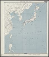
Approaches to Japan
Yale University Library
Yale University Library Digital Collections

Peleng Strait to Tomori Gulf
Stanford University Libraries
Stanford Libraries SearchWorks

Celebes - West Coast : Cape William to Tandyung Karang
Stanford University Libraries
Stanford Libraries SearchWorks

Ryōtō Kaiwan : Daitzu Shan to Fuchou Chao
Stanford University Libraries
Stanford Libraries SearchWorks

Durville Island and Approaches
Stanford University Libraries
Stanford Libraries SearchWorks

Guide to Tokyo City
Yale University Library
Yale University Library Digital Collections

Carte des decouvertes, faites en 1787 dans les mers de Chine et de Tartarie par les Fregates Franc...
Stanford University Libraries
Stanford Libraries SearchWorks

Japan, Manchuria, and adjacent regions
Stanford University Libraries
Stanford Libraries SearchWorks
Last Updated: 2021-01-30
Uploaded: 2021-07-29