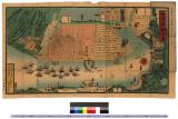
![Kaisei Atami Shigai Zenzu. [Revised Map of the Entire City of Atami]](https://collections.library.yale.edu/iiif/2/15510883/full/!200,200/0/default.jpg)
Kaisei Atami Shigai Zenzu. [Revised Map of the Entire City of Atami]
- Time
- Owner Organization

Nagasaki shigai zenzu = The map of nagasaki city. Kiushiu. Japan
Stanford University Libraries
Stanford Libraries SearchWorks

Dai Nihon zenzu (The picture of the Great Whole Map of Japan; Provinces in the Japanese Empire, in...
Stanford University Libraries
Stanford Libraries SearchWorks

Map of the Great Japanese Empire (Dainihon Kokugun Yochi Zenzu)
Honolulu Museum of Art
Honolulu Museum of Art Collection

[Oranda shinyaku chikyu zenzu : The complete map of the whole World, newly translated from Dutch s...
Stanford University Libraries
Stanford Libraries SearchWorks

[Oranda shinyaku chikyu zenzu : The complete map of the whole World, newly translated from Dutch s...
Stanford University Libraries
Stanford Libraries SearchWorks

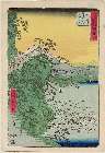
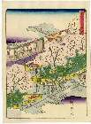
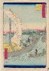
Panoramic view of Kasumigaseki (Kasumigaseki zenzu), from the series Famous Places in the Eastern City (Tōto meisho)
Philadelphia Museum of Art
Philadelphia Museum of Art collection

Panoramic view of Kasumigaseki (Kasumigaseki zenzu), from the series Famous Places in the Eastern City (Tōto meisho)
Philadelphia Museum of Art
Philadelphia Museum of Art collection
Map showing the lay-out of the. city of Shanghai, the centre of the present Sino-Japanese ivarfare. Even the...
National Library of New Zealand
DigitalNZ New Zealand API
![Bankokuzu Zen : [Complete map of the World]](https://stacks.stanford.edu/image/iiif/hd277ns8369%2Fhd277ns8369_05_0001/full/!200,200/0/default.jpg)
Bankokuzu Zen : [Complete map of the World]
Stanford University Libraries
Stanford Libraries SearchWorks

Guide to Tokyo City
Yale University Library
Yale University Library Digital Collections

A map of the city of Nagasaki, and of the adjacent country; Sorts of money current in the Japanese Empire
General Research Division. The New York Public Library
DPLA API
![Fuji-mi jūsan-shū yochi zenzu [Map of the 13 provinces around Mt. Fuji]](https://collections.library.yale.edu/iiif/2/15510837/full/!200,200/0/default.jpg)
Fuji-mi jūsan-shū yochi zenzu [Map of the 13 provinces around Mt. Fuji]
Yale University Library
Yale University Library Digital Collections

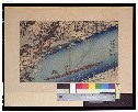
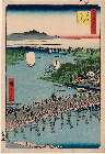
Complete View of Sakurada, One of the Famous Places of Tokyo (Tōkyō meisho uchi Sakurada zenzu)
Philadelphia Museum of Art
Philadelphia Museum of Art collection
City map, central Tokyo. December 1946 / prepared under direction of the chief engineer, general headquarter...
Yale University Library
Yale University Library Digital Collections
City map, central Tokyo / prepared under the direction of Office of the Engineer, HQ, AFFE, by the 64th Engineer Battalion (Base Topographic)
National Library of Australia
Trove: National Library of Australia
City map, central Tokyo / prepared under the direction of the Engineer, GHQ, FEC ; by the 64th Engineer Base Topographic Battalion
National Library of Australia
Trove: National Library of Australia
City map, central Tokyo. October 1947 / prepared under direction of the chief engineer, GHQ, FEC, byt the 64...
Yale University Library
Yale University Library Digital Collections
Yokohama city map : corrected to May 1954 / prepared under the direction of Office of the Engineer, AFFE, by the 29th Engineer Battalion (Base Topographic)
National Library of Australia
Trove: National Library of Australia
Tsunamis in the Pacific Basin, 1900-1983 / map produced by Patricia A. Lockridge, National Geophysical Data Center and Ronald H. Smith, Cooperative Institute for Research in Environmental Sciences ; published by National Geophysical Data Center and World Data Center A for Solid Earth Geophysics with support from Office of U.S. Foreign Disaster Assistance, Agency for International Development in cooperation with Circum-Pacific Council for Energy and Mineral Resources, Map Project
National Library of Australia
Trove: National Library of Australia
「五十三次名所図会」 「七」「藤沢」「」「左り不二」
Museum of Fine Arts, Boston
ARC Ukiyo-e Portal Database
「東海道五拾三駅」 「庄野」「一り塚四十六」
Museum of Fine Arts, Boston
ARC Ukiyo-e Portal Database
横浜明細全図 : 横浜明細全図
Iwase Bunko Libray
ADEAC: A System of Digitalization and Exhibition for Archive Collections

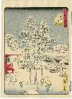
「東都名所亀戸梅屋舗全図」
National Diet Library, Japan
ARC Ukiyo-e Portal Database
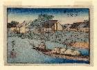
「五十三次名所図会」 「十七」「由井」「薩多嶺親しらす」
Museum of Fine Arts, Boston
ARC Ukiyo-e Portal Database

「浪華天満聖廟図」
C. V. Starr East Asian Library, University of California, Berkeley
ARC Ukiyo-e Portal Database

「鎌倉一覧之図」
Tokyo Metropolitan Central Library
ARC Ukiyo-e Portal Database
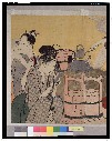
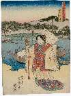
台所美人_二枚続
Tokyo National Museum
ARC Ukiyo-e Portal Database

Kyōto Fushimi Kanpei Taisha Inari Jinja saikenzu
Stanford University Libraries
Stanford Libraries SearchWorks
Kyoutomeishonouchi
Tokyo National Museum
ARC Ukiyo-e Portal Database
Edomeishoshijuuhakkei
Museum of Fine Arts, Boston
ARC Ukiyo-e Portal Database
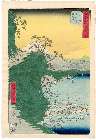
「五十三次名所図会」 「十七」「由井」「薩多嶺親しらす」
Museum of Fine Arts, Boston
ARC Ukiyo-e Portal Database

「東海道浦々風景一覧」
C. V. Starr East Asian Library, University of California, Berkeley
ARC Ukiyo-e Portal Database
Meishoedohyakkei
Museum of Fine Arts, Boston
ARC Ukiyo-e Portal Database
「東都三十六景」
British Museum
ARC Ukiyo-e Portal Database
「大阪八軒屋之図」
Museum of Fine Arts, Boston
ARC Ukiyo-e Portal Database
Edomeishoshijuuhakkei
Museum of Fine Arts, Boston
ARC Ukiyo-e Portal Database
「東海道五十三次之内 宮之図」
Museum of Fine Arts, Boston
ARC Ukiyo-e Portal Database

「三十六ばんつゞき役者十二つき」 「五月江のしま開帳の図」
National Diet Library, Japan
ARC Ukiyo-e Portal Database
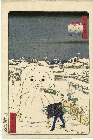
「江戸名所道戯尽」 「二十二」「御蔵前の雪」
Museum of Fine Arts, Boston
ARC Ukiyo-e Portal Database
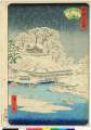
「五十三次名所図会」 「四十三」「桑名」「七里の渡船」
Museum of Fine Arts, Boston
ARC Ukiyo-e Portal Database

「東海道名所之内」 「宇津谷峠」
National Diet Library, Japan
ARC Ukiyo-e Portal Database
「富嶽三十六景」 「従千住花街眺望ノ不二」
Tokyo National Museum
ARC Ukiyo-e Portal Database

Mandchourie et Coree de Kharbine a Seoul de Port-Arthur a Vladivostok Traduction de la Carte d'Eta...
Stanford University Libraries
Stanford Libraries SearchWorks
Last Updated: 2021-01-30
Uploaded: 2021-07-29