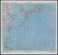
Japan and South China Seas / prepared at the direction of the commanding general, Army Air Forces, for the A...
- Time
- Owner Organization
AAF cloth chart ; no. C-52, C-53
Yale University Library
Yale University Library Digital Collections

LEFT: Lieutenant-General George C. Kenny (left), commander of the Allied Air Forces in the South-west Pacifi...
Auckland Libraries
DigitalNZ New Zealand API
Series ; 5207
Yale University Library
Yale University Library Digital Collections

GENERAL KODAMA, COMMANDER OF THE JAPANESE LAND FORCES
Auckland Libraries
DigitalNZ New Zealand API

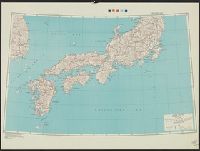
Japan road map, 1:1,000,000 / prepared under the direction of the Chief of Engineers, U.S. Army by the Army ...
Yale University Library
Yale University Library Digital Collections
Handbook to the colony of Victoria / prepared under the direction of the Victorian Government by Henry Heylyn Hayter
National Library of Australia
Trove: National Library of Australia
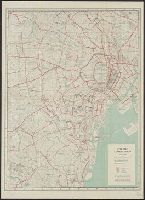
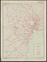
City map, central Tokyo. December 1946 / prepared under direction of the chief engineer, general headquarter...
Yale University Library
Yale University Library Digital Collections
The story of Japanese farming in California. Prepared under the direction of Emil T. H. Bunje. Ber...
University of California Libraries
Europeana API
City map, central Tokyo / prepared under the direction of the Engineer, GHQ, FEC ; by the 64th Engineer Base Topographic Battalion
National Library of Australia
Trove: National Library of Australia
City map, central Tokyo. October 1947 / prepared under direction of the chief engineer, GHQ, FEC, byt the 64...
Yale University Library
Yale University Library Digital Collections

WAR CLOUD IN THE EAST: GENERAL KODAMA, THE NEWLY APPOINTED COMMANDER OF THE JAPANESE LAND FORCES
Auckland Libraries
DigitalNZ New Zealand API
Signing the surrender of the Japanese South-east Army. At top, Admiral Jin-Ichi Kusaka, commander of the Jap...
National Library of New Zealand
DigitalNZ New Zealand API
.jpg)
Air Vice-Marshal L. M. Isitt signing the Japanese surrender at Tokyo Bay, September 1945. General Douglas Ma...
New Zealand Electronic Text Collection
DigitalNZ New Zealand API
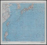
AAF cloth chart ; no. C-52, C-53
Yale University Library
Yale University Library Digital Collections
![Japan and adjacent regions of Asia and the Pacific Ocean [cartographic material] / compiled and drawn in the...](https://collections.library.yale.edu/iiif/2/15510875/full/!200,200/0/default.jpg)
Japan and adjacent regions of Asia and the Pacific Ocean [cartographic material] / compiled and drawn in the...
Yale University Library
Yale University Library Digital Collections
![Japan and adjacent regions of Asia and the Pacific Ocean [cartographic material] / compiled and drawn in the...](https://collections.library.yale.edu/iiif/2/15509964/full/!200,200/0/default.jpg)
Japan and adjacent regions of Asia and the Pacific Ocean [cartographic material] / compiled and drawn in the...
Yale University Library
Yale University Library Digital Collections

「六十余州名所図会」 「大和」「立田山(たつたやま)龍田川(たつたがわ)」
Museum of Fine Arts, Boston
ARC Ukiyo-e Portal Database

Gojūmanbun no ichi chishizu
Stanford University Libraries
Stanford Libraries SearchWorks

Japan and Korea / compiled and drawn in the Cartographic Section of the National Geographic Society ; James ...
Yale University Library
Yale University Library Digital Collections

Japan and it's relation to the territory bordering on the Pacific ocean
Yale University Library
Yale University Library Digital Collections

Ariwara Narihira
The Chester Beatty Library
Chester Beatty's Digital Collections
![[Shina] Hyakumanbunnoichi Kōkūzu](https://stacks.stanford.edu/image/iiif/sy476vd8533%2Fsy476vd8533_00_0001/full/!200,200/0/default.jpg)
[Shina] Hyakumanbunnoichi Kōkūzu
Stanford University Libraries
Stanford Libraries SearchWorks

U.S.S.R. - Far East, Korea, Japan. Pergamon World Atlas. Pergamon Press, Ltd. & P.W.N. Poland 1967...
Stanford University Libraries
Stanford Libraries SearchWorks

Russisch-japanischer Kriegsschauplatz. Karte II, Süd-Mandschurei, Korea, Nordost-China
Stanford University Libraries
Stanford Libraries SearchWorks
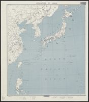
Approaches to Japan
Yale University Library
Yale University Library Digital Collections

Manchuria. Korea. Japan. (insets) (Vicinity of Osaka and Tokyo)
Stanford University Libraries
Stanford Libraries SearchWorks

Hakodate, Hokkaidō, Japan
Stanford University Libraries
Stanford Libraries SearchWorks
Last Updated: 2021-01-30
Uploaded: 2021-07-29