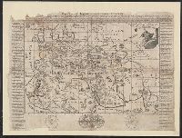
Universal - Historie auf der Land-Karten [ ... most of the eastern hemisphere, omitting Japan, part of China...
- Time
- Owner Organization

Chart of the Coast of China from Cambodia to Nanquam with Part of Japan
Stanford University Libraries
Stanford Libraries SearchWorks

A Chart of the Coast of China From Cambodia to Nanquam with Part of Japan
Stanford University Libraries
Stanford Libraries SearchWorks

Eastern Asia, showing Japan, Korea, Manchuria and adjoining parts of Siberia and China. 185 miles ...
Bibliothèque nationale de France
Europeana API

China, Japan >> Kaart van een gedeelte der Chinesche Zee en Kust, van Van Kampenshoek tot de...
Nationaal Archief
Europeana API

A Chart of the Eastermost part of the East Indies and China from Cape Comarin to Japan with the Ad...
Stanford University Libraries
Stanford Libraries SearchWorks

Japan : Nipon, Kiusiu and Sikok, and a part of the coast of Korea / according to Krusenstern's Chart of 1827 ; J & C Walker sculpt
Library of Congress
Trove: National Library of Australia
Stanford's map of China & Japan with the adjacent parts of the Russian Repubcs. India, Burma &c / Stanford's Geographical Establishment
National Library of Australia
Trove: National Library of Australia
A new chart of the Pacific Ocean : exhibiting the western coast of America, from Cape Horn to Beerings Strait, the eastern shores of Asia including Japan, China and Australia and all the numerous islands and known dangers situated in Polynesia and Australasia / correctly drawn and regulated according to the most approved and modern surveys and astronomical observations by J.W. Norie
State Library of New South Wales
Trove: National Library of Australia
Laurie and Whittle's new chart of the Indian and Pacific Oceans between the Cape of Good Hope, New Holland and Japan : comprehending New Zealand, New Caledonia, New Britain, New Ireland, New Guinea &c., Louisiade and New Georgia; also The Pelew, New Caroline, Ladrone and Philippine Islands &c. with the most remarkable tracks of the English, Spanish, French and Dutch navigators and chiefly the track of the Walpole, EastIndiaman, Captn. Thos. Butler, 1794 from the Cape of Good Hope to Van Diemen's Land and from thence to China, and the track of the Royal Admiral Captn. Henr. Bond in 1792 and 93 from the Cape to Port Jackson and China
State Library of New South Wales
Trove: National Library of Australia

The Actor Iwai Hanshiro IV in the "Sangai-gasa" (Triple-Umbrella) Dance Interlude of the Joruri "Yukashii wa Miyako no Naredoko" (Yearning After One's Own Bedchamber in the Capital), from Part Two of the Play Kuni no Hana Ono no Itsumoji (Flower of Japan: Ono no Komachi's Five Characters), Performed at the Nakamura Theater from the First Day of the Eleventh Month, 1771
Art Institute of Chicago
Art Institute of Chicago API
Mitsuirekosoganokaomise
University of Tokyo Graduate School of Arts and Sciences / College of Liberal Arts
UTokyo Academic Archives Portal

Asia Partiu Orbis Maxima MDXCVIII
Stanford University Libraries
Stanford Libraries SearchWorks
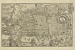
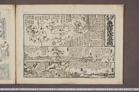
「大阪案内独巡」
Art Research Center, Ritsumeikan University
ARC Ukiyo-e Portal Database

Nagasaki
Yale University Library
Yale University Library Digital Collections
Yasagunbaiodanokarigane
University of Tokyo Graduate School of Arts and Sciences / College of Liberal Arts
UTokyo Academic Archives Portal

「正中山絵図」
Tokyo Metropolitan Central Library
ARC Ukiyo-e Portal Database

Rekidai teiryo junpai zu (Object)
British Museum
British Museum Collection
Takenoharuyoshiwarasuzume
University of Tokyo Graduate School of Arts and Sciences / College of Liberal Arts
UTokyo Academic Archives Portal

「安房国鋸山日本禅寺真景図」
Tokyo Metropolitan Central Library
ARC Ukiyo-e Portal Database

Tartariae Imperium
Stanford University Libraries
Stanford Libraries SearchWorks
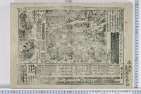
「江戸案内図」
Art Research Center, Ritsumeikan University
ARC Ukiyo-e Portal Database

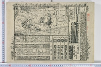
「大坂案内細覧之図」 「高麗橋ヨリ諸方道法附并凡例」
C. V. Starr East Asian Library, University of California, Berkeley
ARC Ukiyo-e Portal Database
Asiae nova descriptio
National Library of Australia
Trove: National Library of Australia
江戸東海道東国荒珍事図
University of Tokyo General Library
UTokyo Academic Archives Portal
![Kasei Kita Shina jūmanbun no ichi zu. Joshū (Xuzhou) [cartographic material]](https://stacks.stanford.edu/image/iiif/hr412vw3270%2Fhr412vw3270_00_0001/full/!200,200/0/default.jpg)
Kasei Kita Shina jūmanbun no ichi zu. Joshū (Xuzhou) [cartographic material]
Stanford University Libraries
Stanford Libraries SearchWorks

India Orientalis
Stanford University Libraries
Stanford Libraries SearchWorks
Igagoenorikakekappa
University of Tokyo Graduate School of Arts and Sciences / College of Liberal Arts
UTokyo Academic Archives Portal
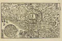
![Casteel Osacca. [By J. Vingboons]](https://collections.library.yale.edu/iiif/2/15511722/full/!200,200/0/default.jpg)
Casteel Osacca. [By J. Vingboons]
Yale University Library
Yale University Library Digital Collections
Last Updated: 2021-01-30
Uploaded: 2021-07-29