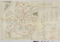
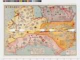
豊太閤朝鮮征伐陣取之図

朝鮮征伐記
National Institute of Japanese Literature
IIIF Discovery in Japan

朝鮮征伐記
National Institute of Japanese Literature
IIIF Discovery in Japan
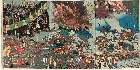
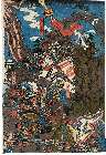
「朝鮮征伐大評定ノ図」
RHAM
ARC Ukiyo-e Portal Database

絵本朝鮮征伐記
広島大学図書館 (国文学研究資料館)
IIIF Discovery in Japan
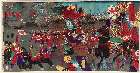
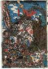
「朝鮮征罰之図」
Museum of Fine Arts, Boston
ARC Ukiyo-e Portal Database

講談太閤記 九州征伐
朝日智雄
ARC Ukiyo-e Portal Database
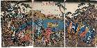
「源頼朝奥州征伐勝軍帰陣行列之図」
Museum of Fine Arts, Boston
ARC Ukiyo-e Portal Database
「源頼朝奥州征伐勝軍帰陣行列之図」
Museum of Fine Arts, Boston
ARC Ukiyo-e Portal Database
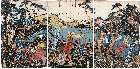
「奥州征伐之図」
Museum of Fine Arts, Boston
ARC Ukiyo-e Portal Database
「三韓征伐之図」
Museum of Fine Arts, Boston
ARC Ukiyo-e Portal Database
「源義家朝臣奥州征伐之図」
The Tsubouchi Memorial Theatre Museum, Waseda University
The database of ukiyo-e
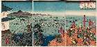
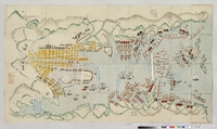
朝鮮豊島海戦之図
NDL Digital Collections
NDL Digital Collections

「倭漢 朝鮮征伐武者見立 豊国威勢鏡 初編」
Tokyo Metropolitan Central Library
Tokyo Metropolitan Library Edo-Tokyo Digital Collections
豊太閤五妻花見図
Graduate School for Law and Politics, the University of Tokyo
UTokyo Academic Archives Portal
![[歴民カード_歴史] 豊太閣朝鮮再征朱印条目](https://khirin-i.rekihaku.ac.jp/iiif/nmjh_rekimin_h/12747081_02.tif/full/200,/0/default.jpg)
[歴民カード_歴史] 豊太閣朝鮮再征朱印条目
National Museum of Japanese History
IIIF Discovery in Japan

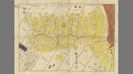
朝鮮八道之図 : 朝鮮八道之図
Iwase Bunko Libray
ADEAC: A System of Digitalization and Exhibition for Archive Collections

「神功皇后三韓征伐之図」
Art Research Center, Ritsumeikan University
ARC Ukiyo-e Portal Database
「神功皇后三韓征伐之図」
Museum of Fine Arts, Boston
ARC Ukiyo-e Portal Database
「神功皇后三韓征伐之図」
Museum of Fine Arts, Boston
ARC Ukiyo-e Portal Database

朝鮮国御進発之人数帳
University of Tokyo Graduate School of Arts and Sciences / College of Liberal Arts
UTokyo Academic Archives Portal

朝鮮八道之図
Nara Prefectural Library and Information Center
Mahoroba Digital Library
朝鮮八道之図
Saga Prefectual Library
Saga Prefectural Library Database

朝鮮八道之図
Saga Prefectual Library
IIIF Discovery in Japan

出兵より撤兵まで : 朝鮮征伐以来の失敗
神戸大学附属図書館
Kobe University Library Digital Archive Newspaper Clippings Collection
長崎ニテ黒船囲様之図
University of Tokyo Graduate School of Arts and Sciences / College of Liberal Arts
UTokyo Academic Archives Portal
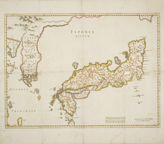
Χάρτης της Ιαπωνίας
Aikaterini Laskaridis Foundation
Europeana API

Greece in the fifth century B.C
Yoshida-South Library, Kyoto University
IIIF Discovery in Japan

Carte des isles du Iapon esquelles est remarqué la route tant par mer que par terre que tiennent l...
Bibliothèque nationale de France
Europeana API
![[歴民カード_歴史] 紙本着色 扇谷村絵図](https://khirin-i.rekihaku.ac.jp/iiif/nmjh_rekimin_h/11449105_02.tif/full/200,/0/default.jpg)
[歴民カード_歴史] 紙本着色 扇谷村絵図
National Museum of Japanese History
IIIF Discovery in Japan

Title page (Sanjūrokkei meisho), series Thirty-six Views of Mt. Fuji
Honolulu Museum of Art
Honolulu Museum of Art Collection
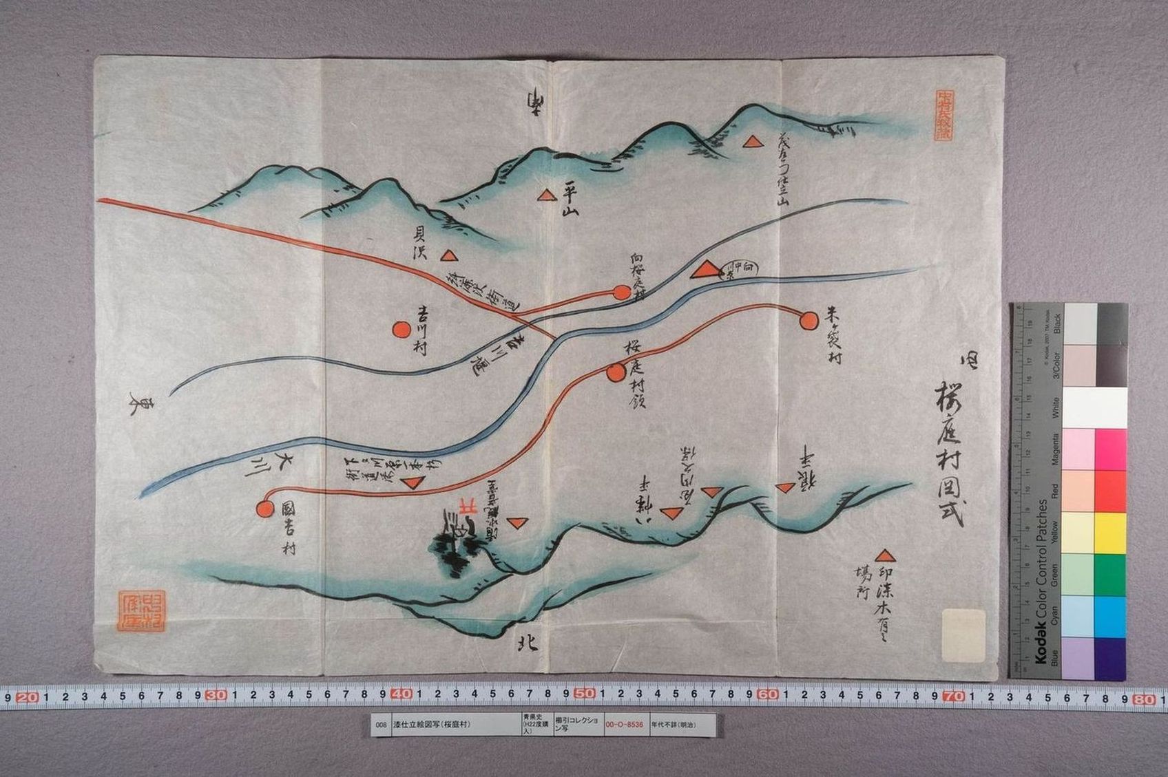
漆仕立絵図写(桜庭村)
History of the Aomori Prefecture Digital Archive
Documents and Literature Database of Aomori Prefectural History

四国八十八ヶ所 遍路道中図
Tokushima Prefectural Archives
ADEAC: A System of Digitalization and Exhibition for Archive Collections

1745年、卞泰禧斜給立案
Kyoto University Library
IIIF Discovery in Japan
遍路道中図(四国八十八カ所)
Tokushima Prefectural Archives
ADEAC: A System of Digitalization and Exhibition for Archive Collections
日本国図
Tokyo National Museum
Integrated Collections Database of the National Museums, Japan

四国八十八ヶ所 遍路道中図
Tokushima Prefectural Archives
ADEAC: A System of Digitalization and Exhibition for Archive Collections
Last Updated:
Uploaded: 2021-07-29