
Australien / Weimar Geographisches Institut ; gezeichnet v. H. Kiepert ; gest. v. C. Katz u. E. Wibel

C H

Australien gezeichnet vom Professor J.M.F. Schmidt . . . 1820

Australien (Sudland) auch Polynesien oder Inselwelt, insgemein der funfte Welltheil . . . 1802
Lieutenant C H Cathie, MC
Major C H Sawyers, DSO
Lieutenant C H Cathie, MC, Egypt
Major C H Sawyers, DSO, Egypt
Lieutenant Colonel C W H Ronaldson
![La répétition, [d'après C. Bulteau] : [estampe] / H. Guérard sculpsit ; C. Bulteau pinxit](https://api.europeana.eu/thumbnail/v2/url.json?uri=https%3A%2F%2Fgallica.bnf.fr%2Fiiif%2Fark%3A%2F12148%2Fbtv1b105317575%2Ff1%2Ffull%2F512%2C%2F0%2Fnative.jpg&type=IMAGE)
La répétition, [d'après C. Bulteau] : [estampe] / H. Guérard sculpsit ; C. Bulteau pinxit
Bericht über Süd-, Südost-, Ostasien und Australien, Neuseeland sowie unsere Wirtschaftsbeziehunge...
Charte von Australien nach den neuesten und besten Hübfsmitteln / entworfen und gezeichnet Friedrich Wilhelm Streit
Electronic spectra of carbon chain molecules : C[4]H, C[4]D and C[3]N
Australien nach den neuesten Berichten und besten Hülfsquellen / entworfen von Fried: Wilh: Sprecht ; gest v. I.G.C. Hempel
Studies of C-H bond carbonylation and decarbonylative cleavage of C-C bonds catalyzed by ruthenium complexes
Capt J H Shelker, O I/C Cairo Base Post Office
![[Vaches au pré, d'après Troyon] : [estampe] / H. Guérard ; C. Troyon, [peintre]](https://api.europeana.eu/thumbnail/v2/url.json?uri=https%3A%2F%2Fgallica.bnf.fr%2Fiiif%2Fark%3A%2F12148%2Fbtv1b105323536%2Ff1%2Ffull%2F512%2C%2F0%2Fnative.jpg&type=IMAGE)
[Vaches au pré, d'après Troyon] : [estampe] / H. Guérard ; C. Troyon, [peintre]
![[Vaches au pré, d'après Troyon] : [estampe] / H. Guérard ; C. Troyon, [peintre]](https://api.europeana.eu/thumbnail/v2/url.json?uri=https%3A%2F%2Fgallica.bnf.fr%2Fiiif%2Fark%3A%2F12148%2Fbtv1b10532354n%2Ff1%2Ffull%2F512%2C%2F0%2Fnative.jpg&type=IMAGE)
[Vaches au pré, d'après Troyon] : [estampe] / H. Guérard ; C. Troyon, [peintre]

欧洲新秩序と独逸外国貿易 (上・下) : H・C・H・ヴォールタット

Vase, H. 11-3/4 in. (Val. C. Prinsep, Esq.); Vase, H. 14 in. (James L. Bowes, Esq.); Jar, H. 9-3/4 in. (Jame...
Dryaden. Et Eventyr fra Udstillingstiden i Paris 1867. Af H. C. Andersen

Cylindrical flower jars, H. 11-3/4 in. (James L. Bowes, Esq.); Vase, H. 11 in. (Val. C. Prinsep, Esq.)
H W Hobson and C H Longworth stroll through village on the Italian Front, World War II - Photograph taken by...
![[Vaches au pré, d'après Troyon] : [estampe] ([3ème état]) / H. Guérard ; C. Troyon, [peintre]](https://api.europeana.eu/thumbnail/v2/url.json?uri=https%3A%2F%2Fgallica.bnf.fr%2Fiiif%2Fark%3A%2F12148%2Fbtv1b105323519%2Ff1%2Ffull%2F512%2C%2F0%2Fnative.jpg&type=IMAGE)
[Vaches au pré, d'après Troyon] : [estampe] ([3ème état]) / H. Guérard ; C. Troyon, [peintre]
Laurie and Whittle's new chart of the Indian and Pacific Oceans between the Cape of Good Hope, New Holland and Japan : comprehending New Zealand, New Caledonia, New Britain, New Ireland, New Guinea &c., Louisiade and New Georgia; also The Pelew, New Caroline, Ladrone and Philippine Islands &c. with the most remarkable tracks of the English, Spanish, French and Dutch navigators and chiefly the track of the Walpole, EastIndiaman, Captn. Thos. Butler, 1794 from the Cape of Good Hope to Van Diemen's Land and from thence to China, and the track of the Royal Admiral Captn. Henr. Bond in 1792 and 93 from the Cape to Port Jackson and China
A new chart of the Indian and Pacific Oceans between the Cape of Good Hope, New Holland and Japan : comprehending New Zealand, New Caledonia, New Britain, New Ireland, New Guinea &c., also the New Caroline, Ladrone and Philippine Islands : with the tracks of the English, French, Spanish and Dutch discoverers

(Composite of) A New Chart of The Pacific Ocean, Exhibiting The Western Coast of America, From Cap...

Laurie and Whittle's New Chart of the Indian and Pacific Oceans Between the Cape of Good Hope, New...
Pas-caert van't Oostelyckste deel van Oost Indien : met alle de Eylanden daer onder gelegen, van Cabo Comorin tot aen Japan / by Hendrick Doncker Boekverkooper en Graadbooghmaacker Inde Nieuwbrughsteegh

Laurie and Whittle's New Chart of the Indian and Pacific Oceans Between the Cape of Good Hope, New...

「西国三十三所順拝地図」

Karte von Australien oder Polynesien, nach den Zeichnungen, Reisebe Schreibungen und Tagebucher de...

A Correct Sea Chart of the Whole World, According to Wright's, Commonly Called Mercator's, Project...
Pacific Ocean [by Sidney E. Morse]
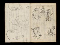
Kuniyoshi's preparatory drawings, no.39
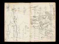
Kuniyoshi's preparatory drawings, no.48

駿河国富士山頂上八葉内院八方遠見図

「豊前国羅漢寺絵図」
A chart of the eastermost part of the East Indies with all the adjacent islands from Cape Comorin to Iapan / by Iohn Seller, Hydrographer to the King
禽虫之図

(Composite Map of) Map of the Island of Japan, Kurile &c. with the Adjacent Coasts of the Chinese ...
Laurie and Whittle's new chart of the Indian and Pacific Oceans between the Cape of Good Hope, New Holland, and Japan, comprehending New Zealand, New Caledonia, New Britain, New Ireland, New Guinea,&c., Louisiade and New Georgia; also the Pelew, New Caroline, Ladrone, and Philippine Islands; &c. with the most remarkable tracks of the English, Spanish, French and Dutch navigators: and chiefly the track of the Walpole, Eastindiaman, Captn. Thos. Butler, 1794 from the Cape of Good Hope to Van Diemen's Land and, from thence to China, and the track of the Royal Admiral Captn. Henr. Bond in 1792 and 93, from the Cape to Port Jackson and China
Manshūkoku chizu / Minami Manshū Tetsudō Kabushiki Kaisha chosaku ken hakkō

「下総銚子之図」

Carte Des Indes et de la Chine Dressee sur plusieurs Relations particulieres Rectifees par quelque...
To the Right Honourable William, Lord Cowper, Lord High Chancellor of Great Britain, this map of Asia : according to ye newest and most exact observations is most humbly dedicated / by your Lordship's most humble servant, Herman Moll, geographer
![East India Archipelago [Eastern Passages to China and Japan] [Chart No. 4] . . . 1868 (Mindanao, B...](https://stacks.stanford.edu/image/iiif/qk341np8650%2F34532/full/!200,200/0/default.jpg)
East India Archipelago [Eastern Passages to China and Japan] [Chart No. 4] . . . 1868 (Mindanao, B...

筑後川改修図
Last Updated: 2020-06-05
Uploaded: 2021-07-22