A new chart of the Indian and Pacific Oceans between the Cape of Good Hope, New Holland and Japan : comprehending New Zealand, New Caledonia, New Britain, New Ireland, New Guinea &c., also the New Caroline, Ladrone and Philippine Islands : with the tracks of the English, French, Spanish and Dutch discoverers
- People
- Time
- Owner Organization

A new chart of the Indian and Pacific Oceans between the Cape of Good Hope, New Holland and Japan : comprehending New Zealand, New Caledonia, New Britain, New Ireland, New Guinea &c., Louisade and New Georgia ; also the Pellew, New Caroline, Ladrone and Philippine Islands; with all these which have been discovered in the year 1788; & the tracks of the English, French, Spanish and Dutch discoverers
Laurie and Whittle's new chart of the Indian and Pacific Oceans between the Cape of Good Hope, New Holland, and Japan, comprehending New Zealand, New Caledonia, New Britain, New Ireland, New Guinea,&c., Louisiade and New Georgia; also the Pelew, New Caroline, Ladrone, and Philippine Islands; &c. with the most remarkable tracks of the English, Spanish, French and Dutch navigators: and chiefly the track of the Walpole, Eastindiaman, Captn. Thos. Butler, 1794 from the Cape of Good Hope to Van Diemen's Land and, from thence to China, and the track of the Royal Admiral Captn. Henr. Bond in 1792 and 93, from the Cape to Port Jackson and China
Laurie and Whittle's new chart of the Indian and Pacific Oceans between the Cape of Good Hope, New Holland and Japan : comprehending New Zealand, New Caledonia, New Britain, New Ireland, New Guinea &c., Louisiade and New Georgia; also The Pelew, New Caroline, Ladrone and Philippine Islands &c. with the most remarkable tracks of the English, Spanish, French and Dutch navigators and chiefly the track of the Walpole, EastIndiaman, Captn. Thos. Butler, 1794 from the Cape of Good Hope to Van Diemen's Land and from thence to China, and the track of the Royal Admiral Captn. Henr. Bond in 1792 and 93 from the Cape to Port Jackson and China

Laurie and Whittle's New Chart of the Indian and Pacific Oceans Between the Cape of Good Hope, New...

Laurie and Whittle's New Chart of the Indian and Pacific Oceans Between the Cape of Good Hope, New...
A New Chart of the Indian and Pacific Oceans Between the Cape of Good Hope, New Holland, and Japan...
Photographs from Papua New Guinea, mainly New Britain and New Ireland
New Guinea engineer : startling stories of peace and war in Queensland, Papua, New Guinea, New Britain, New Ireland and the Squally Islands / as told to Gillian Heming Shadbolt by wartime RAAF Flying Officer Les Bell
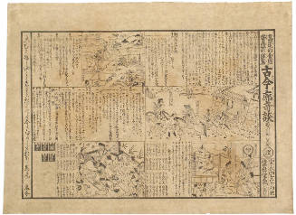
Strange Old and New Tales of the Yoshiwara
A Chart of the Eastern Ocean from C. Good Hope to the Islands of Japan [Material cartográfico]

A new and accurate map of the Empire of Japan. Laid down from the memoirs of the Portuguese and Du...

Descriptions of some of the new marine invertebrata from the Chinese and Japanese Seas /
Descriptions of some of the new marine invertebrata from the Chinese and Japanese Seas /

A new chart of the Pacific Ocean - with courses plotted on it of the whaling ships LEVI STARBUCK, MARCIA and WILLIAM ROTCH

A new and accurate map of the Empire of Japan : laid down from the memoirs of the Portuguese and Dutch, and ...
Soldiers of the 2nd NZEF IP thatching a newly built mess in New Caledonia

Descriptions of some of the new Marine Invertebrata from the Chinese and Japanese Seas (Communicat...
Opening of the "Japan tsunami - Hope and Recovery" exhibition photo, with the participation of Mar...
Opening of the "Japan tsunami - Hope and Recovery" exhibition photo, with the participation of Mar...
Opening of the "Japan tsunami - Hope and Recovery" exhibition photo, with the participation of Mar...
Opening of the "Japan tsunami - Hope and Recovery" exhibition photo, with the participation of Mar...
Opening of the "Japan tsunami - Hope and Recovery" exhibition photo, with the participation of Mar...
Opening of the "Japan tsunami - Hope and Recovery" exhibition photo, with the participation of Mar...
Opening of the "Japan tsunami - Hope and Recovery" exhibition photo, with the participation of Mar...
Laurie and Whittle's new chart of the Indian and Pacific Oceans between the Cape of Good Hope, New Holland and Japan : comprehending New Zealand, New Caledonia, New Britain, New Ireland, New Guinea &c., Louisiade and New Georgia; also The Pelew, New Caroline, Ladrone and Philippine Islands &c. with the most remarkable tracks of the English, Spanish, French and Dutch navigators and chiefly the track of the Walpole, EastIndiaman, Captn. Thos. Butler, 1794 from the Cape of Good Hope to Van Diemen's Land and from thence to China, and the track of the Royal Admiral Captn. Henr. Bond in 1792 and 93 from the Cape to Port Jackson and China
Australien / wolfenbuttel bei C. H. Hartmann
Laurie and Whittle's New Chart of the Indian and Pacific Oceans Between the Cape of Good Hope, New...

「西国三十三所順拝地図」

A Correct Sea Chart of the Whole World, According to Wright's, Commonly Called Mercator's, Project...
Laurie and Whittle's new chart of the Indian and Pacific Oceans between the Cape of Good Hope, New Holland, and Japan, comprehending New Zealand, New Caledonia, New Britain, New Ireland, New Guinea,&c., Louisiade and New Georgia; also the Pelew, New Caroline, Ladrone, and Philippine Islands; &c. with the most remarkable tracks of the English, Spanish, French and Dutch navigators: and chiefly the track of the Walpole, Eastindiaman, Captn. Thos. Butler, 1794 from the Cape of Good Hope to Van Diemen's Land and, from thence to China, and the track of the Royal Admiral Captn. Henr. Bond in 1792 and 93, from the Cape to Port Jackson and China
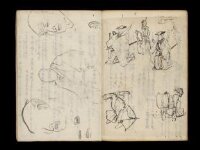
Kuniyoshi's preparatory drawings, no.39
Laurie and Whittle's New Chart of the Indian and Pacific Oceans Between the Cape of Good Hope, New...

(Composite of) A New Chart of The Pacific Ocean, Exhibiting The Western Coast of America, From Cap...

「下総銚子之図」

「箱根七温泉図」
富士山頂上図(表口、須山口)
Pas-caert van't Oostelyckste deel van Oost Indien : met alle de Eylanden daer onder gelegen, van Cabo Comorin tot aen Japan / by Hendrick Doncker Boekverkooper en Graadbooghmaacker Inde Nieuwbrughsteegh

Kaikoku zenzu

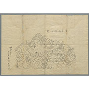
「〔地図〕」
Tokyo : city proper

「武州金沢擲筆山地蔵院能見堂八景之画図」

「〔箱根絵図〕」

「〔御用屋敷地図〕」

「豊前国羅漢寺絵図」

A New Chart of The Pacific Ocean, Exhibiting The Western Coast of America, From Cape Horn To Beeri...
A New Chart of The Pacific Ocean, Exhibiting The Western Coast of America, From Cape Horn To Beeri...
A chart of the eastermost part of the East Indies with all the adjacent islands from Cape Comorin to Iapan / by Iohn Seller, Hydrographer to the King

「鎌倉一覧之図」
Last Updated: 2020-06-05
Uploaded: 2021-07-22