Asia and its several islands and regions : according to their most approved divisions with Captain Cooks new discoveries / by Thomas Kitchin, Hydrographer to His Majesty
- People
- Time
- Owner Organization
Asia with its islands and different regions : according to their modern divisions ; also the discoveries made by Capt. Cook
To the Right Honourable William, Lord Cowper, Lord High Chancellor of Great Britain, this map of Asia : according to ye newest and most exact observations is most humbly dedicated / by your Lordship's most humble servant, Herman Moll, geographer
Asia and its islands according to Danville : divided into empires, kingdoms, states, regions &ca. with the European possessions and settlements in the East Indies and an exact delineation of all the discoveries made in the Eastern parts by the English under Captn. Cook
A new & accurate map of Asia : drawn from the most approved modern maps & charts / by Thos. Bowen ; engraved for Middletons complete system of geography

A new chart of the Pacific Ocean : exhibiting the western coast of America, from Cape Horn to Beerings Strait, the eastern shores of Asia including Japan, China and Australia and all the numerous islands and known dangers situated in Polynesia and Australasia / correctly drawn and regulated according to the most approved and modern surveys and astronomical observations by J.W. Norie
Asia with the islands adioyning described, the atire of the people & townes of importance, all of them newly augmented by I.S. Ano dom. 1626 / Sculptum apud Abrahamum Goos
Manshūkoku chizu / Minami Manshū Tetsudō Kabushiki Kaisha chosaku ken hakkō
A new map of India & China from the latest observations / by I. Senex
Asiae nova descriptio
Pas-caert van't Oostelyckste deel van Oost Indien : met alle de Eylanden daer onder gelegen, van Cabo Comorin tot aen Japan / by Hendrick Doncker Boekverkooper en Graadbooghmaacker Inde Nieuwbrughsteegh
To the Right Honourable William, Lord Cowper, Lord High Chancellor of Great Britain, this map of Asia : according to ye newest and most exact observations is most humbly dedicated / by your Lordship's most humble servant, Herman Moll, geographer
L'empire de la Chine : d'après l'atlas Chinois, avec les isles du Japon / par M. Bonne, Membre de la Societʹe Litteraire Militre. Ingenieur Gʹeographe &c

「〔箱根絵図〕」
Corea and Japan
Carte générale de l'empire Chinois et du Japon / par A. H. Brué, géographe de S.A.R. Monsieur ; gravée sous la direction de l'auteur

冨士山東口須走(登山案内図)
L' Asie divisʹee en ses principaux etats / par le Sr. Janvier, Geographe

駿河国富士山頂上八葉内院八方遠見図
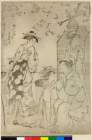
「あふぎや内 にほてる」「なミぢ」「あふミ」
![Karte von China und Japan den Manen D'Anville's und Klapproth's [cartographic material] / gewidmet Potsdam v...](https://collections.library.yale.edu/iiif/2/15824679/full/!200,200/0/default.jpg)
Karte von China und Japan den Manen D'Anville's und Klapproth's [cartographic material] / gewidmet Potsdam v...

Carte Des Indes et de la Chine Dressee sur plusieurs Rectifees par quelques Observations Par Guill...
近世職人尽絵詞

Asia According to the best Authorities

「鎌倉一覧之図」

(Composite Map of) Map of the Island of Japan, Kurile &c. with the Adjacent Coasts of the Chinese ...

「成相山眺望橋立之図」

Carte de l'Asie orientale comprenant l'empire chinois le Japon les états de l'Indo-Chine et le gra...

「江島一望図」
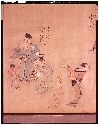
Facsimile of Woodblock for an illustrated Page of a Book by Keisai
Last Updated: 2020-06-05
Uploaded: 2021-07-22