South Sea Islands 1:50,000 Gomanbun no ichi kotsuzu nanyo gunto .: Ponape Island, Caroline Islands (South Sea Islands No. 4)
- Time
- Owner Organization
South Sea Islands 1:50,000 : Gomanbun no ichi kotsuzu nanyo gunto
Gomanbun no ichi seibu Papua, Sarumi kinbō yōzu, nos. 1-3
Gomanbun no ichi seibu Papua, Sarumi kinbō yōzu, nos. 1-3 (sheet 3)
Laurie and Whittle's new chart of the Indian and Pacific Oceans between the Cape of Good Hope, New Holland, and Japan, comprehending New Zealand, New Caledonia, New Britain, New Ireland, New Guinea,&c., Louisiade and New Georgia; also the Pelew, New Caroline, Ladrone, and Philippine Islands; &c. with the most remarkable tracks of the English, Spanish, French and Dutch navigators: and chiefly the track of the Walpole, Eastindiaman, Captn. Thos. Butler, 1794 from the Cape of Good Hope to Van Diemen's Land and, from thence to China, and the track of the Royal Admiral Captn. Henr. Bond in 1792 and 93, from the Cape to Port Jackson and China
Laurie and Whittle's new chart of the Indian and Pacific Oceans between the Cape of Good Hope, New Holland and Japan : comprehending New Zealand, New Caledonia, New Britain, New Ireland, New Guinea &c., Louisiade and New Georgia; also The Pelew, New Caroline, Ladrone and Philippine Islands &c. with the most remarkable tracks of the English, Spanish, French and Dutch navigators and chiefly the track of the Walpole, EastIndiaman, Captn. Thos. Butler, 1794 from the Cape of Good Hope to Van Diemen's Land and from thence to China, and the track of the Royal Admiral Captn. Henr. Bond in 1792 and 93 from the Cape to Port Jackson and China

染井村中佐野村絵図
![淡路国[南海道図]](https://rmda.kulib.kyoto-u.ac.jp/iiif/RB00020058/RB00020058_00001_0.ptif/full/200,/0/default.jpg)
淡路国[南海道図]
阿波麻植両郡絵図

阿波国全図

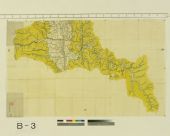
朝鮮地質総圖 = General geological map of Chosen (Korea)

Fugeshisuzuokugunmuramurakumiwakeezu
![駿河国[東海道図]](https://rmda.kulib.kyoto-u.ac.jp/iiif/RB00020018/RB00020018_00001_0.ptif/full/200,/0/default.jpg)
駿河国[東海道図]

Noushuufugeshigunshitamachinogougoshiryoutokikunimuraoazukaridokorotokikunimuraryoumitoriezu
Hokkaido, Japan / prepared and reproduced in the United States Department of the Interior, Geological Survey
![[歴民カード_考古] 辻金具](https://khirin-i.rekihaku.ac.jp/iiif/nmjh_rekimin_a/22247163_02.tif/full/200,/0/default.jpg)
[歴民カード_考古] 辻金具

Genjimonogataritansaihakubyouga
-

南中村絵図

阿波郡切幡村絵図
![武蔵国[東海道図]](https://rmda.kulib.kyoto-u.ac.jp/iiif/RB00020022/RB00020022_00001_0.ptif/full/200,/0/default.jpg)
武蔵国[東海道図]

朝鮮總圖 = General map of Chosen (Korea)

杵島郡村図大崎村 (1)
![遠江国[東海道図]](https://rmda.kulib.kyoto-u.ac.jp/iiif/RB00020017/RB00020017_00001_0.ptif/full/200,/0/default.jpg)
遠江国[東海道図]
![筑後国[西海道図]](https://rmda.kulib.kyoto-u.ac.jp/iiif/RB00020064/RB00020064_00001_0.ptif/full/200,/0/default.jpg)
筑後国[西海道図]

Gomanbunnoichi chikeizu Kaimondake

浜松市全図

Kaetsunousanshuugunwakeryakuezu
![安房国[東海道図]](https://rmda.kulib.kyoto-u.ac.jp/iiif/RB00020023/RB00020023_00001_0.ptif/full/200,/0/default.jpg)
安房国[東海道図]
![薩摩国[西海道図]](https://rmda.kulib.kyoto-u.ac.jp/iiif/RB00020071/RB00020071_00001_0.ptif/full/200,/0/default.jpg)
薩摩国[西海道図]
Last Updated: 2020-06-05
Uploaded: 2021-07-22