
New map of Shanghai. (on verso) A map of China : Published by K. Saito. Osaka Japan Sole agent T. ...
- People
- Time
- Owner Organization

A map of China : Published by K. Saito. Osaka Japan. Sole agent T. Kishida & Co. Shanghai. (inset ...
A map of China : Published by K. Saito. Osaka Japan. Sole agent T. Kishida & Co Shanghai. (inset m...
![Panoramic map of Osaka [cartographic material].](https://stacks.stanford.edu/image/iiif/jv491xw9549%2Fjv491xw9549_0001/full/!200,200/0/default.jpg)
Panoramic map of Osaka [cartographic material].

Map of the State of New York Published by Charles Magnus

Map of the State of New York Published by Charles Magnus

Map of the State of New York Published by Charles Magnus

Map of the State of New York Published by Charles Magnus

Ta. Superioris Indiae et Tartariae Maioris (Modern Map of China, Japan, etc. : Title on Verso)

Ta. Superioris Indiae et Tartariae Maioris (Modern Map of China, Japan, etc. : Title on Verso)

Tokyo and vicinity, showing bombed-out areas. (Regional map on verso)

A New Map of India & China From the latest Observations
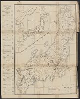
New railway map of Tokyo and vicinity. Published by Japan Guide Map Co., Ltd. Compiled and printed...

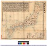
Map of Japan. Published by George F. Cram, Chicago, Ill. (to accompany) Cram's atlas of the world,...

Stanford's map of China and Japan with the adjacents parts of the Russian Rebubcs., India, Burma &...

General map of China and adjacent regions, showing treaty ports and railways

A Map of the Middle British Colonies In North America First Published By Mr. Lewis Evans of Philad...

A pictorial map : Victory in the Pacific Designed and published by Ernest Dudley Chase of Winchest...

Map of China And the Surrounding Regions. Compiled from the latest information by E. Bretscheider....

A New Map of Great Tartary and China, with the adjoyning Parts of Asia, Taken from Mr. De Fer's Ma...

A New Map of Great Tartary and China, with the adjoyning Parts of Asia, Taken from Mr. De Fer's Ma...

A New Map of Great Tartary and China, with the adjoyning Parts of Asia, Taken from Mr. De Fer's Ma...

A New Map of Great Tartary and China, with the adjoyning Parts of Asia, Taken from Mr. De Fer's Ma...
A map of South China, scene of the latest military operations by the Japanese. , (Evening Post, 13 October 1...

General map of China and adjacent regions showing treaty ports and railroads / prepared for the Department o...
Nokpong chŭngsŏ, 1819

「〔上野山内絵図〕」
Carte de L'Empire du Japon ..
![[Palembang and Bangka Island, Indonesia] Het Eiland Banka. 1819 [and] De Rivier van Palembang. 1821](https://stacks.stanford.edu/image/iiif/vz793zp5933%2F36200/full/!200,200/0/default.jpg)
[Palembang and Bangka Island, Indonesia] Het Eiland Banka. 1819 [and] De Rivier van Palembang. 1821

A Chart of the SOUTH=SEA
Picture Book: Chrysanthemum : [volumes 2-3]
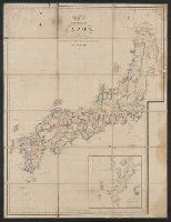
日本府県略図 : 日本府県略図
A new & correct chart of the Indian Sea from Cabo Bonea Esperanca to Japan according to Mr. Edward Wrights projection vulgarly called Mercators chart
Map of the missionary districts of north Tokyo & Kyoto : under the jurisdiction of the Bishop of Tokyo 1895

Australien gezeichnet vom Professor J.M.F. Schmidt . . . 1820
Okudoushamusumesugegasa
Koinoyamisatsukinouwanari、dannourakabutogunki

御老中間部下総守様御上京ニ付御寄宿妙満寺取繕仮建物御取建等絵図
周茂叔図(模本)

筑後川改修図

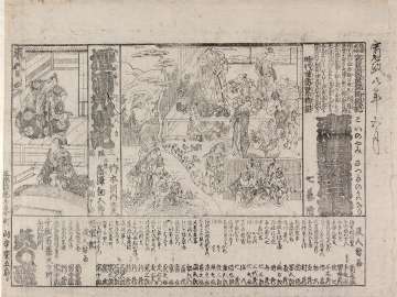
「正月三日御拵絵図」

Skizze des weges von Tokio nach Yumotto (Nikko Berge) nach eigenen Aufzeichnungen / von E. Knippin...

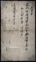
学芸志林進達ノ件

Karte von Australien oder Polynesien, nach den Zeichnungen, Reisebe Schreibungen und Tagebucher de...

拝借書籍返上可致旨外来生徒へ達書
A chart of the South Sea / by J. Seller, J. Colson, W. Fisher, J. Atkinson & J. Thornton ; Dundee, sculp

Tō "So" jūmanbun no ichizu
Range upon Range of Mountains

Carte réduite de l'océan septentrional compris entre l'Asie et l'Amérique ... Par le Sr. Bellin ..
Last Updated: 2020-04-17
Uploaded: 2021-09-21