
[Transport Map of Russia: 'Map of the routes of Steamships, Communication lines, Railways and Road...
- People
- Time
- Owner Organization

General map of the Government Railways in Japan
General Research Division. The New York Public Library
DPLA API
Keifu Testudō senro ryakuzu = Map of the Seoul-Pusan Railway ; Fu Tōyō Tetsudō senro ryakuzu = Map of the Eastern Railways
National Library of Australia
Trove: National Library of Australia

General map of China and adjacent regions, showing treaty ports and railways
Stanford University Libraries
Stanford Libraries SearchWorks

Map of Asia showing its Gt. Political Divisions, and, also, the Various routes of travel between L...
Stanford University Libraries
Stanford Libraries SearchWorks

The railway map of Japan
Boston Public Library
DPLA API

Map of Asia showing its gt. political divisions, and also the various routes of travel between Lon...
Stanford University Libraries
Stanford Libraries SearchWorks

Rand, McNally & Co.'s 1904 war map of Russia and the continent of Asia
Yale University Library
Yale University Library Digital Collections

1904 war map of Japan, Korea, and China
Yale University Library
Yale University Library Digital Collections

1904 war map of Russia and the continent of Asia
Yale University Library
Yale University Library Digital Collections

Map Of Asia Showing its Gt. Political Divisions, and also the Various Routes of Travel Between Lon...
Stanford University Libraries
Stanford Libraries SearchWorks

Map Of Asia Showing its Gt. Political Divisions, and also the Various Routes of Travel Between Lon...
Stanford University Libraries
Stanford Libraries SearchWorks

Map of Asia Showing its Gt. Political Divisions, and, also, the Various routes of Travel Between L...
Stanford University Libraries
Stanford Libraries SearchWorks

Map of Asia showing its gt. political divisions, and also various routes of travel between London ...
Stanford University Libraries
Stanford Libraries SearchWorks

Map of Asia showing its gt. political divisions, and also various routes of travel between London ...
Stanford University Libraries
Stanford Libraries SearchWorks

Map of Asia showing its gt. political divisions, and also various routes of travel between London ...
Stanford University Libraries
Stanford Libraries SearchWorks

Map of Asia Showing its Gt. Political Divisions and...Routes of Trade between London & India, Chin...
Stanford University Libraries
Stanford Libraries SearchWorks

Map of Asia Showing its Gt. Political Divisions and...Routes of Trade between London & India, Chin...
Stanford University Libraries
Stanford Libraries SearchWorks
![A particular map of the road from Fammamatz [Hamamatsu-shi] to Jedo [Edo], the residence of the Secular Mona...](https://dp.la/thumb/23b2f68f5d919e55533118734b6cde2e)
A particular map of the road from Fammamatz [Hamamatsu-shi] to Jedo [Edo], the residence of the Secular Mona...
General Research Division. The New York Public Library
DPLA API
Map showing the area affected in the present differences betiveen Russia and Japan, (Evening Post, 05 August...
National Library of New Zealand
DigitalNZ New Zealand API

General Railway Map of Japan and Manchuria : Showing lines open and under construction on March 31...
Stanford University Libraries
Stanford Libraries SearchWorks
![[Russian railroad troop transport and soldiers crashing through ice]](https://tile.loc.gov/storage-services/service/pnp/jpd/00900/00939_150px.jpg)
[Russian railroad troop transport and soldiers crashing through ice]
Library of Congress
Digital Collections, Library of Congress
![[Taisho Japanese map of the world. Taisho Japanese map of Japan and Korea]. [9 insets].](https://stacks.stanford.edu/image/iiif/yj892bp5625%2F11670000/full/!200,200/0/default.jpg)
[Taisho Japanese map of the world. Taisho Japanese map of Japan and Korea]. [9 insets].
Stanford University Libraries
Stanford Libraries SearchWorks

The latest map of Manchuria, Korea, Formosa, and Saghalien
Stanford University Libraries
Stanford Libraries SearchWorks
New Zealand Division transport on road outside the ancient town wall of Alife in Italy, World War II - Photo...
Alexander Turnbull Library
DigitalNZ New Zealand API

Nijūmanbun no ichi Chishizu
Stanford University Libraries
Stanford Libraries SearchWorks
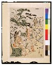
見立安宅の関
Tokyo National Museum
ARC Ukiyo-e Portal Database

Amazing invasion map : Jap plan to seize the West Coast : Pictorial review. Seattle Post - Intelli...
Stanford University Libraries
Stanford Libraries SearchWorks

Nagasaki
Yale University Library
Yale University Library Digital Collections

Jūmanbun no ichizu Neruchinsuku
Stanford University Libraries
Stanford Libraries SearchWorks
![Ulan ude [cartographic material]](https://stacks.stanford.edu/image/iiif/zh630gz7261%2Fzh630gz7261_00_0001/full/!200,200/0/default.jpg)
Ulan ude [cartographic material]
Stanford University Libraries
Stanford Libraries SearchWorks

A Map of the East-Indies and the Adjacent Countries; with the Settlements, Factories and Territori...
Stanford University Libraries
Stanford Libraries SearchWorks

Tokyo City center 1, Japan. (to accompany) Shomitsu Nippon chizu. (Atlas of Japan) Nippon Shoin. (...
Stanford University Libraries
Stanford Libraries SearchWorks

「正中山絵図」
Tokyo Metropolitan Central Library
ARC Ukiyo-e Portal Database

Tokyo central, Japan. (to accompany) Shomitsu Nippon chizu. (Atlas of Japan). Nippon Shoin. (Tokyo...
Stanford University Libraries
Stanford Libraries SearchWorks
五百羅漢図
Tokyo National Museum
ARC Ukiyo-e Portal Database

Tabula Tartariae et majoris partis regni Chinae / edita a F. de Wit ; Lhuilier fecit
Yale University Library
Yale University Library Digital Collections

Matsushima shinkei zenzu
Stanford University Libraries
Stanford Libraries SearchWorks

China, Contains 15 Subject Provinces, including the 2 Islands of Hainan Formosa and the Tributary ...
Stanford University Libraries
Stanford Libraries SearchWorks
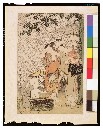
大木の下雨宿り
Tokyo National Museum
ARC Ukiyo-e Portal Database

China and Japan. (with) Islands of Japan. By Keith Johnston, F.R.S.E. Keith Johnston's General Atl...
Stanford University Libraries
Stanford Libraries SearchWorks

「宗吾霊堂境内全図」 「宗吾霊堂境内全図」
Tokyo Metropolitan Central Library
ARC Ukiyo-e Portal Database
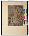
見立黄石公張良
Tokyo National Museum
ARC Ukiyo-e Portal Database

Gojūmanbun no ichi Gobaikaru hōmen sozu
Stanford University Libraries
Stanford Libraries SearchWorks
Last Updated: 2020-04-17
Uploaded: 2021-09-21