
A Map of the East-Indies and the Adjacent Countries; with the Settlements, Factories and Territori...
- People
- Time
- Owner Organization

A Map of the East-Indies and the Adjacent Countries; with the Settlements, Factories and Territori...

A Map of the East-Indies and the Adjacent Countries; with the Settlements, Factories and Territori...

A Map of the East-Indies and the Adjacent Countries; with the Settlements, Factories and Territori...

A Map of the East-Indies and the Adjacent Countries; with the Settlements, Factories and Territori...

A Map of the East-Indies and the Adjacent Countries; with the Settlements, Factories and Territori...
A map of the East-Indies and adjacent countries : with settlements, factories, and territories : explaining what belongs to England, Spain, France, Holland, Denmark, Portugal, etc. with many remarks not extant in any other map / by H. Moll, geog

A map of the East-Indies and adjacent countries : with settlements, factories, and territories : explaining what belongs to England, Spain, France, Holland, Denmark, Portugal, etc. with many remarks not extant in any other map / by H. Moll, geog

A chart of the tradeing part of the East Indies and China, with the adjacent islands, from Surrat ...

A chart of the easternmost part of the East Indies with all the adjacent islands from Cape Comorin...

Map of the Island of Japan, Kurile &c. with the Adjacent Coasts of the Chinese Dominions and a Ske...

Map of the Island of Japan, Kurile &c. with the Adjacent Coasts of the Chinese Dominions and a Ske...
Stanford's map of the empires of China and Japan : with the adjacent parts of the Russian Empire, ...

(Composite Map of) Map of the Island of Japan, Kurile &c. with the Adjacent Coasts of the Chinese ...
.jpg)
SOUTH-EAST ASIA AND EAST INDIES ARCHIPELAGO
A chart of the eastermost part of the East Indies with all the adjacent islands from Cape Comorin to Iapan / by Iohn Seller, Hydrographer to the King

Japan and Korea. (with) The Japanese Empire. (with) Port Arthur and Adjacent Territory. (with) For...
This map shows, by the cross-lining, the Netherlands East Indies and also the island possessions of the U.S....

A map of the city of Nagasaki, and of the adjacent country; Sorts of money current in the Japanese Empire
A chart of the eastermost part of the East Indies with all the adjacent islands from Cape Comorin to Iapan / by Iohn Seller, Hydrographer to the King ; F. Lamb Sculp

A Chart of the Eastermost part of the East Indies and China from Cape Comarin to Japan with the Ad...

A Chart of the Eastermost part of the East Indies and China from Cape Comarin to Japan with the Ad...
Stanford's map of the empires of China and Japan with the adjacent parts of the Russian Empire, India, Burma &c / Stanford's Geogl. Estabt

Karta Aziatskoi Rossii . . . [Map of the Asian part of Russia and Possessions Adjacent, with the R...

General map of China and adjacent regions, showing treaty ports and railways
A Map of the East-Indies and the Adjacent Countries; with the Settlements, Factories and Territori...
A Map of the East-Indies and the Adjacent Countries; with the Settlements, Factories and Territori...

Descripcao nova, e exacta dos Reynos, e Provincias do Japao

A New Map of Great Tartary and China, with the adjoyning Parts of Asia, Taken from Mr. De Fer's Ma...
A Map of the East-Indies and the Adjacent Countries; with the Settlements, Factories and Territori...

Exacta et accurata delineatio cum orarum maritimarum tum etiam locotum terrestrium quae in regioni...

Descripcao nova, e exacta dos Reynos, e Provincias do Japao

the Kingdome of China newly augmented by I.S. 1626

the Kingdome of China newly augmented by I.S. 1626

India quae Orientalis dicitur et Insulae Adiacentes

An Improved Map of the United States By Shelton & Kensett

Carte Des Indes et de la Chine Dressee sur plusieurs Relations particulieres Rectifees par quelque...

To the Right Honorable William Lord Cowper Lord High Chancellor of Great Britain This Map of Asia ...
![[Untitled Map of the Ancient World : Europe, Asia and Africa]](https://stacks.stanford.edu/image/iiif/ss295kf6573%2F37437/full/!200,200/0/default.jpg)
[Untitled Map of the Ancient World : Europe, Asia and Africa]
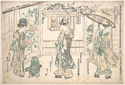
「若衆三福対」 「左」「中」「右」
Kotobanohanamomijinoyozakari

A New Map of Great Tartary and China, with the adjoyning Parts of Asia, Taken from Mr. De Fer's Ma...

the Kingdome of China newly augmented by I.S. 1626
![Suitadoshikawazoiyanagi、[kaidouichiyawaragisoga]](http://mfas3.s3.amazonaws.com/styles/grid-2_thumbnail_retina/s3/objects/SC209535.jpg)
Suitadoshikawazoiyanagi、[kaidouichiyawaragisoga]

To the Right Honorable William Lord Cowper Lord High Chancellor of Great Britain This Map of Asia ...

the Kingdome of China newly augmented by I.S. 1626
![Unohanakoinonakagaki、hototogisuyumeniikudama、[hanakyoudaiaioisoga]](http://mfas3.s3.amazonaws.com/styles/grid-2_thumbnail_retina/s3/objects/SC210433.jpg)
Unohanakoinonakagaki、hototogisuyumeniikudama、[hanakyoudaiaioisoga]

Asia recens summa cura delineata Auct. Iud: Hondio
Last Updated: 2020-04-17
Uploaded: 2021-09-21