
A Correct Sea Chart of the Whole World, According to Wright's, Commonly Called Mercator's, Project...
- People
- Time
- Owner Organization

A New and Correct Chart of all the Known World Laid down according to Mercator's Projection
Stanford University Libraries
Stanford Libraries SearchWorks

A New and Correct Chart of all the Known World Laid down according to Mercator's Projection
Stanford University Libraries
Stanford Libraries SearchWorks

A New and Correct Chart of all the Known World Laid down according to Mercator's Projection
Stanford University Libraries
Stanford Libraries SearchWorks

A new & correct chart of the Indian sea from Cabo Bonea Esperanca to Japan : according to Mr Edwar...
Bibliothèque nationale de France
Europeana API

A New Map of the Whole World According To The New Observations by Moll Geographer
Stanford University Libraries
Stanford Libraries SearchWorks

Teachers of the World. Eating : A Way to Understanding (Japan)
Stanford University Libraries
Stanford Libraries SearchWorks
World War II New Zealand soldiers from Rest Camp near Ancona, Italy, on their way to the sea for a swim - Ph...
Alexander Turnbull Library
DigitalNZ New Zealand API
A Graham and R J Richardson watch passing nuns on steps leading to Campobasso castle, Italy, during World Wa...
Alexander Turnbull Library
DigitalNZ New Zealand API
A new chart of the Pacific Ocean : exhibiting the western coast of America, from Cape Horn to Beerings Strait, the eastern shores of Asia including Japan, China and Australia and all the numerous islands and known dangers situated in Polynesia and Australasia / correctly drawn and regulated according to the most approved and modern surveys and astronomical observations by J.W. Norie
State Library of New South Wales
Trove: National Library of Australia

Laurie and Whittle's New Chart of the Indian and Pacific Oceans Between the Cape of Good Hope, New...
Stanford University Libraries
Stanford Libraries SearchWorks

「西国三十三所順拝地図」
Tokyo Metropolitan Central Library
ARC Ukiyo-e Portal Database
Laurie and Whittle's new chart of the Indian and Pacific Oceans between the Cape of Good Hope, New Holland and Japan : comprehending New Zealand, New Caledonia, New Britain, New Ireland, New Guinea &c., Louisiade and New Georgia; also The Pelew, New Caroline, Ladrone and Philippine Islands &c. with the most remarkable tracks of the English, Spanish, French and Dutch navigators and chiefly the track of the Walpole, EastIndiaman, Captn. Thos. Butler, 1794 from the Cape of Good Hope to Van Diemen's Land and from thence to China, and the track of the Royal Admiral Captn. Henr. Bond in 1792 and 93 from the Cape to Port Jackson and China
State Library of New South Wales
Trove: National Library of Australia

Nouvelle Carte de la Mer Mediterranee Juscques au Cap S. Vincent et Cap Cantin
Stanford University Libraries
Stanford Libraries SearchWorks

(Composite of) A New Chart of The Pacific Ocean, Exhibiting The Western Coast of America, From Cap...
Stanford University Libraries
Stanford Libraries SearchWorks
![Carte de la Découverte faite en [1735] par les Hollandois, à la partie la plus orientale de l'Asie...](https://api.europeana.eu/api/v2/thumbnail-by-url.json?uri=http%3A%2F%2Fgallica.bnf.fr%2Fark%3A%2F12148%2Fbtv1b53032838p.thumbnail.jpg&type=IMAGE)
Carte de la Découverte faite en [1735] par les Hollandois, à la partie la plus orientale de l'Asie...
Bibliothèque nationale de France
Europeana API
Pas-caert van't Oostelyckste deel van Oost Indien : met alle de Eylanden daer onder gelegen, van Cabo Comorin tot aen Japan / by Hendrick Doncker Boekverkooper en Graadbooghmaacker Inde Nieuwbrughsteegh
National Library of Australia
Trove: National Library of Australia

A New Chart of The Pacific Ocean, Exhibiting The Western Coast of America from Cape Horn to Beerin...
Stanford University Libraries
Stanford Libraries SearchWorks

Taifuu nanagou ni yoru yamanashi kenka no shuyou saigai zu
Yamanashi Prefectural Library
Yamanashi Digital Archive

Laurie and Whittle's New Chart of the Indian and Pacific Oceans Between the Cape of Good Hope, New...
Stanford University Libraries
Stanford Libraries SearchWorks

Nomigunhanedamuraseisakugumiwakemuranaikenchiryouezu
Imizu City Shinminato Museum
ADEAC: A System of Digitalization and Exhibition for Archive Collections

A New Chart of The Pacific Ocean, Exhibiting The Western Coast of America, From Cape Horn To Beeri...
Stanford University Libraries
Stanford Libraries SearchWorks
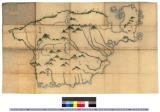
南部図 : 奥州図〈南部、津軽、棚倉〉
Iwase Bunko Libray
ADEAC: A System of Digitalization and Exhibition for Archive Collections

Kaikoku zenzu
Yamanashi Prefectural Library
Yamanashi Digital Archive

「下総銚子之図」
Tokyo Metropolitan Central Library
ARC Ukiyo-e Portal Database
Last Updated: 2020-04-17
Uploaded: 2021-09-21