
An Improved Map of the United States By Shelton & Kensett
- People
- Time
- Owner Organization

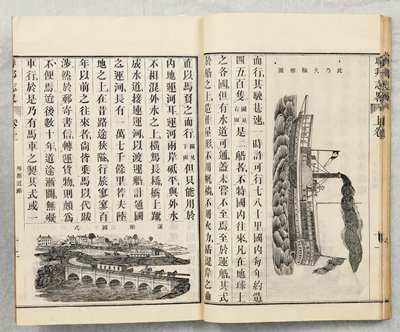
Picture map of China. Designed by Frank Randolph Southard. Printed in United States of America. (C...
Stanford University Libraries
Stanford Libraries SearchWorks

Picture map of China. Designed by Frank Randolph Southard. Printed in United States of America. (C...
Stanford University Libraries
Stanford Libraries SearchWorks

(Covers to) Picture map of China. Designed by Frank Randolph Southard. Printed in United States of...
Stanford University Libraries
Stanford Libraries SearchWorks

El Capitan, from the series The United States
Freer and Sackler
DPLA API
This map of the Pacific shows the "pincers" strength of the United States from the Aleutian Islands in the n...
National Library of New Zealand
DigitalNZ New Zealand API

Williams' Copper - Plate Map Of The United States, Canada, Mexico, Central America, West Indies, &...
Stanford University Libraries
Stanford Libraries SearchWorks
Pearl Harbour, Oahu, Hawaii, United States of America [electronic resource]
Stanford University Libraries
Stanford Libraries SearchWorks

Northwestern America Showing The Territory Ceded By Russia To The United States Compiled For The D...
Stanford University Libraries
Stanford Libraries SearchWorks
Aerial view of. the explosion of a Japanese ammunition dump, hit by United States aircraft, at the south-eas...
National Library of New Zealand
DigitalNZ New Zealand API

Representation of the United States of America: a pleasing group which took part in the peace procession at ...
Auckland Libraries
DigitalNZ New Zealand API

Fishes of Honolulu, from the series The United States
Freer and Sackler
DPLA API
Brief Account of the United States, vol. 2
Minneapolis Institute of Arts
Minneapolis Institute of Art API
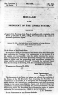
Message of the President of the United States. ca.
国際日本文化研究センター
Catalogue of the pre-1900 printed books on Japan in European languages held by Nichibunken
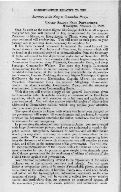
Message of the President of the United States. ca.
国際日本文化研究センター
Catalogue of the pre-1900 printed books on Japan in European languages held by Nichibunken

Topographical map of the Japanese Empire, 1899 / Imperial Geological Survey of Japan ; drawn by T. Togawa an...
Yale University Library
Yale University Library Digital Collections

UNITED STATES NAVY TASK FORCE ASSEMBLES IN FORMER JAPANESE BASE
Auckland Libraries
DigitalNZ New Zealand API
A Japanese camp in the Solomon Islands after-it had been wrecked by United States marines. Even food ivas on...
National Library of New Zealand
DigitalNZ New Zealand API
The decks of a United States cruiser as the crew pour shells into one of the Pacific Islands held, by the Ja...
National Library of New Zealand
DigitalNZ New Zealand API
Visit of Connie Hedegaard, Member of the EC, to the United States
Audiovisual Library of the European Commission
Europeana API
Report by the United Panhellenic Youth Organisation (EPON) of Peloponnese
Contemporary Social History Archives (ASKI)
Europeana API
Meeting of the new Pacific War Council, during World War II, Washington, DC, United States
Alexander Turnbull Library
DigitalNZ New Zealand API

An embassy from the East-India Company of the United Provinces, to the Grand Tartar Cham Emperor o...
Stanford University Libraries
Stanford Libraries SearchWorks

Map of the Empire of Japan
Salem State University Archives and Special Collections
DPLA API
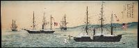
Painting of the United States East India Squadron in Tokyo Bay
Yale University Library
Yale University Library Digital Collections

Carte des Indes, de la Chine & des Iles de Sumatra, Java &c.
Stanford University Libraries
Stanford Libraries SearchWorks

Greece in the fifth century B.C
Yoshida-South Library, Kyoto University
IIIF Discovery in Japan

Asiae Nova Delineatio . .
Stanford University Libraries
Stanford Libraries SearchWorks

A New Map of India & China From the latest Observations
Stanford University Libraries
Stanford Libraries SearchWorks

Carte Reduite De L'Ocean Septentrional compris entre l'Asie et l'Amerique Suivante les Decouvertes...
Stanford University Libraries
Stanford Libraries SearchWorks

Korea, Nordost-China und Süd-Japan / Carl Flemming
Bibliothèque nationale de France
Europeana API

Bancroft's Map of California, Nevada, Utah & Arizona … 1864
Stanford University Libraries
Stanford Libraries SearchWorks

A Map of the East-Indies and the Adjacent Countries; with the Settlements, Factories and Territori...
Stanford University Libraries
Stanford Libraries SearchWorks

L'Amerique Septentrionale & Meridionale divisee en ses principales parties . .
Stanford University Libraries
Stanford Libraries SearchWorks

Isola del Giapone e Penisola di Corea. .
Stanford University Libraries
Stanford Libraries SearchWorks

Isole Del Giappone e la Corea . . . 1797
Stanford University Libraries
Stanford Libraries SearchWorks

Charte Von America nach astronomischen Bestimmungen und den neuesten Charten entworfen von .L. Gus...
Stanford University Libraries
Stanford Libraries SearchWorks
Last Updated: 2020-04-17
Uploaded: 2021-09-21