![Russian Empire [with] Chart of the Communication Between The Archipelago And Black Sea](https://stacks.stanford.edu/image/iiif/bk956jy9388%2F18960/full/!200,200/0/default.jpg)
Russian Empire [with] Chart of the Communication Between The Archipelago And Black Sea
- People
- Time
- Owner Organization

The Russian Empire, in Europe and Asia
Stanford's map of the empires of China and Japan : with the adjacent parts of the Russian Empire, ...

Shore of the Black Sea
Stanford's map of the empires of China and Japan with the adjacent parts of the Russian Empire, India, Burma &c / Stanford's Geogl. Estabt

Japan-- Inland Sea, channels between Misima Nada and Bingo Nada republication of Brit. Admlty. chart no. 132...

Soldiers of the Russian empire passing through the gates of Mukden, Manchuria
A chart of the northern part of the China Sea shewing the passage from Formosa to Japan : with the eastern coast of China and the Lekeyo Islands

Chart of Discoveries made in 1787 In the Seas of China and Tartary between Manilla and Avateha by ...
Harbor of the Black Sea (Kurodumi no funatsukiba)
.jpg)
Black and white photograph of ships at sea

Laurie and Whittle's New Chart of the Indian and Pacific Oceans Between the Cape of Good Hope, New...

Laurie and Whittle's New Chart of the Indian and Pacific Oceans Between the Cape of Good Hope, New...
The Islands of Japan with Corea, Manchooria and the russian territory on the Amoor
A New Chart of the Indian and Pacific Oceans Between the Cape of Good Hope, New Holland, and Japan...

Fishes of the Sea of Japan and the adjacent areas of the Sea of Okhotsk and the Yellow Sea / G.U. ...
Fishes of the Sea of Japan and the adjacent areas of the Sea of Okhotsk and the Yellow Sea / G.U. ...

Chart of the coast of China and of the Japan islands including the Marianes and part of the Philippines

Biodiversity and distribution of the deep-sea fauna in the Sea of Japan and in the Kuril-Kamchatka...
Treaties and conventions between the Empire of Japan and other powers.

The Japanese empire : with central and southern Manchukuo (Manchuria)

The Japanese empire : with central and southern Manchukuo (Manchuria)

Japan and Korea. (with) The Japanese Empire. (with) Port Arthur and Adjacent Territory. (with) For...

The Empire of China and Island of Japan, Agreeable to Modern History

A Chart of the Eastermost part of the East Indies and China from Cape Comarin to Japan with the Ad...
![[Two scenes related to the Soga family]](https://tile.loc.gov/storage-services/service/pnp/jpd/02500/02588_150px.jpg)
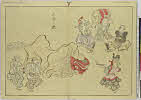
[Two scenes related to the Soga family]
![[Wild horses running in water, across a river or in surf]](https://tile.loc.gov/storage-services/service/pnp/jpd/02400/02428_150px.jpg)
[Wild horses running in water, across a river or in surf]
A new & accurate map of Asia : drawn from the most approved modern maps & charts / by Thos. Bowen ; engraved for Middletons complete system of geography
![[Peony blossoms]](https://tile.loc.gov/storage-services/service/pnp/jpd/02400/02420_150px.jpg)
[Peony blossoms]

Sumō

Paskaerte Zynde t'Oosterdeel Van Oost Indien, met alle de Eylanden daer ontrendt geleegen van C.Co...
「大神楽」
Zeekaart van het oostelijk deel van de Indische Oceaan, van India tot Australië en Japan
![[Cat with black markings on its fur and a fragrant rose mallow]](https://tile.loc.gov/storage-services/service/pnp/jpd/02400/02429_150px.jpg)
[Cat with black markings on its fur and a fragrant rose mallow]
![[Scenes related to the Soga family - two warriors with swords walking behind retainers leading two horses]](https://tile.loc.gov/storage-services/service/pnp/jpd/02500/02587_150px.jpg)
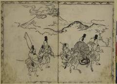
[Scenes related to the Soga family - two warriors with swords walking behind retainers leading two horses]

To the Right Honorable William Lord Cowper Lord High Chancellor of Great Britain This Map of Asia ...
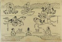
Korean Horseback Acrobats
Itchō Picture Album : [volume 3]
![[Scenes related to the Soga family - three warriors, one with two swords and two with bow and arrows; retainers holding the reins of horses in the foreground]](https://tile.loc.gov/storage-services/service/pnp/jpd/02500/02586_150px.jpg)
[Scenes related to the Soga family - three warriors, one with two swords and two with bow and arrows; retainers holding the reins of horses in the foreground]

Shinnoshichiken
Isemonogatariasama
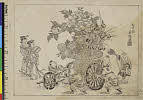
(童子女と花車)
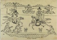
Korean Horseback Acrobats

An accurate Map of the British Colonies in North Ameria bordering on the River Ohio (First Appeara...
![[Foxes and chrysanthemums]](https://tile.loc.gov/storage-services/service/pnp/jpd/02400/02433_150px.jpg)
[Foxes and chrysanthemums]
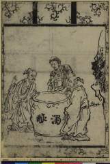
Susuinosannin

「鹿島香取筑波日光参詣順路図」

Seconde Partie De la Carte D'Asie Contenant La Chine et partie de la Tartarie, L'Inde au dela du G...
A Garden of Celebrated Japanese and Chinese Paintings : [volume 6]
Last Updated: 2020-04-17
Uploaded: 2021-09-21