
Map of Asia Showing its Gt. Political Divisions and...Routes of Trade between London & India, Chin...
- People
- Time
- Owner Organization

Map of Asia Showing its Gt. Political Divisions and...Routes of Trade between London & India, Chin...

Map of Asia Showing its Gt. Political Divisions and...Routes of Trade between London & India, Chin...

Map of Asia Showing its Gt. Political Divisions and...Routes of Trade between London & India, Chin...

Map of Asia showing its gt. political divisions, and also various routes of travel between London ...

Map of Asia showing its gt. political divisions, and also various routes of travel between London ...

Map of Asia showing its gt. political divisions, and also various routes of travel between London ...

Map of Asia showing its gt. political divisions, and also the various routes of travel between Lon...

Map of Asia showing its gt. political divisions, and also the various routes of travel between Lon...

Map of Asia showing its gt. political divisions, and also the various routes of travel between Lon...

Map of Asia showing its Gt. Political Divisions, and, also, the Various routes of travel between L...

Map Of Asia Showing its Gt. Political Divisions, and also the Various Routes of Travel Between Lon...

Map Of Asia Showing its Gt. Political Divisions, and also the Various Routes of Travel Between Lon...

Map of Asia Showing its Gt. Political Divisions, and, also, the Various routes of Travel Between L...
![Tokyo : [base map showing political divisions]](https://stacks.stanford.edu/image/iiif/jw443fg4075%2Fjw443fg4075_00_0001/full/!200,200/0/default.jpg)
Tokyo : [base map showing political divisions]
![Osaka : [base map showing political divisions]](https://stacks.stanford.edu/image/iiif/rk252rh2515%2Frk252rh2515_00_0001/full/!200,200/0/default.jpg)
Osaka : [base map showing political divisions]
![Yokohama : [base map showing political divisions]](https://stacks.stanford.edu/image/iiif/hg765ms3579%2Fhg765ms3579_00_0001/full/!200,200/0/default.jpg)
Yokohama : [base map showing political divisions]

Commercial Culture, Political Culture & the Political Economy of Trade Policy: The Case of Japan
Stanford's London atlas of universal geography exhibiting the physical and political divisions of the various countries of the world
Court Exh. No. 2570: Map showing various sectors or divisions of the city of Hankow, and showing the various routes of entry of the several units and their disposition
Court Exh. No. 2570: Map showing various sectors or divisions of the city of Hankow, and showing the various routes of entry of the several units and their disposition

Press conference by Karel De Gucht on the future deepening of Trade and political ties with Japan
Prospects of Regional Cooperation in Trade, Investment & Finance in Asia: An Empirical Analysis on...
The JVC video anthology of world music and dance. Volume 13, South Asia III : India 3
The JVC video anthology of world music and dance. Volume 12, South Asia II : India 2
Map of Asia Showing its Gt. Political Divisions and...Routes of Trade between London & India, Chin...
Map of Asia showing its Gt. Political Divisions, and, also, the Various routes of travel between L...
Map Of Asia Showing its Gt. Political Divisions, and also the Various Routes of Travel Between Lon...
Map of Asia showing its gt. political divisions, and also the various routes of travel between Lon...

Chinae, olim Sinarum regionis nova descriptio auctore Ludovico Georgio . . . 1584

Tabula Tartariae et majoris partis regni Chinae / edita a F. de Wit ; Lhuilier fecit

China, Contains 15 Subject Provinces, including the 2 Islands of Hainan Formosa and the Tributary ...
Map of Asia Showing its Gt. Political Divisions, and, also, the Various routes of Travel Between L...
Map of Asia showing its gt. political divisions, and also the various routes of travel between Lon...
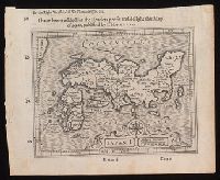
Japan I

Asia Partiu Orbis Maxima MDXCVIII

Indiae Orientalis, Insularumque Adiacentium Typus. Cum Privilegio

India Orientalis
![Novae Insulae XXVI Nova Tabula [1st Map of the continent of America]](https://stacks.stanford.edu/image/iiif/wy766vv8554%2F34123/full/!200,200/0/default.jpg)
Novae Insulae XXVI Nova Tabula [1st Map of the continent of America]

Novae Insulae XXVI Nova Tabula

Tartariae Imperium
1 centime Sceptre of Indra or Vajra
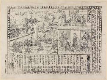
Kanadehonchuushingura

Spatiosissimum Imperium Russiae Magnae juxta recentissimas Observationes Mappa Geographica . .

Tōkyō shigai zenzu

Jōshū Kusatsu Onsenzu narabini hakkei
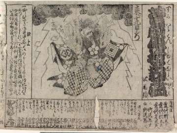
Sugawaradenjutenaraikagami
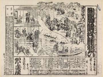
Norikakesogadouchuusugoroku
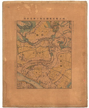
埼玉縣武蔵國北埼玉郡麦倉村
Last Updated: 2020-04-17
Uploaded: 2021-09-21