![Indo oyobi Seia [cartographic material] : Roppyakmanbun no ichi](https://stacks.stanford.edu/image/iiif/dx650yf2686%2Fdx650yf2686_00_0001/full/!200,200/0/default.jpg)
Indo oyobi Seia [cartographic material] : Roppyakmanbun no ichi
- People
- Time
- Owner Organization
![Indo hyakumanbun no ichi zu [cartographic material]](https://stacks.stanford.edu/image/iiif/yh140pd1258%2Fyh140pd1258_00_0001/full/!200,200/0/default.jpg)
Indo hyakumanbun no ichi zu [cartographic material]
![Tōa gojūmanbun no ichi zu [cartographic material]](https://www.gumtree.com/static/1/resources/assets/rwd/images/orphans/a37b37d99e7cef805f354d47.noimage_thumbnail.png)
Tōa gojūmanbun no ichi zu [cartographic material]
![Indo Gojūmanbunnoichi Zu [cartographic material]](https://stacks.stanford.edu/image/iiif/fr949xk3381%2Ffr949xk3381_00_0001/full/!200,200/0/default.jpg)
Indo Gojūmanbunnoichi Zu [cartographic material]
![Manshū oyobi Shiberi heiyō nijūmanbun no ichi zu [cartographic material]](https://stacks.stanford.edu/image/iiif/jy648rw3726%2Fjy648rw3726_00_0001/full/!200,200/0/default.jpg)
Manshū oyobi Shiberi heiyō nijūmanbun no ichi zu [cartographic material]
![Nihyakumanbun no ichi kōkūzu [cartographic material]](https://stacks.stanford.edu/image/iiif/qf331pm3870%2Fqf331pm3870_00_0001/full/!200,200/0/default.jpg)
Nihyakumanbun no ichi kōkūzu [cartographic material]
![Indo Hyakumanbunnoichi Zu Tōbu Shūiki [cartographic material]](https://stacks.stanford.edu/image/iiif/wr290sd1084%2Fwr290sd1084_00_0001/full/!200,200/0/default.jpg)
Indo Hyakumanbunnoichi Zu Tōbu Shūiki [cartographic material]
![Taiheiyō shotō yochizu [cartographic material] : Roppyakumanbun no ichi](https://stacks.stanford.edu/image/iiif/td070bz1257%2Ftd070bz1257_00_0001/full/!200,200/0/default.jpg)
Taiheiyō shotō yochizu [cartographic material] : Roppyakumanbun no ichi
![Manshūkoku yochizu [cartographic material] : hyakumanbun no ichi](https://stacks.stanford.edu/image/iiif/dc116hp3130%2Fdc116hp3130_00_0001/full/!200,200/0/default.jpg)
Manshūkoku yochizu [cartographic material] : hyakumanbun no ichi
![Niman-gosenbun no ichi zu Oha oyobi Baikaru kinbō [cartographic material]](https://stacks.stanford.edu/image/iiif/tb039vx7430%2Ftb039vx7430_00_0001/full/!200,200/0/default.jpg)
Niman-gosenbun no ichi zu Oha oyobi Baikaru kinbō [cartographic material]
![Yonhyakumanbun no ichi bōkūyō sakusenzu [cartographic material]](https://stacks.stanford.edu/image/iiif/gr529zh9648%2Fgr529zh9648_00_0001/full/!200,200/0/default.jpg)
Yonhyakumanbun no ichi bōkūyō sakusenzu [cartographic material]
Jūmanbun no ichi chishizu [cartographic material]
![Ichimanbun no ichi "Sorowēyofuka" kinbō [cartographic material]](https://stacks.stanford.edu/image/iiif/gw752gv2909%2Fgw752gv2909_00_0001/full/!200,200/0/default.jpg)
Ichimanbun no ichi "Sorowēyofuka" kinbō [cartographic material]
![Ichimanbun no ichi "Berezuniyakī" kinbo [cartographic material]](https://stacks.stanford.edu/image/iiif/cz633dr9513%2Fcz633dr9513_00_0001/full/!200,200/0/default.jpg)
Ichimanbun no ichi "Berezuniyakī" kinbo [cartographic material]
Nijūmanbun no ichi teikokuzu [cartographic material]
![Sensei-shō gojūmanbun no ichi chishizu [cartographic material]](https://stacks.stanford.edu/image/iiif/wm502tg3204%2Fwm502tg3204_00_0001/full/!200,200/0/default.jpg)
Sensei-shō gojūmanbun no ichi chishizu [cartographic material]
Shiberi heiyō nijūmanbun no ichi zu [cartographic material]
Manshū gomanbun no ichi zu [cartographic material]
![Ichimanbun no ichi Hakkōho kinbō [cartographic material]](https://stacks.stanford.edu/image/iiif/mv457bk9689%2Fmv457bk9689_00_0001/full/!200,200/0/default.jpg)
Ichimanbun no ichi Hakkōho kinbō [cartographic material]
Firippin gomanbun no ichi zu [cartographic material]
![Nimanbun no ichi Honkon Kinbō [cartographic material]](https://stacks.stanford.edu/image/iiif/nv455pd8800%2Fnv455pd8800_00_0001/full/!200,200/0/default.jpg)
Nimanbun no ichi Honkon Kinbō [cartographic material]
Firippin jūmanbun no ichi zu [cartographic material]
![Mōko hyakumanbun no ichi zu [cartographic material] : Rohan kaibyō](https://stacks.stanford.edu/image/iiif/mk343nf5624%2Fmk343nf5624_00_0001/full/!200,200/0/default.jpg)
Mōko hyakumanbun no ichi zu [cartographic material] : Rohan kaibyō
![Ichimanbun no ichi zu Oha kinbō [cartographic material]](https://stacks.stanford.edu/image/iiif/fg028vd4641%2Ffg028vd4641_00_0001/full/!200,200/0/default.jpg)
Ichimanbun no ichi zu Oha kinbō [cartographic material]
![Nimanbun no ichi Kōshū kinbōzu [cartographic material]](https://stacks.stanford.edu/image/iiif/jk583dp9826%2Fjk583dp9826_00_0001/full/!200,200/0/default.jpg)
Nimanbun no ichi Kōshū kinbōzu [cartographic material]

Gojūmanbun no ichi Gobaikaru hōmen sozu

Nagasaki
![Karte von China und Japan den Manen D'Anville's und Klapproth's [cartographic material] / gewidmet Potsdam v...](https://collections.library.yale.edu/iiif/2/15824679/full/!200,200/0/default.jpg)
Karte von China und Japan den Manen D'Anville's und Klapproth's [cartographic material] / gewidmet Potsdam v...

Asia According to the best Authorities
![Nimangosenbun no ichi chikeizu Parao Rettō [cartographic material]](https://stacks.stanford.edu/image/iiif/dx617ts1787%2Fdx617ts1787_00_0001/full/!200,200/0/default.jpg)
Nimangosenbun no ichi chikeizu Parao Rettō [cartographic material]

The Japanese empire : with central and southern Manchukuo (Manchuria)

General map of China and adjacent regions showing treaty ports and railroads / prepared for the Department o...

The Japanese empire : with central and southern Manchukuo (Manchuria)

China (Ostl. Theil), Korea Und Japan Im Maassstabe Von 1:7.500.000. Von A Petermann. Bearbeitet vo...

Strategical map of part of Korea and Manchuria / prepared by the Second Division, General Staff (Military In...

Das Suedoestliche Asien oder China, Japan, und Hinter-Indien mit dem Indischen Archipelagus. (The ...
Manshūkoku chizu / Minami Manshū Tetsudō Kabushiki Kaisha chosaku ken hakkō

Chinese Empire (including Trans Oceanic Cables to Hong Kong,etc.)

Carte Des Indes et de la Chine Dressee sur plusieurs Rectifees par quelques Observations Par Guill...

Central Tokyo : city map.

China, Contains 15 Subject Provinces, including the 2 Islands of Hainan Formosa and the Tributary ...

Kankō - Seito

東亞大陸圖 : 二百五十万分一
![Taiwan Kasei Nijūmanbunnoichi Zu [cartographic material]](https://stacks.stanford.edu/image/iiif/wc958mv2300%2Fwc958mv2300_00_0001/full/!200,200/0/default.jpg)
Taiwan Kasei Nijūmanbunnoichi Zu [cartographic material]

Map of Chosen (Korea)
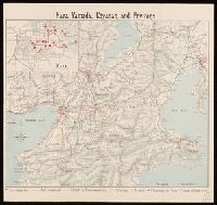
Nara, Yamada, Koyasan, & environs

Manshū jūmanbun no ichizu Chūbu Daikōanrei
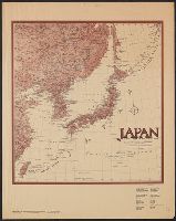
Japan and adjacent regions / prepared and distributed by Army Information Branch, Army Service Forces

Russia in Asia, Chinese Empire, etc. No. 3. Letts's popular atlas. Letts Son & Co. Limited, London...
Last Updated: 2020-04-17
Uploaded: 2021-09-21