
Taichū shigaizu = Map of T'ai-chung city
- Owner Organization

Shinchiku shigaizu = : Map of Hsinchu city
Stanford University Libraries
Stanford Libraries SearchWorks

Kagi shigaizu = Map of Chiayi city
Stanford University Libraries
Stanford Libraries SearchWorks

Nagasaki shigai zenzu = The map of nagasaki city. Kiushiu. Japan
Stanford University Libraries
Stanford Libraries SearchWorks

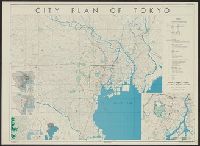
Map of Tokyo : city communications
Stanford University Libraries
Stanford Libraries SearchWorks

Jitchi tōsoku Kōbe shigai zenzu = New map of Kobe
Stanford University Libraries
Stanford Libraries SearchWorks

Central Tokyo : city map.
Stanford University Libraries
Stanford Libraries SearchWorks
![Kaisei Atami Shigai Zenzu. [Revised Map of the Entire City of Atami]](https://collections.library.yale.edu/iiif/2/15510883/full/!200,200/0/default.jpg)
Kaisei Atami Shigai Zenzu. [Revised Map of the Entire City of Atami]
Yale University Library
Yale University Library Digital Collections
Akita City: Map of city. Report No. 14f(1)(f), USSBS Index Section 2
NDL Digital Collections
NDL Digital Collections

Guide to Tokyo City
Yale University Library
Yale University Library Digital Collections
Map showing the lay-out of the. city of Shanghai, the centre of the present Sino-Japanese ivarfare. Even the...
National Library of New Zealand
DigitalNZ New Zealand API

Koubeshi zenzu = Map of Kobe
NDL Digital Collections
NDL Digital Collections

Koubeshi zenzu = Map of Kobe
NDL Digital Collections
NDL Digital Collections
City of Kobe 192A
Harvard Art Museums
Harvard Art Museums API
![[Map of China]](https://collections.library.yale.edu/iiif/2/16189150/full/!200,200/0/default.jpg)
[Map of China]
Yale University Library
Yale University Library Digital Collections
Map- city of Tokyo. Report No. 12g(3), USSBS Index Section 2
NDL Digital Collections
NDL Digital Collections

A map of the city of Nagasaki, and of the adjacent country; Sorts of money current in the Japanese Empire
General Research Division. The New York Public Library
DPLA API
Map of city of Kyoto showing locations of sirens. Report No. 6d, USSBS Index Section 2
NDL Digital Collections
NDL Digital Collections
City plan of Yokohama
National Library of Australia
Trove: National Library of Australia
Japanese map of Nagasaki City giving brief history of city and other information. Report No. 3t(19), USSBS Index Section 2
NDL Digital Collections
NDL Digital Collections

City plan of Kōbe.
Stanford University Libraries
Stanford Libraries SearchWorks
City plan of Tōkyō
Yale University Library
Yale University Library Digital Collections

Bird's Eye View of the City of Nebraska City. Otoe County Nebraska 1868
Stanford University Libraries
Stanford Libraries SearchWorks

The City of Paris, France
Philadelphia Museum of Art
Philadelphia Museum of Art collection
Map of Kyoto City water system. Report No. 6h, USSBS Index Section 2
NDL Digital Collections
NDL Digital Collections

Tō "So" jūmanbun no ichizu
Stanford University Libraries
Stanford Libraries SearchWorks
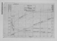
〔軍艦加古 馬力・速力関係曲線図〕
東京大学柏図書館
UTokyo Academic Archives Portal
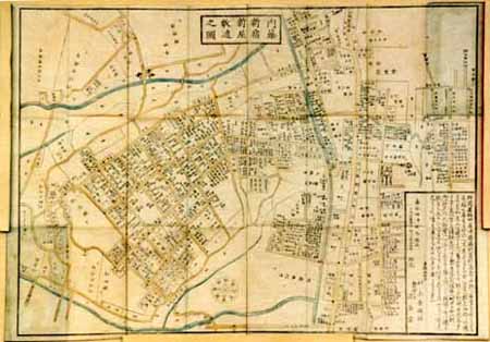
改正 内藤新宿新屋鋪代々木辺図 全
Geospatial Information Authority of Japan
FishPix
東照神君開運城跡浜松鉄城閣及市街略図
Hamamatsu City Central Library
ADEAC: A System of Digitalization and Exhibition for Archive Collections

(佐賀市)住居表示案内図1
Saga Prefectual Library
IIIF Discovery in Japan
Shinchiku shigaizu = : Map of Hsinchu city
Stanford University Libraries
Stanford Libraries SearchWorks

諸富津
Saga Prefectual Library
IIIF Discovery in Japan
Plano de las bahías de Hiogo y Kobé. H. 793 [Material cartográfico]
Biblioteca Nacional de España
Europeana API
![[Carte simplifiée de l'Ouest de la ville d'Osaka.]](https://api.europeana.eu/api/v2/thumbnail-by-url.json?uri=http%3A%2F%2Fgallica.bnf.fr%2Fark%3A%2F12148%2Fbtv1b530667820.thumbnail.jpg&type=IMAGE)
[Carte simplifiée de l'Ouest de la ville d'Osaka.]
Bibliothèque nationale de France
Europeana API

Japan distribution of waterworks
Stanford University Libraries
Stanford Libraries SearchWorks

A Chart of the SOUTH=SEA
Stanford University Libraries
Stanford Libraries SearchWorks

犬井道
Saga Prefectual Library
IIIF Discovery in Japan

Hemisphere Septentrional pour voir plus distinctement Les Terres Arctiques . . . Corrige et Augmen...
Stanford University Libraries
Stanford Libraries SearchWorks
小石川辺図
Geospatial Information Authority of Japan
FishPix
百姓町人等御礼之図 : 雑図一束
Iwase Bunko Libray
ADEAC: A System of Digitalization and Exhibition for Archive Collections

浜松市全図
個人蔵
ADEAC: A System of Digitalization and Exhibition for Archive Collections
The entrance of Nangasacqui the chief port of the island of Kiusiu in the Kingdom of Japan from the manuscript chart of the Dutch East India Company
National Library of Australia
Trove: National Library of Australia

中佐嘉郷神野村
Saga Prefectual Library
IIIF Discovery in Japan
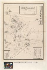
改正 渋谷宮益辺図 全
Geospatial Information Authority of Japan
FishPix
A Pavement (Hodō)
Honolulu Museum of Art
Honolulu Museum of Art Collection
〔米軍艦シルエット図〕
東京大学柏図書館
UTokyo Academic Archives Portal

下村
Saga Prefectual Library
IIIF Discovery in Japan
![Kasei Kita Shina jūmanbun no ichi zu. Hsüchow (Xuzhou) [cartographic material]](https://stacks.stanford.edu/image/iiif/js550gn2130%2Fjs550gn2130_00_0001/full/!200,200/0/default.jpg)
Kasei Kita Shina jūmanbun no ichi zu. Hsüchow (Xuzhou) [cartographic material]
Stanford University Libraries
Stanford Libraries SearchWorks

「西国第八番大和長谷寺観音堂平面図」「他(畳物)」
Tokyo Metropolitan Central Library
ARC Ukiyo-e Portal Database
Last Updated: 2020-04-17
Uploaded: 2021-09-21