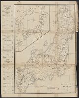
![[Highway map of the Tokyo region].](https://stacks.stanford.edu/image/iiif/gm158cc8245%2Fgm158cc8245_0001/full/!200,200/0/default.jpg)
[Highway map of the Tokyo region].
- Time
- Owner Organization
![Il conflitto Russo-Giappanese : [map of the region]](https://collections.library.yale.edu/iiif/2/15828541/full/!200,200/0/default.jpg)
Il conflitto Russo-Giappanese : [map of the region]
Yale University Library
Yale University Library Digital Collections
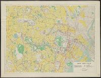
Map of Tokyo
National Library of Australia
Trove: National Library of Australia
Map of the missionary districts of north Tokyo & Kyoto : under the jurisdiction of the Bishop of Tokyo 1895
Yale University Library
Yale University Library Digital Collections

Map of Tokyo and Yokohama
Freer and Sackler
DPLA API

Map of Tokyo : city communications
Stanford University Libraries
Stanford Libraries SearchWorks
![Eifuku Tokyo go-ezu [Illustrated map of Tokyo]](https://collections.library.yale.edu/iiif/2/15511725/full/!200,200/0/default.jpg)
Eifuku Tokyo go-ezu [Illustrated map of Tokyo]
Yale University Library
Yale University Library Digital Collections

The Guide Map to the Railway in The Neighbourhood of Tokyo
Stanford University Libraries
Stanford Libraries SearchWorks

Zoning map of town-planning area of Tokyo - 1925
Boston Public Library
DPLA API

Tokyo metropolis. (inset map) Kanto district. (cover title) Tourist map of Tokyo. Japan : where th...
Stanford University Libraries
Stanford Libraries SearchWorks

Map of Japan and adjacenl regions. The Society for International Gulturel Relations. Tokyo 1937
Royal Library, Denmark
Europeana API

Guide to Tokyo City
Yale University Library
Yale University Library Digital Collections

Tokyo, karta, Karta, map@eng
Museum of Ethnography, Sweden
Europeana API

DES AVIONS PILONNENT LA REGION DE TOKYO
National Audiovisual Institute
Europeana API

Central Tokyo : city map.
Stanford University Libraries
Stanford Libraries SearchWorks
Bilingual map of Greater Tokyo. Prepared by the Cartographic Division of King Associates. Publishe...
Stanford University Libraries
Stanford Libraries SearchWorks

New Century map of Tokyo : with index
Stanford University Libraries
Stanford Libraries SearchWorks

(Map of the world). (to accompany) Shomitsu Nippon chizu. (Atlas of Japan). Nippon Shoin. (Tokyo, ...
Stanford University Libraries
Stanford Libraries SearchWorks
Railway map of Tokyo & vicinity. U.S. Army Map Service, Far East -58-102 - 10/57.1M.
Stanford University Libraries
Stanford Libraries SearchWorks
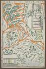
Kanto Civil Affairs Region - Map of Shizuoka
NDL Digital Collections
NDL Digital Collections
The role of IDA (Inter-DFG-APE) region in the regulation of MAP kinase activity
NDL Digital Collections
NDL Digital Collections
Map of central Tokyo / prepared for the 64th Engineer Topographic Battalion for GHQ Visitors Bureau
Yale University Library
Yale University Library Digital Collections
Map of Tokyo, featuring subway system. Copy rights by Creative Associates, Tokyo, Japan, (May 1975...
Stanford University Libraries
Stanford Libraries SearchWorks
![[The Bridge of Tokyo City.]](https://api.europeana.eu/api/v2/thumbnail-by-url.json?uri=http%3A%2F%2Fwww.beeldbankwo2.nl%2Fcgi-bin%2Ffrsiserver.dll%2Fthumbnail%2F49348-thumb.jpg%3Ffrskey%3D49348&type=IMAGE)
[The Bridge of Tokyo City.]
NIOD Institute for War, Holocaust and Genocide Studies
Europeana API
![[The Bridges of Tokyo - City.]](https://api.europeana.eu/api/v2/thumbnail-by-url.json?uri=http%3A%2F%2Fwww.beeldbankwo2.nl%2Fcgi-bin%2Ffrsiserver.dll%2Fthumbnail%2F49322-thumb.jpg%3Ffrskey%3D49322&type=IMAGE)
[The Bridges of Tokyo - City.]
NIOD Institute for War, Holocaust and Genocide Studies
Europeana API

Tartarie Chinoise, Roy, De Coree et Isles Du Japon
Stanford University Libraries
Stanford Libraries SearchWorks

Tartarie Chinoise, Roy, De Coree et Isles Du Japon
Stanford University Libraries
Stanford Libraries SearchWorks
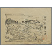
駿河国富士郡大宮国幣中社浅間神社之図
Mt.Fuji World Heritage Center, Shizuoka
ADEAC: A System of Digitalization and Exhibition for Archive Collections

Royaume du Japon / designé par le Père Ph. Briet,... ; Somer sculp
Bibliothèque nationale de France
Europeana API

Royaume Du Iapon Designe par le Pere Ph. Briet . .
Stanford University Libraries
Stanford Libraries SearchWorks

China. (with) Islands of Japan. By Keith Johnston, F.R.S.E. Keith Johnston's General Atlas. Engrav...
Stanford University Libraries
Stanford Libraries SearchWorks

Tabula Geodoborica Itinerum a Varijs in Cataium susceptorum rationem exhibens (Kircher's map of hi...
Stanford University Libraries
Stanford Libraries SearchWorks

De Agtste Oostindize Reys voor d'Engelze Maatschappie onder Kapitein Ioan Saris, gedaan ne Iava, d...
Stanford University Libraries
Stanford Libraries SearchWorks

Imperii Sinarum Nova Descriptio
Stanford University Libraries
Stanford Libraries SearchWorks

Ost-Indien
Stanford University Libraries
Stanford Libraries SearchWorks

China, Contains 15 Subject Provinces, including the 2 Islands of Hainan Formosa and the Tributary ...
Stanford University Libraries
Stanford Libraries SearchWorks

Ichimanbun no ichi chikeizu Yokohama kinbō
Stanford University Libraries
Stanford Libraries SearchWorks

Motor road network, Japan
Stanford University Libraries
Stanford Libraries SearchWorks
![Manzhou shi ju di tu [cartographic material]](https://stacks.stanford.edu/image/iiif/qm091qd5651%2Fqm091qd5651_00_0001/full/!200,200/0/default.jpg)
Manzhou shi ju di tu [cartographic material]
Stanford University Libraries
Stanford Libraries SearchWorks

L'Empire Du Japon devisé en sept principales parties, et subdivisè en soixante et six Royaumes, Par le Sr....
Yale University Library
Yale University Library Digital Collections

Australia - West Coast. Shark Bay
Stanford University Libraries
Stanford Libraries SearchWorks

Royaume du Japon / designé par le Père Ph. Briet,... ; Somer sculp
Bibliothèque nationale de France
Europeana API

Royaume Du Iapon Designe par le Pere Ph. Briet . .
Stanford University Libraries
Stanford Libraries SearchWorks
![Tokyo : [base map showing political divisions]](https://stacks.stanford.edu/image/iiif/jw443fg4075%2Fjw443fg4075_00_0001/full/!200,200/0/default.jpg)
Tokyo : [base map showing political divisions]
Stanford University Libraries
Stanford Libraries SearchWorks
「忠臣蔵討入組上五枚續」
Shochiku Otani Library
ARC Ukiyo-e Portal Database

Atlas Russicus mappa una generali et undeviginti specialibus vastissimum imperium Russicum adjacen...
Bibliothèque nationale de France
Europeana API

Carte De La Coree et Du Japon
Stanford University Libraries
Stanford Libraries SearchWorks

Ost-Indien Mit Den Inseln. 1831
Stanford University Libraries
Stanford Libraries SearchWorks

Nouvelle Representation Des Cotes Nord et Est De L'Asie, pour servir ... Articles du Supplement de...
Stanford University Libraries
Stanford Libraries SearchWorks
Last Updated: 2020-04-17
Uploaded: 2021-09-21