
A pictorial map : Victory in the Pacific Designed and published by Ernest Dudley Chase of Winchest...
- People
- Time
- Owner Organization

Japan, the target : a pictorial Jap-map : By Ernest Dudley Chase of Winchester, Mass. Published an...

Japan, The Target - A Pictorial Jap-Map. By Ernest Dudley Chase. Winchester, MA. Published and cop...
Seinan Taiheiyo seizu [Map of southwest Pacific Ocean] / compiled by Asahi Shinbunsha
Span of the U.S. in the Pacific / news map by staff artist Sundberg
Picture map of China. Designed by Frank Randolph Southard. Printed in United States of America. (C...

Picture map of China. Designed by Frank Randolph Southard. Printed in United States of America. (C...

(Covers to) Picture map of China. Designed by Frank Randolph Southard. Printed in United States of...

A Map of the Middle British Colonies In North America First Published By Mr. Lewis Evans of Philad...
![[World War II battlefronts]. Map VI. The Southwest Pacific. Copyright, 1944, by Remington Rand, In...](https://stacks.stanford.edu/image/iiif/vs321mz7073%2F6758006/full/!200,200/0/default.jpg)
[World War II battlefronts]. Map VI. The Southwest Pacific. Copyright, 1944, by Remington Rand, In...

New map of Shanghai. (on verso) A map of China : Published by K. Saito. Osaka Japan Sole agent T. ...

JAPANESE SHIPS DESTROYED BY BOMBERS IN PACIFIC AND INDIAN OCEANS

Rand McNally map of Eastern Asia and Western Pacific Ocean. (Mercator projection). Copyright by Ra...
Rand McNally map of Eastern Asia and Western Pacific Ocean. Mercator projection. Copyright by Rand...
Tsunamis in the Pacific Basin, 1900-1983 / map produced by Patricia A. Lockridge, National Geophysical Data Center and Ronald H. Smith, Cooperative Institute for Research in Environmental Sciences ; published by National Geophysical Data Center and World Data Center A for Solid Earth Geophysics with support from Office of U.S. Foreign Disaster Assistance, Agency for International Development in cooperation with Circum-Pacific Council for Energy and Mineral Resources, Map Project

A map of China : Published by K. Saito. Osaka Japan. Sole agent T. Kishida & Co. Shanghai. (inset ...

map from "Canadian Pacific Railway's Royal Mail Steamship Line. Japan and China ... Handbook of in...

map from "Canadian Pacific Railway's Royal Mail Steamship Line. Japan and China ... Handbook of in...
Ampol Pacific map / with the compliments of Australian Motorists Petrol Co. Ltd. ; published Gregory Publishing Co. ; copyright C. Barrass
A map of China : Published by K. Saito. Osaka Japan. Sole agent T. Kishida & Co Shanghai. (inset m...
Theater of war. Episode 4, Victory at sea, America fights back [electronic resource] : the Pacific...
Tokyo metropolitan Railway system. Designed and produced by Zero Per Zero. Printed in Korea

(Covers to) Rand McNally map of Eastern Asia and Western Pacific Ocean Mercator projection. Copyri...
The Japanese air-strip on Woleai Island, in the Pacific, ivas rendered useless by Pacific Fleet dive-bombers...
A United States cruiser blasting military installations on a Japanese island in the Pacific. (Evening Post, ...

Auckland Harbour

Empire of Japan. (with) Nagasaki Harbour. Engraved by J. & C. Walker. Published under the superint...
![Indo Hyakumanbunnoichi Zu Tōbu Shūiki [cartographic material]](https://stacks.stanford.edu/image/iiif/wr290sd1084%2Fwr290sd1084_00_0001/full/!200,200/0/default.jpg)
Indo Hyakumanbunnoichi Zu Tōbu Shūiki [cartographic material]
Empire of Japan / published under the superintendence of the Society for the Diffusion of Useful Knowledge
![Yokkaichi kōkū shashin sokuryōzu [cartographic material]](https://stacks.stanford.edu/image/iiif/dx686xz3690%2Fdx686xz3690_00_0001/full/!200,200/0/default.jpg)
Yokkaichi kōkū shashin sokuryōzu [cartographic material]
![Tokyo city proper [cartographic material]](https://stacks.stanford.edu/image/iiif/vj067cj0650%2Fvj067cj0650_00_0001/full/!200,200/0/default.jpg)
Tokyo city proper [cartographic material]

「大仏耳塚」

〔神道修成派東口登山講 休伯(ママ)所定宿引札〕

「御室仁和寺」 「都名勝 三拾景 初編」
![The Northwestern Pacific [cartographic material].](https://stacks.stanford.edu/image/iiif/hk776rv6776%2Fhk776rv6776_00_0001/full/!200,200/0/default.jpg)
The Northwestern Pacific [cartographic material].

冨士山東口須走(登山案内図)

Sendai key map.
Story of Michizane Sugawara, known as Tenjin
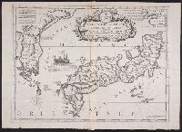
Isola del Giapone e penisola de Corea / Vincenzo Coronelli

「従成相山眺望天橋立之図 日本三景之一」 「呼名 月ノ橋立」
![[Southeast Asia, China & India]](https://stacks.stanford.edu/image/iiif/jj467gk2095%2F0171gh/full/!200,200/0/default.jpg)
[Southeast Asia, China & India]
Illustrations of Beautiful Women : [volume 1]

Exacta & accurata delineatio cum orarum maritimarum tum etiam locorum terrestrium quae in regionibus China, ...
![[Untitled Map of the Ancient World : Europe, Asia and Africa]](https://stacks.stanford.edu/image/iiif/ss295kf6573%2F37437/full/!200,200/0/default.jpg)
[Untitled Map of the Ancient World : Europe, Asia and Africa]

Terza Tavola (China, Southeast Asia, Philippines and Japan)

「肥前長崎丸山」

Chart Prepared By James B. Moore, To Accompany His Memorial To Congress Respecting the subject of ...

Asia : Coast of China : Ryōtō Kaiwan. Approaches to Ryō Ga Entrance

China, Contains 15 Subject Provinces, including the 2 Islands of Hainan Formosa and the Tributary ...
Last Updated: 2020-04-17
Uploaded: 2021-09-21