
West Coast of Korea. Approaches to Séoul : with Sir James Hall Group and Ta-Tong River
- Owner Organization

Japan, Hokushu _ West Coast. Iwanai Byochi and Approaches
Stanford University Libraries
Stanford Libraries SearchWorks

Approach to West Coast of Gazelle Peninsula
Stanford University Libraries
Stanford Libraries SearchWorks

New Guinea - South-East Coast. Approaches to Dedele
Stanford University Libraries
Stanford Libraries SearchWorks

Asia : Coast of China : Ryōtō Kaiwan. Approaches to Ryō Ga Entrance
Stanford University Libraries
Stanford Libraries SearchWorks

China - east coast : Hangchow Wan - southeast portion : including the approaches to the Yung Kiang
Stanford University Libraries
Stanford Libraries SearchWorks

Japan, Kyūshū--south coast : approaches to Osumi Kaikyo (Van Diemen Strait) (Eastern part)
Stanford University Libraries
Stanford Libraries SearchWorks

Japan : Nipon, Kiusiu and Sikok, and a part of the coast of Korea / according to Krusenstern's Chart of 1827 ; J & C Walker sculpt
Library of Congress
Trove: National Library of Australia
A chart of the northern part of the China Sea shewing the passage from Formosa to Japan : with the eastern coast of China and the Lekeyo Islands
National Library of Australia
Trove: National Library of Australia
A chart of the northern part of the China Sea shewing the passage from Formosa to Japan with the eastern coast of China and the Lekeyo islands / by Van Kuelen ; improved from the maps drawn in China by Father Gaubil in 1752
National Library of Australia
Trove: National Library of Australia

North Part of Kokai : Takushan Road and Approaches
Stanford University Libraries
Stanford Libraries SearchWorks

Empire Chinois et Japon
Bibliothèque nationale de France
Europeana API

Hyakumanbun no ichi Nanpō kōkūzu
Stanford University Libraries
Stanford Libraries SearchWorks

Auckland Harbour
Stanford University Libraries
Stanford Libraries SearchWorks

North West Pacific Ocean : Including Yellow, Japan & Okhotsk Seas, the Kuril Islands and Kamchatka
Stanford University Libraries
Stanford Libraries SearchWorks
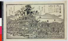
Akougishishinkangishi seppuku
Ako City Museum of History
ARC Ukiyo-e Portal Database

South Pacific Ocean, British New Guinea - South Coast. Orangerie Bay to Round Head
Stanford University Libraries
Stanford Libraries SearchWorks
![America Bay [cartographic material]](https://stacks.stanford.edu/image/iiif/nj035cf2832%2Fnj035cf2832_00_0001/full/!200,200/0/default.jpg)
America Bay [cartographic material]
Stanford University Libraries
Stanford Libraries SearchWorks
Japan, the islands of Loochoo & Formosa, and the maritime provinces of China with the tract of the Morrison's voyage in 1837 / J. Arrowsmith, Lith
National Library of Australia
Trove: National Library of Australia
![Tokuyama-shi kōkū shashin sokuryōzu [cartographic material]](https://stacks.stanford.edu/image/iiif/sd246gp9987%2Fsd246gp9987_00_0001/full/!200,200/0/default.jpg)
Tokuyama-shi kōkū shashin sokuryōzu [cartographic material]
Stanford University Libraries
Stanford Libraries SearchWorks

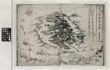
Aru Shotō
Stanford University Libraries
Stanford Libraries SearchWorks

Hyakumanbunnoichi manso kokkyō hōmen kōkūzu
Stanford University Libraries
Stanford Libraries SearchWorks

A New Map of North America, with the British, French, Spanish, Dutch & Danish Dominions on that gr...
Stanford University Libraries
Stanford Libraries SearchWorks

Plan de la ville et du port de Nangasaki d'après un ancien Plan Japonais réduit à moitié de l'Orig...
Bibliothèque nationale de France
Europeana API

Das Chinesische Reich mit den Schutz-Staaten, und Japan: entw. u. gez. v. C.G R.(eichard) 1826. Ge...
Stanford University Libraries
Stanford Libraries SearchWorks

Carte des decouvertes au nord du Japon. Faites en 1643 par les Vaisseaux Hollandais le Kastrikum e...
Stanford University Libraries
Stanford Libraries SearchWorks

Carte des decouvertes, faites en 1787 dans les mers de Chine et de Tartarie par les Fregates Franc...
Stanford University Libraries
Stanford Libraries SearchWorks

Das Suedoestliche Asien oder China, Japan, und Hinter-Indien mit dem Indischen Archipelagus. (The ...
Stanford University Libraries
Stanford Libraries SearchWorks
Asia : Coast of China : Ryōtō Kaiwan. Approaches to Ryō Ga Entrance
Stanford University Libraries
Stanford Libraries SearchWorks

Empire of Japan. (with) Nagasaki Harbour. Engraved by J. & C. Walker. Published under the superint...
Stanford University Libraries
Stanford Libraries SearchWorks
房州野嶋ヶ﨑眞景
Funabashi-shi Western Library
ADEAC: A System of Digitalization and Exhibition for Archive Collections
Kūchū shashin yōzu Ichiman Hassen Yonhyakuman bun no ichi Bisumaruku Guntō, Nyū Buriten-tō: sheet 2
National Library of Australia
Trove: National Library of Australia

Islands of Japan. (with) Japan, Mandshuria, (Showing the Course of the Amur River) The Kurile Isle...
Stanford University Libraries
Stanford Libraries SearchWorks
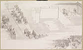
「上之御山図」
British Museum
ARC Ukiyo-e Portal Database
Last Updated: 2020-04-17
Uploaded: 2021-09-21