
Japan and South Manchuria : Railway and steamer connections
- Time
- Owner Organization

International Railway and Steamship Connections
General Research Division. The New York Public Library
DPLA API

Japan, Manchuria, and adjacent regions
Stanford University Libraries
Stanford Libraries SearchWorks

General Railway Map of Japan and Manchuria : Showing lines open and under construction on March 31...
Stanford University Libraries
Stanford Libraries SearchWorks

Erie Railway and connections. (inset) Map of New York City & vicinity issued by N.Y.L.E. & W. R.R....
Stanford University Libraries
Stanford Libraries SearchWorks

Travels of a naturalist in Japan and Manchuria
National Library Board, Singapore
Europeana API
Travels of a naturalist in Japan and Manchuria
National Library Board, Singapore
Europeana API
Travels of a naturalist in Japan and Manchuria
オクスフォード大学ボドリアン図書館サービス
Europeana API

Japan railway & transport review
Stanford University Libraries
Stanford Libraries SearchWorks
SCAPIN-848: CLOSING OF OFFICES IN JAPAN OF SUBSIDIARIES OF SOUTH MANCHURIA RAILWAY COMPANY AND MANCHURIA HEAVY INDUSTRY DEVELOPMENT CO,. LTD. 1946/03/28
NDL Digital Collections
NDL Digital Collections

The railway map of Japan
Boston Public Library
DPLA API

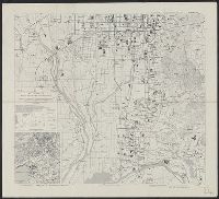
Manchuria. Korea. Japan. (insets) (Vicinity of Osaka and Tokyo)
Stanford University Libraries
Stanford Libraries SearchWorks
![[Railroads in China, Manchuria, Korea, Japan and the eastern U.S.S.R.] [cartographic material]](https://stacks.stanford.edu/image/iiif/pf710vm7134%2Fpf710vm7134_00_0001/full/!200,200/0/default.jpg)
[Railroads in China, Manchuria, Korea, Japan and the eastern U.S.S.R.] [cartographic material]
Stanford University Libraries
Stanford Libraries SearchWorks

portrait from "Travels of a Naturalist in Japan and Manchuria"
British Library
Europeana API

The Japanese empire : with central and southern Manchukuo (Manchuria)
Yale University Library
Yale University Library Digital Collections

The Japanese empire : with central and southern Manchukuo (Manchuria)
Yale University Library
Yale University Library Digital Collections
General railway map of Japan
Univerzita Karlova. Mapová sbírka
Europeana API
Korean War 1950-1953 -- Asia, North Korea, South Korea, China, Manchuria, Japan Map / Maps.com(CR)
National Library of Australia
Trove: National Library of Australia
Kyoto South : Kyoto Prefecture, Honshu, Japan
Yale University Library
Yale University Library Digital Collections

Eastern Asia, showing Japan, Korea, Manchuria and adjoining parts of Siberia and China. 185 miles ...
Bibliothèque nationale de France
Europeana API
Railway Time and Rubber Time
GESIS - Leibniz-Institut für Sozialwissenschaften. Bibliothek Köln
Europeana API
Nisshi oyobi Nichi-Man kokusai renraku un'yu senrozu : Japan-China and Japan-Manchuria through traffic routes
National Library of Australia
Trove: National Library of Australia

A Dispatch on the Fighting between Japan and Russia: Bandits Destroy the Russian Railway in Manchuria (Nichi-Ro sensō denpō jikki: Bazoku Manshū tetsudō o hakaisu)
Philadelphia Museum of Art
Philadelphia Museum of Art collection

Kyoto South: Kyoto Prefecture, Honshu, Japan
Monash University Library
Trove: National Library of Australia

Southwest Japan (Kyūshū, Shikoku, and southwest Honshū), railroads and railroad facilities
Yale University Library
Yale University Library Digital Collections

Jūmanbun no ichi Zu Girubāto Shotō
Stanford University Libraries
Stanford Libraries SearchWorks

Eastern Archipelago : Celebes - East Coast. Tg. Losoni to Northern Entrance to Buton Str.
Stanford University Libraries
Stanford Libraries SearchWorks

Motor road network, Japan
Stanford University Libraries
Stanford Libraries SearchWorks
![Tōbu nyūginia fon hantō oyobi madan chiku heiyō chishi shiryōzu [cartographic material]](https://stacks.stanford.edu/image/iiif/ns225gy7512%2Fns225gy7512_00_0001/full/!200,200/0/default.jpg)
Tōbu nyūginia fon hantō oyobi madan chiku heiyō chishi shiryōzu [cartographic material]
Stanford University Libraries
Stanford Libraries SearchWorks

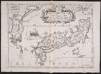
Imperii Sinarum nova descriptio
Stanford University Libraries
Stanford Libraries SearchWorks

Japan (with Formosa Island Inset)
Stanford University Libraries
Stanford Libraries SearchWorks

Japanese Empire. Copyright "Geographia" Map Co. (Produced by) Alexander Gross, F.R.G.S. (inset map...
Stanford University Libraries
Stanford Libraries SearchWorks

Imperii Sinarum Nova Descriptio
Stanford University Libraries
Stanford Libraries SearchWorks

Tiefenkarte des Japanischen Binnenmeeres : Setouchi / von Dr. N. Yamasaki
Yale University Library
Yale University Library Digital Collections

Descripcion De Las Indias Del Poniente
Stanford University Libraries
Stanford Libraries SearchWorks
Riben / Di tu chu ban she bian zhi
National Library of Australia
Trove: National Library of Australia
Isola del Giapone e penisola de Corea / Vincenzo Coronelli
Yale University Library
Yale University Library Digital Collections
![Tokyo and vicinity, showing bombed-out areas [cartographic material]](https://stacks.stanford.edu/image/iiif/jx217xm7539%2Fjx217xm7539_00_0001/full/!200,200/0/default.jpg)
Tokyo and vicinity, showing bombed-out areas [cartographic material]
Stanford University Libraries
Stanford Libraries SearchWorks

Japan and it's relation to the territory bordering on the Pacific ocean
Yale University Library
Yale University Library Digital Collections

Royaume du Japon
Stanford University Libraries
Stanford Libraries SearchWorks

Carte des Isles du Iapon : esquelles est remarqve la Route tant par Mer que par Terre que tiennent les Holla...
Yale University Library
Yale University Library Digital Collections

Iaponia Regnum
Stanford University Libraries
Stanford Libraries SearchWorks

Empire of Japan ... Published under the Supervision of the Society for the Diffusion of Useful Kno...
Stanford University Libraries
Stanford Libraries SearchWorks
![Panoramic map of Osaka [cartographic material].](https://stacks.stanford.edu/image/iiif/jv491xw9549%2Fjv491xw9549_0001/full/!200,200/0/default.jpg)
Panoramic map of Osaka [cartographic material].
Stanford University Libraries
Stanford Libraries SearchWorks
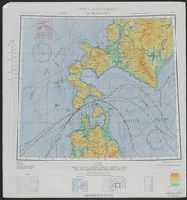
Nemuro
Yale University Library
Yale University Library Digital Collections

Empire of Japan. (with) Nagasaki Harbour. Engraved by J. & C. Walker. Published under the superint...
Stanford University Libraries
Stanford Libraries SearchWorks
Kaart van Oost-Azië / J. Wackie
VU University Amsterdam Library
Europeana API

What are the possibilities of attacking the Islands of Japan. Map by Charles Owens, Times Staff Ar...
Stanford University Libraries
Stanford Libraries SearchWorks

(Japan transportation system map ). (to accompany) Shomitsu Nippon chizu. (Atlas of Japan). Nippon...
Stanford University Libraries
Stanford Libraries SearchWorks
Last Updated: 2020-04-17
Uploaded: 2021-09-21