
Proposed plan of Ujigawa denki kabushiki kwai-sha : From Nango, Ishiyama-Mura, Shiga Prefecture, t...
- Time
- Owner Organization

Eastern Archipelago : Flores Sea. Tana Jampea and Adjacent Islands
![Kure [cartographic material] : plan of port and naval establishments](https://stacks.stanford.edu/image/iiif/rk636yd7844%2Frk636yd7844_0001/full/!200,200/0/default.jpg)
Kure [cartographic material] : plan of port and naval establishments

Jūmanbunnoichi Guamutō fukin

Hokutō onsen fukinzu = Map of Beitou hot springs and surrounding area
![Japan [cartographic material] : principal fishing ports](https://stacks.stanford.edu/image/iiif/mz394yg5271%2Fmz394yg5271_00_0001/full/!200,200/0/default.jpg)
Japan [cartographic material] : principal fishing ports

Isahaya, Japan, Nagasaki-ken, Kyushū.

The Japanese petroleum industry (map no. two)

Japan. Pergamon World Atlas. Pergamon Press, Ltd. & P.W.N. Poland 1967. Sluzba Topograficzna W.P

Yōzu (kūchū shashin sokuryō) Rusontō jūmanbun no ichi zu

City plan of Kōbe.
![Nijumanbunnoichi zu pantaruto [cartographic material] : Daitoshu timorushu oyobi zokuchi](https://stacks.stanford.edu/image/iiif/vs896bc0895%2Fvs896bc0895_00_0001/full/!200,200/0/default.jpg)
Nijumanbunnoichi zu pantaruto [cartographic material] : Daitoshu timorushu oyobi zokuchi

Southwest Japan (Kyūshū, Shikoku, and southwest Honshū), cotton spinning, silk and rayon production

Southwest Japan (Kyūshū, Shikoku, and southwest Honshū), non-metallic mineral production
![Tōbu nyūginia fon hantō oyobi madan chiku heiyō chishi shiryōzu [cartographic material]](https://stacks.stanford.edu/image/iiif/ns225gy7512%2Fns225gy7512_00_0001/full/!200,200/0/default.jpg)
Tōbu nyūginia fon hantō oyobi madan chiku heiyō chishi shiryōzu [cartographic material]

Kanto Plain administrative divisions
![Tōkyō, Ōmori-ku, guide to postal districts [cartographic material] = 大森區詳細圖](https://collections.library.yale.edu/iiif/2/15511728/full/!200,200/0/default.jpg)
Tōkyō, Ōmori-ku, guide to postal districts [cartographic material] = 大森區詳細圖
![Yokohama : [base map showing political divisions]](https://stacks.stanford.edu/image/iiif/hg765ms3579%2Fhg765ms3579_00_0001/full/!200,200/0/default.jpg)
Yokohama : [base map showing political divisions]
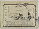
Tsurukame、oukan

Rand, McNally & Company's indexed atlas of the world map of Japan Copyright 1892, by Rand, McNally...

Japan: Topography and industrial areas

Ichimanbun no ichi chikeizu Yokohama kinbō

Southwest Japan (Kyūshū, Shikoku, and southwest Honshū) non-ferrous metals, mines and processing p...

Southwest Japan (Kyūshū, Shikoku, and southwest Honshū) industrial concentration, 1943 [cartograph...

Carte De L'Oceanie Contenant L'Australe, La Polynesie et Les Iles Asiatique [Australia called Nota...
Last Updated: 2020-04-17
Uploaded: 2021-09-21