
Japan : Karafuto : town plan of Ōtomari
- Time
- Owner Organization

Japan : Karafuto, town plan of Ochiai

Town plan of Otomari : Japan: Karafuto

Town plan of Toyohara : Japan: Karafuto

Town plan of Toyohashi

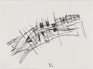
Town plan of Kōfu
![Town plan of Sendai [cartographic material]](https://stacks.stanford.edu/image/iiif/fv573yp8495%2Ffv573yp8495_00_0001/full/!200,200/0/default.jpg)
Town plan of Sendai [cartographic material]
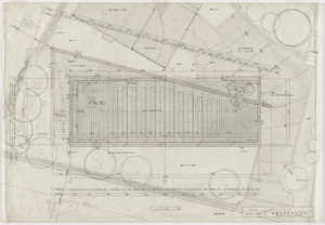
Town Plan Project, Kobe, Japan, Site plan

Town plan of Wakayama

Japan, Karafuto : production and processing of principal foods
View of the harbour and town Kanagawa, Japan

Japan. (inset) Plan of Yeddo Bay

Plan of thermo-baths ; Kokura town plan; devices used for the criminals' executions; a large bell; a shuit o...

Church of the Light, Ibaraki, Osaka, Japan (Plan)
Church of the Light, Ibaraki, Osaka, Japan, Plan
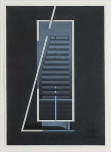
Church of the Light, Ibaraki, Osaka, Japan, Plan
Plan Of Nakanoshima Project, Osaka, Japan
Recently: the town' of Tientsin was inundated when waters of the Pei River entered the town and transformed ...
Oyamazaki Villa Museum, Kyoto, Japan, Site Plan

Yui town, Suruga, from the series Selection of views of the Tokaido
Damage to town of Larissa, Greece, World War II
Italian women in the newly liberated town of Massa Lombarda

Children of Japan

Ōtsu: View of the Lake and the Town of Ōtsu from the Kannon Hall of Mii Temple (Ōtsu; Miidera Kannondō yori Ōtsu no machi kosui chōbō)
Transactions of the Asiatic Society of Japan

Japanese living in the far east outside Japan Proper

Kankoku kōutsū zenzu; Tōyō tetsudō oyobi kōro renrakuzu

実測安房全図
![Japan, Yamaguchi-ken [cartographic material]](https://stacks.stanford.edu/image/iiif/zc849tw9296%2Fzc849tw9296_00_0001/full/!200,200/0/default.jpg)
Japan, Yamaguchi-ken [cartographic material]

Japan, Hokushu _ West Coast. Iwanai Byochi and Approaches

Nyūjōjiatō fukin sozu

Niman-gosenbun no ichi zu Renzanwan kinbō

Population densities in Japan
In 't Moeras. De Entente: Kom er op Uncle Sam, Iwan begint te zakken!
![Kantō area [cartographic material] : highways and waterways](https://stacks.stanford.edu/image/iiif/gd204cf5107%2Fgd204cf5107_00_0001/full/!200,200/0/default.jpg)
Kantō area [cartographic material] : highways and waterways

Ost-Indien
![Tsuruga-shi Kōkū shashin sokuryōzu [cartographic material]](https://stacks.stanford.edu/image/iiif/yn152cf5419%2Fyn152cf5419_00_0001/full/!200,200/0/default.jpg)
Tsuruga-shi Kōkū shashin sokuryōzu [cartographic material]

Japan: Topography and industrial areas

Kūchū shashin yōzu Sanman Gosen bun no ichi Bisumaruku Guntō Tsurubu - Busshingu Misaki kan

Southern Okinawa
![Taihokufu fukinzu [cartographic material]](https://stacks.stanford.edu/image/iiif/hq090pr2850%2Fhq090pr2850_00_0001/full/!200,200/0/default.jpg)
Taihokufu fukinzu [cartographic material]
風流雪の遊_三枚続

Ichiman bun no ichi Chōsen Chikeizu Heijō
In het Verre Oosten. Onder groote belangstelling der toeschouwers tracht Japan de Chineesche draak...

Map of Asia showing its gt. political divisions, and also various routes of travel between London ...

豊橋市街図 二万八千分の一 昭和13年

Central Japan (Central and Northern Honshū). Administrative divisions. No. 5282

Coal Resources of the World. Japan. Map No. 14. Plate I. Map Showing the Distribution of Coal in J...
Nichi-Ro sesshō zenkyokumen daichizu / henshūnin Saiki Hironao
Last Updated: 2020-04-17
Uploaded: 2021-09-21