
China and Japan

China and Japan

China and Japan

China and Japan. 8456

CHINA AND JAPAN AT WAR

The dragon in China and Japan
The dragon in China and Japan
China and Japan

Southeastern Asia, China, and Japan
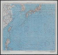
![China and Japan [cartographic material]](https://collections.library.yale.edu/iiif/2/15828553/full/!200,200/0/default.jpg)
China and Japan [cartographic material]

Butterflies from China, Japan, and Corea

Butterflies from China, Japan, and Corea

Butterflies from China, Japan, and Corea
Butterflies from China, Japan, and Corea
![[Visits to Japan, China and Egypt]](https://api.europeana.eu/api/v2/thumbnail-by-url.json?uri=http%3A%2F%2Fscreenarchive.brighton.ac.uk%2Fwp-content%2Fuploads%2Ffilms%2F1435%2Fimage_a_full.jpg&type=VIDEO)
[Visits to Japan, China and Egypt]

Japan and China Battle at Sea
China and Japan / by Keith Johnston

China. Japan
China and Japan / by W. and A. K. Johnston

China and Japan. (Copyright) G.P. Ltd
Japan and China their history, arts and literature

China en Japan

China und Japan

China und Japan

Map of the Empire of China and Japan. J.W. del. (engraved by) Stockley, Sc London, James Wyld, Cha...

Magnae Tartariae Magni Mogolis Imperii Iaponiae et Chinae Nova Descriptio

Das Chinesische Reich mit seinen Schutzstaaten (den Ländern der Mandschu und Mongolen, Ost Turkist...

China divided into its Great Provinces, and The Isle of Japan . . . 1774

Mandchourie et Coree de Kharbine a Seoul de Port-Arthur a Vladivostok Traduction de la Carte d'Eta...

L'Empire de la Chine d'après l'Atlas Chinois avec les Isles du Japon . .

China (Ostl. Theil), Korea Und Japan Im Maassstabe Von 1:7.500.000. Von A Petermann. Bearbeitet vo...

L'Empire de la Chine d'après l'Atlas Chinois avec les Isles du Japon . .

Chinese Empire (including Trans Oceanic Cables to Hong Kong,etc.)
![Nihyakugojūmanbun no ichi Tōbu Chūbu "So" ryō yochizu [cartographic material]](https://stacks.stanford.edu/image/iiif/nb222jb7845%2Fnb222jb7845_00_0001/full/!200,200/0/default.jpg)
Nihyakugojūmanbun no ichi Tōbu Chūbu "So" ryō yochizu [cartographic material]

Carte générale de la Tartarie Chinoise dressée sur les cartes particulières faites sur les lieux p...

Military Map of South-Eastern Virginia

Nord Asien. Okt. 1905. Bearb. v. Dr. E. Friedrich u. E. Umbreit. Lith. v. K. K.lug u A. Soeder

Jūmanbun no ichizu Neruchinsuku

Asia According to the best Authorities

Tabula Tartariae et majoris partis Regni Chinae . .

L'Empire de la Chine d'après l'Atlas Chinois avec les Isles du Japon . .
AAF cloth chart ; no. C-52, C-53

Gojūmanbun no ichi Gobaikaru hōmen sozu

No. 69. China und Japan

Russisch-japanischer Kriegsschauplatz. Karte II, Süd-Mandschurei, Korea, Nordost-China

Politische Karte von China : Japan, Korea, China und der Mandschurei / herausgegeben von A. Scobel

Eastern Asia, showing Japan, Korea, Manchuria and adjoining parts of Siberia and China. 185 miles ...

Das Suedoestliche Asien oder China, Japan, und Hinter-Indien mit dem Indischen Archipelagus. (The ...
Last Updated: 2020-04-17
Uploaded: 2021-09-21