
Okinawa Mem-O-Map part of the Ryukyu Islands. Drawn by T/4 John G. Drury 214th_ Ordnance Battalion...
- People
- Time
- Owner Organization

Mem-O-Map of Japan and Korea. Drawn by T/4 John G. Drury 214th Ordnance Battalion. Copyright 1946 ...
Stanford University Libraries
Stanford Libraries SearchWorks

Okinawa henkan kinenzu : Map of Japan / limited first edition in commemoration of the return by the United States to Japan of Administrative Rights over the Ryūkyū Islands and the Daitō Islands, May 15, 1972
Library of Congress
Trove: National Library of Australia
.jpg)
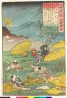
A Japanese mountain gun captured in the Treasuries by the 36th Battalion and left at the headquarters of G t...
New Zealand Electronic Text Collection
DigitalNZ New Zealand API
A chart of the northern part of the China Sea shewing the passage from Formosa to Japan with the eastern coast of China and the Lekeyo islands / by Van Kuelen ; improved from the maps drawn in China by Father Gaubil in 1752
National Library of Australia
Trove: National Library of Australia
Chart of the coast of China and of the Japan Islands including the Marianes and a part of the Philippines / compiled by order of Commodore M.C. Perry U.S.N. from the latest authorities with additions and corrections by the U.S. Japan Expedition by Lieuts. W.L. Maury and S. Bent U.S.N. ; drawn by Edw. Sels ; engr. by S. Siebert
National Library of Australia
Trove: National Library of Australia
Caroline Islands 1:25,000 : Yap / prepared under the direction of Engineer, Hq AFFE/BA, by the Military Geology Branch, Intelligence Division ; map compiled by C. G. Johnson, geologist, Military Geology Branch, U.S. Geological Survey, for the Intelligence Division, Office of the Engineer, Hq. U.S. Army Japan
National Library of Australia
Trove: National Library of Australia
A new chart of the Pacific Ocean : exhibiting the western coast of America, from Cape Horn to Beerings Strait, the eastern shores of Asia including Japan, China and Australia and all the numerous islands and known dangers situated in Polynesia and Australasia / correctly drawn and regulated according to the most approved and modern surveys and astronomical observations by J.W. Norie
State Library of New South Wales
Trove: National Library of Australia
Mem-O-Map of Japan and Korea. Drawn by T/4 John G. Drury 214th Ordnance Battalion. Copyright 1946 ...
Stanford University Libraries
Stanford Libraries SearchWorks

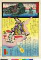
Nihon Nankyoku tanken-zu. (Illustration of Japanese Exploration of the Antarctic). (inset: locatio...
Stanford University Libraries
Stanford Libraries SearchWorks
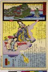
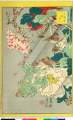
Kannonreigenki、saigokujunrei、oumi chikubushima、matsumuro chuusanshouninnochigo
Nationaal Museum van Wereldculturen (Rijksmuseum Volkenkunde, Leiden)
ARC Ukiyo-e Portal Database
「観音霊験記」 「近江竹生島」「松室仲算上人の児」
British Museum
ARC Ukiyo-e Portal Database
「百人一首之内」 「文屋康秀」
British Museum
ARC Ukiyo-e Portal Database

Maris Pacifici quod vulgo Mar del Zud
Stanford University Libraries
Stanford Libraries SearchWorks

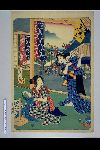
「伊賀越敵討の図」 「沢井股五郎」「和田志津广」「竹内伝内」
National Diet Library, Japan
ARC Ukiyo-e Portal Database

Aomori Ken, Japan. (to accompany) Shomitsu Nippon chizu. (Atlas of Japan). Nippon Shoin. (Tokyo, 1...
Stanford University Libraries
Stanford Libraries SearchWorks
「明石 十三」
British Museum
ARC Ukiyo-e Portal Database

Indiae Orientalis Insularumque Adiacientium Typus
Stanford University Libraries
Stanford Libraries SearchWorks

Dated Events. On To Tokyo. Map of the Pacific and the Far East. Stanley Turner, 44. Copyright, Can...
Stanford University Libraries
Stanford Libraries SearchWorks
「生写四十八鷹」
British Museum
ARC Ukiyo-e Portal Database

Carte de L'Asie selon le auteurs Anciens enrichie de Remarques Historiques sur les changemens qui ...
Stanford University Libraries
Stanford Libraries SearchWorks

Yokohama and Vicinity
Stanford University Libraries
Stanford Libraries SearchWorks

Dated Events. On To Tokyo. Map of the Pacific and the Far East. Stanley Turner, 44. Copyright, Can...
Stanford University Libraries
Stanford Libraries SearchWorks
Dated Events. On To Tokyo. Map of the Pacific and the Far East. Stanley Turner, 44 Copyright, Cana...
Stanford University Libraries
Stanford Libraries SearchWorks

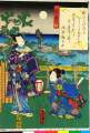
「蓮生法師」
National Diet Library, Japan
ARC Ukiyo-e Portal Database

(Japan administrative divisions map). (to accompany) Shomitsu Nippon chizu. (Atlas of Japan). Nipp...
Stanford University Libraries
Stanford Libraries SearchWorks

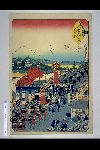
「末広五十三次」 「府中」
National Diet Library, Japan
ARC Ukiyo-e Portal Database

Maboroshi
Library of Congress
Digital Collections, Library of Congress

「東都名所合」 「亀井戸」
National Diet Library, Japan
ARC Ukiyo-e Portal Database

Tartariae Sive Magni Chami Regni typus
Stanford University Libraries
Stanford Libraries SearchWorks
「末広五十三次」 「鳴海」
National Diet Library, Japan
ARC Ukiyo-e Portal Database
「末広五十三次」 「日本橋」
National Diet Library, Japan
ARC Ukiyo-e Portal Database
Last Updated: 2020-04-17
Uploaded: 2021-09-21