

Spice Islands

Hermit Islands

Pacific Islands

North Pacific Ocean : Eastern Part of Hawaiin Islands

Ryukyu Islands, orientation
South Sea Islands 1:50,000 Gomanbun no ichi kotsuzu nanyo gunto .: Ponape Island, Caroline Islands (South Sea Islands No. 4)

Eastern Archipelago, Arafura Sea. Tanimbar Islands

Eastern Archipelago. Plans in Sermata Islands

South Pacific Ocean : Islands and Anchorages in Cook Islands

Midway I

Midway II

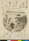
Matsushima (Islands)

Japan Series: North Honshu Islands

Total occupation of the Hoko islands

Pacific Ocean. Gilbert Islands (Kingsmill Group)

Plans of Anchorages in Witu Islands
Wrecked Japanese ship, Guadalcanal, Solomon Islands
Wrecked Japanese ship, Guadalcanal, Solomon Islands
Wrecked Japanese ship, Guadalcanal, Solomon Islands

Central Portion of Sumbawa with Pulo Tenga Islands

Pine Islands (Matsushima)

Islands (Shima tachi)
Pine Islands (Matsushima)
Papua gojūmanbun no ichi zu (Taninbaru shotō [Tanimbar Islands] タニンバル 諸島)
![[歴民カード_考古] 打製石斧](http://khirin-i.rekihaku.ac.jp/iiif/nmjh_rekimin_a/21348038_02.tif/full/200,/0/default.jpg)
[歴民カード_考古] 打製石斧

A New & Accurate Chart of the Discoveries made by the late Capt. Js. Cook, and other distinguished...

Japan, Hokushu _ West Coast. Iwanai Byochi and Approaches

「天明堂詠物垣内六拾評」
![Taihokufu fukinzu [cartographic material]](https://stacks.stanford.edu/image/iiif/hq090pr2850%2Fhq090pr2850_00_0001/full/!200,200/0/default.jpg)
Taihokufu fukinzu [cartographic material]
![Purutō heiyō chishi shiryōzu [cartographic material]](https://stacks.stanford.edu/image/iiif/dv198bk6496%2Fdv198bk6496_00_0001/full/!200,200/0/default.jpg)
Purutō heiyō chishi shiryōzu [cartographic material]

Gomanbun no ichi Nikobaru Shotō rikukai hengōzu
「景色七小町」 「鸚鵡小町」

Durville Island and Approaches

Yōzu (kūchū shashin sokuryō) Rusontō jūmanbun no ichi zu
The island of Formosa

Carte des isles du Iapon esquelles est remarqué la route tant par mer que par terre que tiennent l...
Kagamiyamagonichinoomokage
Eis van de gouverneur van Nangasakij

「〔上野山内絵図〕」
Tenmagawahanjahirou hachigatsujuugoya tsukinomadoi gaichiyou

China - east coast : Hangchow Wan - southeast portion : including the approaches to the Yung Kiang
![[歴民カード_歴史] 世界之図](https://khirin-i.rekihaku.ac.jp/iiif/nmjh_rekimin_h/10447042_02.tif/full/200,/0/default.jpg)
[歴民カード_歴史] 世界之図

「権中納言定家(墨絵)」
Kūchū shashin yōzu Ichiman Hassen Yonhyakuman bun no ichi Bisumaruku Guntō, Nyū Buriten-tō: sheet 2
Plans of Anchorages in Witu Islands

Japan, Kyūshū--south coast : approaches to Osumi Kaikyo (Van Diemen Strait) (Eastern part)
Momochidorinigiwaisoga

Kūchū shashin yōzu Sanman Gosen bun no ichi Bisumaruku Guntō Tsurubu - Busshingu Misaki kan
Last Updated: 2020-04-17
Uploaded: 2021-09-21