
South Pacific Ocean : Islands and Anchorages in Cook Islands
- Time
- Owner Organization

South Pacific Ocean ; Fiji Islands ; Viti Levu. Suva Harbour
Stanford University Libraries
Stanford Libraries SearchWorks

South Pacific Ocean, Maraenui
Metropolitan Museum of Art
The Metropolitan Museum of Art Open Access CSV

South Pacific Ocean, Tearai
Art Institute of Chicago
Art Institute of Chicago API

South Pacific Ocean, Waihau
Art Institute of Chicago
Art Institute of Chicago API

South Pacific Ocean, Maraenui
Art Institute of Chicago
Art Institute of Chicago API

Pacific Ocean. Gilbert Islands (Kingsmill Group)
Stanford University Libraries
Stanford Libraries SearchWorks

Plans of Anchorages in Witu Islands
Stanford University Libraries
Stanford Libraries SearchWorks

North Pacific Ocean : Eastern Part of Hawaiin Islands
Stanford University Libraries
Stanford Libraries SearchWorks

Pacific Islands
Stanford University Libraries
Stanford Libraries SearchWorks

Pacific Ocean, Approaches to south east part of New Guinea
Stanford University Libraries
Stanford Libraries SearchWorks

South Pacific Ocean : New Hebrides Is. North Coast of Aneityum Island showing Port Patrick, Ijipth...
Stanford University Libraries
Stanford Libraries SearchWorks

South Pacific Ocean, British New Guinea - South Coast. Orangerie Bay to Round Head
Stanford University Libraries
Stanford Libraries SearchWorks

North West Pacific Ocean : Including Yellow, Japan & Okhotsk Seas, the Kuril Islands and Kamchatka
Stanford University Libraries
Stanford Libraries SearchWorks
South Sea Islands 1:50,000 Gomanbun no ichi kotsuzu nanyo gunto .: Ponape Island, Caroline Islands (South Sea Islands No. 4)
National Library of Australia
Trove: National Library of Australia
South Pacific study = Minami Taiheiyō kenkyū.
Stanford University Libraries
Stanford Libraries SearchWorks

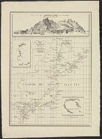
Map of the Pacific Ocean
Philadelphia Museum of Art
Philadelphia Museum of Art collection
Pacific Islands trade with Japan [electronic resource]
Stanford University Libraries
Stanford Libraries SearchWorks

Map - Japan, Trust Territory of the Pacific Islands
Museum of Transport and Technology Auckland
DigitalNZ New Zealand API
South Pacific - Fiji - Anti-tank wall, Suva Peninsula
Alexander Turnbull Library
DigitalNZ New Zealand API
South Pacific - Fiji - Ammunition tunnels at Tamavua, Viti Levu
Alexander Turnbull Library
DigitalNZ New Zealand API
East Asia and North Pacific 1:4,350,000: South China Sea (Sheet 6)
National Library of Australia
Trove: National Library of Australia
![Japan and adjacent regions of Asia and the Pacific Ocean [cartographic material] / compiled and drawn in the...](https://collections.library.yale.edu/iiif/2/15510875/full/!200,200/0/default.jpg)
Japan and adjacent regions of Asia and the Pacific Ocean [cartographic material] / compiled and drawn in the...
Yale University Library
Yale University Library Digital Collections
![Japan and adjacent regions of Asia and the Pacific Ocean [cartographic material] / compiled and drawn in the...](https://collections.library.yale.edu/iiif/2/15509964/full/!200,200/0/default.jpg)
Japan and adjacent regions of Asia and the Pacific Ocean [cartographic material] / compiled and drawn in the...
Yale University Library
Yale University Library Digital Collections
North Pacific Ocean, Japan, Nampō-Shotō [electronic resource]
Stanford University Libraries
Stanford Libraries SearchWorks

「JAPANESE CRESTS ARMS CARRIAGE」
C. V. Starr East Asian Library, University of California, Berkeley
ARC Ukiyo-e Portal Database
Hirakanaseisuiki、shigurenokarakasa、sayaate
Shochiku Otani Library
ARC Banzuke (Playbills) Portal Database
Tokiniuttarioyatsunotaiko
University of Tokyo Graduate School of Arts and Sciences / College of Liberal Arts
UTokyo Academic Archives Portal
Enkoukozouukaishinroku
Shochiku Otani Library
ARC Banzuke (Playbills) Portal Database
Pacific Ocean. Gilbert Islands (Kingsmill Group)
Stanford University Libraries
Stanford Libraries SearchWorks
![Tokyo : [base map showing political divisions]](https://stacks.stanford.edu/image/iiif/jw443fg4075%2Fjw443fg4075_00_0001/full/!200,200/0/default.jpg)
Tokyo : [base map showing political divisions]
Stanford University Libraries
Stanford Libraries SearchWorks
Kaizokufusajirou、torikaeshinjuu
Shochiku Otani Library
ARC Banzuke (Playbills) Portal Database

Plans in south eastern part of New Guinea
Stanford University Libraries
Stanford Libraries SearchWorks
Kuniyoshi's preparatory drawings, no.39
Victoria and Albert Museum
Victoria and Albert Museums API
Katakiuchigappougatsuji
University of Tokyo Graduate School of Arts and Sciences / College of Liberal Arts
UTokyo Academic Archives Portal

Chuushinguraanasagashiyanagidaru
Ako City Local History Compilation Department
ARC Ukiyo-e Portal Database
Honchounijuushikou
University of Tokyo Graduate School of Arts and Sciences / College of Liberal Arts
UTokyo Academic Archives Portal

〔関東道中図〕
Funabashi-shi Western Library
ADEAC: A System of Digitalization and Exhibition for Archive Collections
Kaart van Japan ... Van R.G. Bennet en J. Van Wyk R. ... R Van Wyk Jx del
Yale University Library
Yale University Library Digital Collections
![[双六集]大新板尾張名所飛廻雙六](https://lapis.nichibun.ac.jp/image?did=6&pic=2&fid=11-4-2_01_01.jpg)
[双六集]大新板尾張名所飛廻雙六
国際日本文化研究センター
SODA Collection: Pictorial and Miscellaneous Materials

「新板江戸名所はんし双六」 「新板江戸名所はんじ双六」
Tokyo Metropolitan Central Library
ARC Ukiyo-e Portal Database
Suite de L'Ocean Oriental : contenant les Isles de la Sonde les Costes de Tunquin et de la Chine, les Isles du Japon, les Philippines Moluques / dresse sur les divers manuscrits du depost des plans de la marine par N. Bellin, Ingenr. de la Marine ; J. v. Schley direx
National Library of Australia
Trove: National Library of Australia

Kii no Kuni Hidaka-gun Tennonsan Dōjōji yurai
Stanford University Libraries
Stanford Libraries SearchWorks
![Tsuruga-shi Kōkū shashin sokuryōzu [cartographic material]](https://stacks.stanford.edu/image/iiif/yn152cf5419%2Fyn152cf5419_00_0001/full/!200,200/0/default.jpg)
Tsuruga-shi Kōkū shashin sokuryōzu [cartographic material]
Stanford University Libraries
Stanford Libraries SearchWorks
Kannushinomusume、aida、meguminohana
Shochiku Otani Library
ARC Banzuke (Playbills) Portal Database
Karte vom Japanischen Reiche, nach Original-karten und astronomischen Beobachtungen der Japaner : ...
Royal Library of the Netherlands
Europeana API

Chuushinguraanasagashiyanagidaru
Ako City Local History Compilation Department
ARC Ukiyo-e Portal Database

「下総国横曽根報恩寺掛所全図」
Tokyo Metropolitan Central Library
ARC Ukiyo-e Portal Database

Chuushingura anasagashi yanagidaru
Ako City Local History Compilation Department
ARC Ukiyo-e Portal Database
Last Updated: 2020-04-17
Uploaded: 2021-09-21