
South Pacific Ocean : New Hebrides Is. North Coast of Aneityum Island showing Port Patrick, Ijipth...
- Time
- Owner Organization
North Pacific Ocean
National Library of Australia
Trove: National Library of Australia

South Pacific Ocean, British New Guinea - South Coast. Orangerie Bay to Round Head
Stanford University Libraries
Stanford Libraries SearchWorks

North Pacific Ocean : Eastern Part of Hawaiin Islands
Stanford University Libraries
Stanford Libraries SearchWorks

South Pacific Ocean, Maraenui
Metropolitan Museum of Art
The Metropolitan Museum of Art Open Access CSV

South Pacific Ocean, Tearai
Art Institute of Chicago
Art Institute of Chicago API

South Pacific Ocean, Waihau
Art Institute of Chicago
Art Institute of Chicago API

South Pacific Ocean, Maraenui
Art Institute of Chicago
Art Institute of Chicago API
North Pacific Ocean, Iwate
Metropolitan Museum of Art
The Metropolitan Museum of Art Open Access CSV
North Pacific Ocean, Stinson Beach
Harvard Art Museums
Harvard Art Museums API

Pacific Ocean, Approaches to south east part of New Guinea
Stanford University Libraries
Stanford Libraries SearchWorks

South Pacific Ocean : Islands and Anchorages in Cook Islands
Stanford University Libraries
Stanford Libraries SearchWorks

South Pacific Ocean ; Fiji Islands ; Viti Levu. Suva Harbour
Stanford University Libraries
Stanford Libraries SearchWorks
South Pacific - Fiji - Rifle drill for New Zealand soldiers on the coast of Viti Levu
Alexander Turnbull Library
DigitalNZ New Zealand API

(Composite of) A New Chart of The Pacific Ocean, Exhibiting The Western Coast of America, From Cap...
Stanford University Libraries
Stanford Libraries SearchWorks
North Pacific Ocean, Japan, Nampō-Shotō [electronic resource]
Stanford University Libraries
Stanford Libraries SearchWorks

A voyage of discovery to the North Pacific Ocean in which the coast of Asia, from the lat. of 35@ ...
Canadiana.org
Europeana API
A voyage of discovery to the North Pacific Ocean in which the coast of Asia, from the lat. of 35@ ...
Canadiana.org
Europeana API

A New Chart of The Pacific Ocean, Exhibiting The Western Coast of America from Cape Horn to Beerin...
Stanford University Libraries
Stanford Libraries SearchWorks

Plans on the north-eastern coast of New Guinea
Stanford University Libraries
Stanford Libraries SearchWorks

Oshima, south coast of Japan
Royal Museums Greenwich
Europeana API

A New Chart of The Pacific Ocean, Exhibiting The Western Coast of America, From Cape Horn To Beeri...
Stanford University Libraries
Stanford Libraries SearchWorks

A New Chart of The Pacific Ocean, Exhibiting The Western Coast of America, From Cape Horn To Beeri...
Stanford University Libraries
Stanford Libraries SearchWorks
A New Chart of The Pacific Ocean, Exhibiting The Western Coast of America, From Cape Horn To Beeri...
Stanford University Libraries
Stanford Libraries SearchWorks

Map of the Pacific Ocean
Philadelphia Museum of Art
Philadelphia Museum of Art collection
Pomasu Misaki / (Kūchū shashin sokuzu Rikuchi Sokuryōbu) Sanbō Honbu
National Library of Australia
Trove: National Library of Australia

Australia - West Coast. Shark Bay
Stanford University Libraries
Stanford Libraries SearchWorks

Durville Island and Approaches
Stanford University Libraries
Stanford Libraries SearchWorks

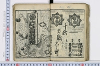
「天明堂詠物垣内六拾評」
Tokyo Metropolitan Central Library
ARC Ukiyo-e Portal Database

Iaponia Regnum
Stanford University Libraries
Stanford Libraries SearchWorks

Descripcion De Las Yndias Ocidentales
Stanford University Libraries
Stanford Libraries SearchWorks
Bandaifuekishibainohajimari
University of Tokyo Graduate School of Arts and Sciences / College of Liberal Arts
UTokyo Academic Archives Portal

Carte des Isles du Japon et la Presqu Isle de Coree Avec les Costes de la Chine. Depuis Pekin Jusqu'a Canton...
Yale University Library
Yale University Library Digital Collections
![Hailaerh fukin zu [cartographic material]](https://stacks.stanford.edu/image/iiif/nc103dh1915%2Fnc103dh1915_00_0001/full/!200,200/0/default.jpg)
Hailaerh fukin zu [cartographic material]
Stanford University Libraries
Stanford Libraries SearchWorks

A New & Accurate Chart of the Discoveries made by the late Capt. Js. Cook, and other distinguished...
Stanford University Libraries
Stanford Libraries SearchWorks
![[Southeast Asia, China & India]](https://stacks.stanford.edu/image/iiif/jj467gk2095%2F0171gh/full/!200,200/0/default.jpg)
[Southeast Asia, China & India]
Stanford University Libraries
Stanford Libraries SearchWorks

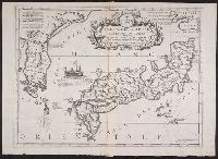
Isola del Giapone e Penisola di Corea. .
Stanford University Libraries
Stanford Libraries SearchWorks

Torokina Hikōjo
Stanford University Libraries
Stanford Libraries SearchWorks
Isola del Giapone e penisola de Corea / Vincenzo Coronelli
Yale University Library
Yale University Library Digital Collections

Plans of Anchorages in Witu Islands
Stanford University Libraries
Stanford Libraries SearchWorks

都市計畫基本圖. : 5 鷹ヶ峯
Yoshida-South Library, Kyoto University
IIIF Discovery in Japan

Isola del Giapone e penisola de Corea. Dedicata al Molto Revdo. Pre. Fontaine della compagnia de G...
Stanford University Libraries
Stanford Libraries SearchWorks
A new & correct chart of the Indian Sea from Cabo Bonea Esperanca to Japan according to Mr. Edward Wrights projection vulgarly called Mercators chart
National Library of Australia
Trove: National Library of Australia

A New Map of North America, with the British, French, Spanish, Dutch & Danish Dominions on that gr...
Stanford University Libraries
Stanford Libraries SearchWorks
![[Japan] (Published in Manila!)](https://stacks.stanford.edu/image/iiif/gv355sq3352%2F37869hs/full/!200,200/0/default.jpg)
[Japan] (Published in Manila!)
Stanford University Libraries
Stanford Libraries SearchWorks

Towada
Stanford University Libraries
Stanford Libraries SearchWorks

North West Pacific Ocean : Including Yellow, Japan & Okhotsk Seas, the Kuril Islands and Kamchatka
Stanford University Libraries
Stanford Libraries SearchWorks

Ryōtō Kaiwan : Daitzu Shan to Fuchou Chao
Stanford University Libraries
Stanford Libraries SearchWorks
![Government railroads of Japan [cartographic material].](https://stacks.stanford.edu/image/iiif/kn953gw3179%2Fkn953gw3179_0001/full/!200,200/0/default.jpg)
Government railroads of Japan [cartographic material].
Stanford University Libraries
Stanford Libraries SearchWorks
Last Updated: 2020-04-17
Uploaded: 2021-09-21