

Fuasshizumu no shinzui to Itaria no sangyō tōsei
Library of Congress
Digital Collections, Library of Congress

Biruma no shigen to sangyou
NDL Digital Collections
NDL Digital Collections

大南洋産業資源精図
Kyushu University Collections
Kyushu University Collections
Manmou no sangyou to sono shigen
NDL Digital Collections
NDL Digital Collections

Biruma kousan shigen
NDL Digital Collections
NDL Digital Collections

Sangyou shiryou
NDL Digital Collections
NDL Digital Collections
Sangyou shiryou
NDL Digital Collections
NDL Digital Collections

Chousen sangyou chizu
NDL Digital Collections
NDL Digital Collections

ソ連の対欧関心
神戸大学附属図書館
Kobe University Library Digital Archive Newspaper Clippings Collection
Sangyou chousa shiryou
NDL Digital Collections
NDL Digital Collections
Sangyou chousa shiryou
NDL Digital Collections
NDL Digital Collections
Sangyou chousa shiryou
NDL Digital Collections
NDL Digital Collections
Sangyou chousa shiryou
NDL Digital Collections
NDL Digital Collections
Sangyou kenkyuu shiryou
NDL Digital Collections
NDL Digital Collections

Sangyou keizai shiryou
NDL Digital Collections
NDL Digital Collections

Sangyou keizai shiryou
NDL Digital Collections
NDL Digital Collections

Sangyou keizai shiryou
NDL Digital Collections
NDL Digital Collections
Sangyou chousa shiryou
NDL Digital Collections
NDL Digital Collections
Sangyou chousa shiryou
NDL Digital Collections
NDL Digital Collections

Sangyou kouza shiryou
NDL Digital Collections
NDL Digital Collections

Sangyou kouza shiryou
NDL Digital Collections
NDL Digital Collections

Sangyou kenkyuu shiryou
NDL Digital Collections
NDL Digital Collections

Sangyou kouza shiryou
NDL Digital Collections
NDL Digital Collections

Sangyou kouza shiryou
NDL Digital Collections
NDL Digital Collections
![Tokyo and vicinity, showing bombed-out areas [cartographic material]](https://stacks.stanford.edu/image/iiif/jx217xm7539%2Fjx217xm7539_00_0001/full/!200,200/0/default.jpg)
Tokyo and vicinity, showing bombed-out areas [cartographic material]
Stanford University Libraries
Stanford Libraries SearchWorks

Chinese Empire & Japan
Stanford University Libraries
Stanford Libraries SearchWorks
![Manzhou shi ju di tu [cartographic material]](https://stacks.stanford.edu/image/iiif/qm091qd5651%2Fqm091qd5651_00_0001/full/!200,200/0/default.jpg)
Manzhou shi ju di tu [cartographic material]
Stanford University Libraries
Stanford Libraries SearchWorks

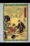
「俤けんじ五十四帖」 「梅が枝」
National Diet Library, Japan
ARC Ukiyo-e Portal Database

New Map of Japan
Stanford University Libraries
Stanford Libraries SearchWorks

The topographic map of Manchoukuo
Stanford University Libraries
Stanford Libraries SearchWorks
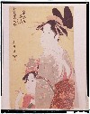
「青楼美人合」 「扇屋内 華扇」「よしの」「たつた」
Tokyo National Museum
ARC Ukiyo-e Portal Database

Nyūjōjiatō fukin sozu
Stanford University Libraries
Stanford Libraries SearchWorks
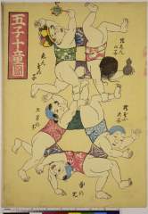
Goshijuudouzu、jishinnoko、enmanoko、jizounoko、dokatanoko、kaminarinoko
Nationaal Museum van Wereldculturen (Rijksmuseum Volkenkunde, Leiden)
ARC Ukiyo-e Portal Database

General map of China and adjacent regions, showing treaty ports and railways
Stanford University Libraries
Stanford Libraries SearchWorks
「俤けんじ五十四帖」 「絵合」
National Diet Library, Japan
ARC Ukiyo-e Portal Database

「俤けんじ五十四帖」 「野分」
National Diet Library, Japan
ARC Ukiyo-e Portal Database

Hyakumanbun no ichi Heiyō chiri chōsazu
Stanford University Libraries
Stanford Libraries SearchWorks

Regni Japoniae nova mappa geographica , ex indigenarum observationibus delineata ab Engelberto Kae...
Bibliothèque nationale de France
Europeana API

Japan and South Manchuria : Railway and steamer connections
Stanford University Libraries
Stanford Libraries SearchWorks

China, Contains 15 Subject Provinces, including the 2 Islands of Hainan Formosa and the Tributary ...
Stanford University Libraries
Stanford Libraries SearchWorks

「俤けんじ五十四帖」 「御法」
National Diet Library, Japan
ARC Ukiyo-e Portal Database
Last Updated: 2020-04-17
Uploaded: 2021-09-21